File:Peak District National Park UK location map.svg
跳转到导航
跳转到搜索

此SVG文件的PNG预览的大小:469 × 599像素。 其他分辨率:188 × 240像素 | 376 × 480像素 | 601 × 768像素 | 802 × 1,024像素 | 1,604 × 2,048像素 | 1,022 × 1,305像素。
原始文件 (SVG文件,尺寸为1,022 × 1,305像素,文件大小:1.41 MB)
说明
说明
添加一行文字以描述该文件所表现的内容
| 描述 |
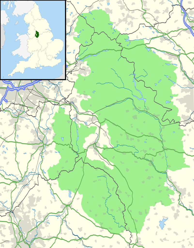
Map of the Peak District National Park, UK with the following information shown:
Equirectangular map projection on WGS 84 datum, with N/S stretched 165% Geographic limits:
|
| 日期 | |
| 来源 |
Office of National Statistics Geography
|
| 作者 | Nilfanion, created using Ordnance Survey data |
| 授权 (二次使用本文件) |
本文件采用知识共享署名-相同方式共享 3.0 未本地化版本许可协议授权。 署名: Contains Ordnance Survey data © Crown copyright and database right
|
文件历史
点击某个日期/时间查看对应时刻的文件。
| 日期/时间 | 缩略图 | 大小 | 用户 | 备注 | |
|---|---|---|---|---|---|
| 当前 | 2010年10月29日 (五) 21:37 | | 1,022 × 1,305(1.41 MB) | Nilfanion(留言 | 贡献) | {{Information |Description=Map of the Peak District National Park, UK with the following information shown: *National Park boundary *Administrative borders *Coastline, lakes and rivers *Roads and railways *Urban areas Equirectangular |
您不可以覆盖此文件。
文件用途
以下页面使用本文件:
全域文件用途
以下其他wiki使用此文件:
- da.wikipedia.org上的用途
- en.wikipedia.org上的用途
- fr.wikipedia.org上的用途
- he.wikipedia.org上的用途
- is.wikipedia.org上的用途
- it.wikipedia.org上的用途
- nl.wikipedia.org上的用途
- nn.wikipedia.org上的用途
- ru.wikipedia.org上的用途
- simple.wikipedia.org上的用途
- sl.wikipedia.org上的用途
- vi.wikipedia.org上的用途
- zh.wikipedia.org上的用途