File:Pillbox (6), Tollerton Airfield.jpg
From Wikimedia Commons, the free media repository
Jump to navigation
Jump to search
Size of this preview: 800 × 600 pixels. Other resolutions: 320 × 240 pixels | 640 × 480 pixels | 1,024 × 768 pixels | 1,280 × 960 pixels.
Original file (1,280 × 960 pixels, file size: 426 KB, MIME type: image/jpeg)
File information
Structured data
Captions
Summary
[edit]DescriptionPillbox (6), Tollerton Airfield.jpg |
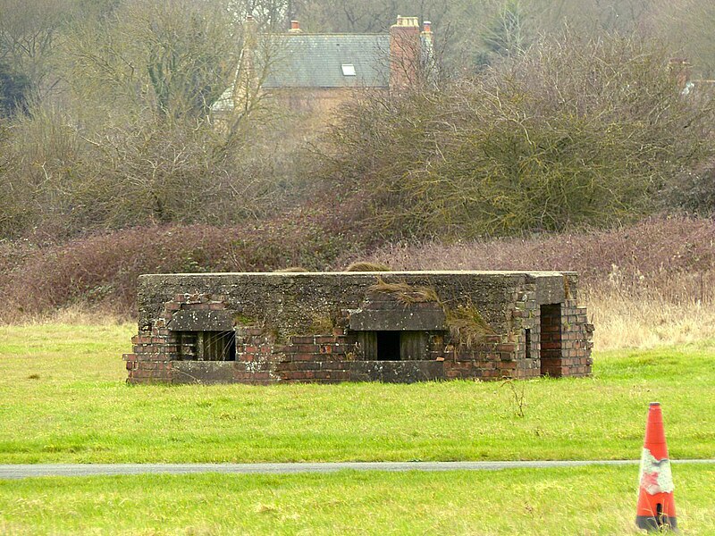
English: photograph of the pillbox at SK 61808 35777, Tollerton Airfield, Nottinghamshire, England |
Date | |
Source | https://www.geograph.org.uk/photo/7085228 |
Author | Alan Murray-Rust |
Attribution (required by the license) InfoField | Alan Murray-Rust / Pillbox at Tollerton Airfield / |
InfoField | Alan Murray-Rust / Pillbox at Tollerton Airfield |
Camera location | 52° 55′ 04.08″ N, 1° 04′ 51.31″ W | View this and other nearby images on: OpenStreetMap | 52.917800; -1.080920 |
---|
This is a photo of listed building number 1402065. |
Wikidata has entry Pillbox Square Type At Sk 61808 35777 (Q26675519) with data related to this item. |
Licensing
[edit]This image was taken from the Geograph project collection. See this photograph's page on the Geograph website for the photographer's contact details. The copyright on this image is owned by Alan Murray-Rust and is licensed for reuse under the Creative Commons Attribution-ShareAlike 2.0 license.
|
This file is licensed under the Creative Commons Attribution-Share Alike 2.0 Generic license.
Attribution: Alan Murray-Rust
- You are free:
- to share – to copy, distribute and transmit the work
- to remix – to adapt the work
- Under the following conditions:
- attribution – You must give appropriate credit, provide a link to the license, and indicate if changes were made. You may do so in any reasonable manner, but not in any way that suggests the licensor endorses you or your use.
- share alike – If you remix, transform, or build upon the material, you must distribute your contributions under the same or compatible license as the original.
File history
Click on a date/time to view the file as it appeared at that time.
Date/Time | Thumbnail | Dimensions | User | Comment | |
---|---|---|---|---|---|
current | 06:52, 15 October 2023 | 1,280 × 960 (426 KB) | Geograph Update Bot (talk | contribs) | Higher-resolution version from Geograph | |
09:06, 12 October 2023 | 1,024 × 768 (262 KB) | Peter I. Vardy (talk | contribs) | Uploaded a work by Alan Murray-Rust from https://www.geograph.org.uk/photo/7085228 with UploadWizard |
You cannot overwrite this file.
File usage on Commons
There are no pages that use this file.
File usage on other wikis
The following other wikis use this file:
- Usage on en.wikipedia.org
Metadata
This file contains additional information such as Exif metadata which may have been added by the digital camera, scanner, or software program used to create or digitize it. If the file has been modified from its original state, some details such as the timestamp may not fully reflect those of the original file. The timestamp is only as accurate as the clock in the camera, and it may be completely wrong.
Camera manufacturer | Panasonic |
---|---|
Camera model | DMC-FZ200 |
Exposure time | 1/60 sec (0.016666666666667) |
F-number | f/4.5 |
ISO speed rating | 100 |
Date and time of data generation | 14:23, 30 January 2022 |
Lens focal length | 108 mm |
Latitude | 52° 55′ 4.09″ N |
Longitude | 1° 4′ 51.3″ W |
Orientation | Normal |
Horizontal resolution | 180 dpi |
Vertical resolution | 180 dpi |
Software used | Ver.1.0 |
File change date and time | 14:23, 30 January 2022 |
Y and C positioning | Co-sited |
Exposure Program | Aperture priority |
Exif version | 2.3 |
Date and time of digitizing | 14:23, 30 January 2022 |
Meaning of each component |
|
Image compression mode | 4 |
APEX exposure bias | 0 |
Maximum land aperture | 2.96875 APEX (f/2.8) |
Metering mode | Pattern |
Light source | Shade |
Flash | Flash did not fire, compulsory flash suppression |
Supported Flashpix version | 1 |
Color space | sRGB |
Sensing method | One-chip color area sensor |
File source | Digital still camera |
Scene type | A directly photographed image |
Custom image processing | Normal process |
Exposure mode | Auto exposure |
White balance | Manual white balance |
Digital zoom ratio | 0 |
Focal length in 35 mm film | 600 mm |
Scene capture type | Standard |
Scene control | None |
Contrast | Normal |
Saturation | Normal |
Sharpness | Normal |
GPS time (atomic clock) | 14:23 |
Geodetic survey data used | WGS-84 |
GPS date | 30 January 2022 |
GPS tag version | 0.0.2.2 |
Supported Flashpix version | 1 |
Image width | 4,000 px |
Image height | 3,000 px |
Compression scheme | JPEG (old) |
Structured data
Items portrayed in this file
depicts
image/jpeg
ce58fa6b4dd3bb67d6b7cef5f1caf84017a6e275
268,232 byte
768 pixel
1,024 pixel
52°55'4.080"N, 1°4'51.312"W
0.01666666666666666666 second
4.5
108 millimetre
100
Hidden categories:
- Information field template with formatting
- Files with coordinates missing SDC location of creation (52° N, 2° W)
- Listed buildings in England with known IDs
- Listed buildings in England missing SDC depicts
- Listed buildings in England missing SDC location of creation
- CC-BY-SA-2.0
- Images from Geograph Britain and Ireland
- Images from Geograph Britain and Ireland missing SDC creator
- Images from Geograph Britain and Ireland missing SDC inception
- Images from Geograph Britain and Ireland missing SDC source of file
- Images from Geograph Britain and Ireland missing SDC coordinates of depicted place
- Pages with maps