File:Plan de Valenciennes.jpg
Jump to navigation
Jump to search

Size of this preview: 800 × 582 pixels. Other resolutions: 320 × 233 pixels | 640 × 466 pixels | 1,024 × 745 pixels | 1,280 × 931 pixels | 2,560 × 1,862 pixels | 11,063 × 8,047 pixels.
Original file (11,063 × 8,047 pixels, file size: 14.01 MB, MIME type: image/jpeg)
Captions
Captions
Add a one-line explanation of what this file represents
Summary
[edit]
| Warning | The original file is very high-resolution. It might not load properly or could cause your browser to freeze when opened at full size. |
|---|
| Title |
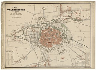
Français : Plan de Valenciennes et de ses environs dressé par M. Fourquez agent voyer principal de l'arrondissement de Valenciennes. 1884. G. Giard. Libraire éditeur. 49 Place d'Armes. |
||||
| Date | |||||
| Source |
|
||||
| Creator |
M. Fourquez |
||||
| Permission (Reusing this file) |
|
||||
| Geotemporal data | |||||
| Map location | Valenciennes | ||||
| Georeferencing | If inappropriate please set warp_status = skip to hide. | ||||
| Bibliographic data | |||||
| Publisher |
Imprimerie G. Giard et A. Seulin à Valenciennes |
||||
| Printed by |
Imprimerie G. Giard et A. Seulin à Valenciennes |
||||
| Other versions |
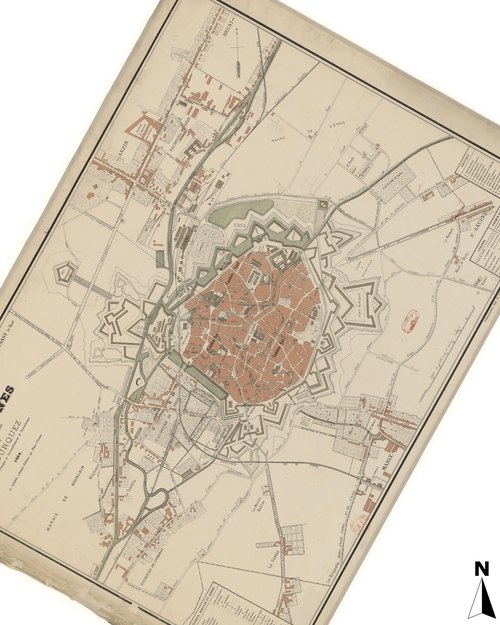 Français : Fichier orienté vers le nord. |
||||
Licensing
[edit]
I, the copyright holder of this work, hereby publish it under the following license:
This file is licensed under the Creative Commons Attribution-Share Alike 4.0 International license.
- You are free:
- to share – to copy, distribute and transmit the work
- to remix – to adapt the work
- Under the following conditions:
- attribution – You must give appropriate credit, provide a link to the license, and indicate if changes were made. You may do so in any reasonable manner, but not in any way that suggests the licensor endorses you or your use.
- share alike – If you remix, transform, or build upon the material, you must distribute your contributions under the same or compatible license as the original.
File history
Click on a date/time to view the file as it appeared at that time.
| Date/Time | Thumbnail | Dimensions | User | Comment | |
|---|---|---|---|---|---|
| current | 05:01, 23 August 2019 | | 11,063 × 8,047 (14.01 MB) | Arflhn (talk | contribs) | User created page with UploadWizard |
You cannot overwrite this file.
File usage on Commons
The following 4 pages use this file: