File:Plan du port du Carenage ou petit cul de sac de l'Isle Se. Lucie. LOC 74691677.jpg
Jump to navigation
Jump to search

Size of this preview: 460 × 599 pixels. Other resolutions: 184 × 240 pixels | 368 × 480 pixels | 589 × 768 pixels | 786 × 1,024 pixels | 2,452 × 3,195 pixels.
Original file (2,452 × 3,195 pixels, file size: 955 KB, MIME type: image/jpeg)
Captions
Captions
Add a one-line explanation of what this file represents
Summary[edit]
| Description |
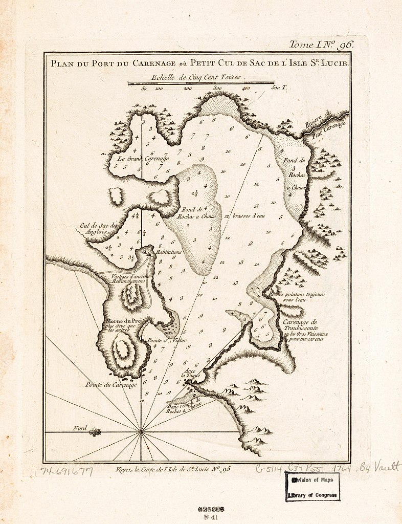
English: Scale ca. 1:12,600. Relief shown pictorially and by hachures. Depths shown in fathoms. "Tome I, no. 96." "Voyez la carte de l'isle de Se. Lucie, no. 95." From the author's Le petit atlas maritime. 1764. LC Maps of North America, 1750-1789, 2077 Available also through the Library of Congress Web site as a raster image. Vault AACR2 |
||
| Title | Plan du port du Carenage ou petit cul de sac de l'Isle Se. Lucie. | ||
| Shelf ID | G5114.C37P55 1764 .B4 | ||
| Date | |||
| Source | https://www.loc.gov/item/74691677/ | ||
| Author | [Bellin, Jacques Nicolas] | ||
| Permission (Reusing this file) |
|
||
| Other versions |
|
||
| Location | Saint Lucia · Castries. · Castries | ||
| Part of | Cities And Towns · Military Battles And Campaigns · Catalog · American Memory · Geography And Map Division · American Revolution And Its Era: Maps And Charts Of North America And The West Indies, 1750-1789 | ||
| Subject | Maps · Saint Lucia · Early Works To 1800 · Castries · Harbors |


Licensing[edit]
|
This is a faithful photographic reproduction of a two-dimensional, public domain work of art. The work of art itself is in the public domain for the following reason:
The official position taken by the Wikimedia Foundation is that "faithful reproductions of two-dimensional public domain works of art are public domain".
This photographic reproduction is therefore also considered to be in the public domain in the United States. In other jurisdictions, re-use of this content may be restricted; see Reuse of PD-Art photographs for details. | ||||
File history
Click on a date/time to view the file as it appeared at that time.
| Date/Time | Thumbnail | Dimensions | User | Comment | |
|---|---|---|---|---|---|
| current | 12:33, 12 February 2019 | | 2,452 × 3,195 (955 KB) | Fæ (talk | contribs) | LOC Maps https://www.loc.gov/item/74691677/ #14678 |
You cannot overwrite this file.
File usage on Commons
The following page uses this file: