File:Positionskarte EE + LV 1260.png
Jump to navigation
Jump to search
Size of this preview: 553 × 600 pixels. Other resolutions: 221 × 240 pixels | 443 × 480 pixels | 794 × 861 pixels.
Original file (794 × 861 pixels, file size: 120 KB, MIME type: image/png)
Captions
Captions
Add a one-line explanation of what this file represents
Summary[edit]
| Description |
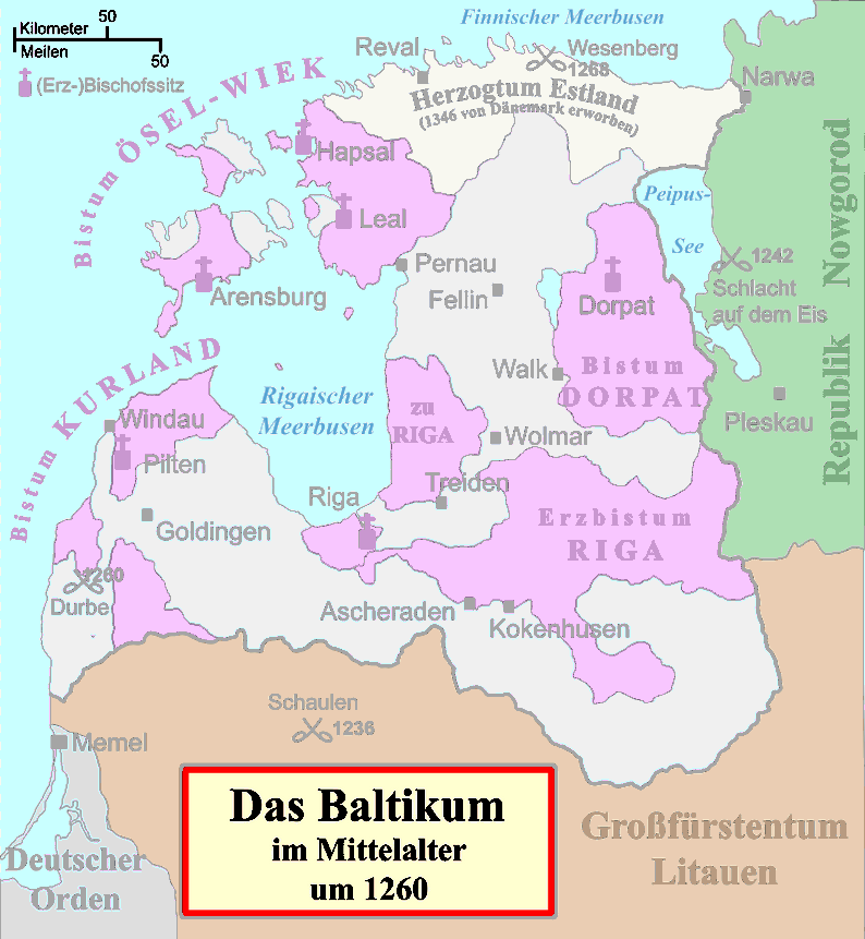
Deutsch: Politische Karte von Livland im Mittelalter, etwa 1260, Farbbearbeitung zur Verwendung als Hintergrundkarte.
Besitz des Schwertbrüderordens bzw. Deutschen Ordens (in Preußen)
Geistlicher Besitz English: Political map of the Medieval Livonia, circa 1260, along with surrounding areas, recoloured to be appropriate as background for locator maps:
Possessions of the Sword Brothers (in Livonia) and the Teutonic Order (in Prussia)
Ecclesiastical possessions |
||||||||
| Date | 2009-09-01, adaption 2018-07-25 | ||||||||
| Source |
File:Livland 1260.svg, using
|
||||||||
| Author | Originally created by MapMaster, commissioned by Attilios, translated by NordNordWest, modified by Furfur, adapted by Ulamm (talk) | ||||||||
| Permission (Reusing this file) |
I, the copyright holder of this work, hereby publish it under the following license:
|
||||||||
| Other versions | see source |

File history
Click on a date/time to view the file as it appeared at that time.
| Date/Time | Thumbnail | Dimensions | User | Comment | |
|---|---|---|---|---|---|
| current | 23:14, 24 July 2018 | | 794 × 861 (120 KB) | Ulamm (talk | contribs) | {{Information |Description= {{de|Politische Karte von Livland im Mittelalter, etwa 1260, Farbbearbeitung zur Verwendung als Hintergrundkarte. {{legend|#80D9ED|Besitz des Schwertbrüderordens bzw. Deutschen Ordens (in Preußen)}} {{legend|#BF8DC6|Geistlicher Besitz}} }} {{en|Political map of the Medieval Livonia, circa 1260, along with surrounding areas, recoloured to be appropriate as background for locator maps: {{legend|#80D9ED|Possessions of the Sword Brothers (in Livonia) and the Teutonic... |
You cannot overwrite this file.
File usage on Commons
There are no pages that use this file.
File usage on other wikis
The following other wikis use this file:
- Usage on et.wikipedia.org