File:Pozieres map J00158.jpg
Jump to navigation
Jump to search
Size of this preview: 389 × 599 pixels. Other resolutions: 156 × 240 pixels | 425 × 654 pixels.
Original file (425 × 654 pixels, file size: 172 KB, MIME type: image/jpeg)
Captions
Captions
Add a one-line explanation of what this file represents
Summary
[edit]| Description |
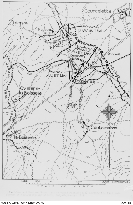
English: A map of Pozieres and Mouquet Farm, Somme, showing the four main phases in the Australian attack, July - September, 1916. |
||
| Date | |||
| Source |
|
||
| Author | From a tracing by Lieutenant Peter Rigby Wightman |

Licensing
[edit]
This image or other work is of Australian origin and is now in the public domain because its term of copyright has expired. According to the Australian Copyright Council (ACC), ACC Information Sheet G023v19 (Duration of copyright) (January 2019).1
When using this template, please provide information of where the image was first published and who created it. |
 | |||||||||||||||||||
File history
Click on a date/time to view the file as it appeared at that time.
| Date/Time | Thumbnail | Dimensions | User | Comment | |
|---|---|---|---|---|---|
| current | 23:47, 23 July 2016 | | 425 × 654 (172 KB) | Hawkeye7 (talk | contribs) | User created page with UploadWizard |
You cannot overwrite this file.
File usage on Commons
The following page uses this file: