File:Map of Rakhine (Arakan) State in Myanmar.png
(Redirected from File:Rakhine01.png)

Size of this preview: 373 × 600 pixels. Other resolutions: 149 × 240 pixels | 298 × 480 pixels | 651 × 1,047 pixels.
Original file (651 × 1,047 pixels, file size: 56 KB, MIME type: image/png)
Captions
Captions
Add a one-line explanation of what this file represents
Summary[edit]
_State_in_Myanmar.png&action=edit§ion=1)
| Description |
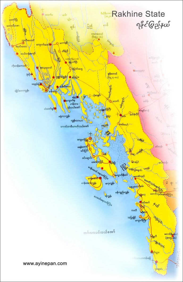
English: Map of the Rakhine (Arakan) State in Myanmar. |
| Date | |
| Source | Own work |
| Author | PANONIAN |
Licensing[edit]
_State_in_Myanmar.png&action=edit§ion=2)
I, the copyright holder of this work, hereby publish it under the following license:
| This file is made available under the Creative Commons CC0 1.0 Universal Public Domain Dedication. | |
| The person who associated a work with this deed has dedicated the work to the public domain by waiving all of their rights to the work worldwide under copyright law, including all related and neighboring rights, to the extent allowed by law. You can copy, modify, distribute and perform the work, even for commercial purposes, all without asking permission.
|
References[edit]
_State_in_Myanmar.png&action=edit§ion=3)
- http://www.myanmars.net/myanmar-map/rakhine.jpg
- http://www.edenhilltravels.com/wp-content/uploads/2013/08/rakhine-modified.jpg
- http://www.rfa.org/english/news/myanmar/violence-10252012182913.html/rakhine-map-new-390.jpg
- http://www.asterism.info/states/7/map.jpg
- http://www.allthingsburmese.com/images/Rakhine%20State%20Map.gif
- http://www.guideformyanmar.com/images/touristplace/rakhine_state.jpg
- https://arakanindobhasa.files.wordpress.com/2009/11/12.jpg
- http://reliefweb.int/sites/reliefweb.int/files/resources/map_2466.pdf
- http://maps.maphill.com/burma/arakan-rakhine/maps/savanna-style-map/savanna-style-map-of-arakan-rakhine.jpg
- http://maps.maphill.com/burma/arakan-rakhine/maps/satellite-map/cropped-outside/satellite-map-of-arakan-rakhine-cropped-outside.jpg
- http://maps.maphill.com/burma/arakan-rakhine/maps/shaded-relief-map/shaded-relief-map-of-arakan-rakhine.jpg
- http://www.burmalibrary.org/docs08/HRDU_YB-2008/multimedia/maps/townships.jpg
File history
Click on a date/time to view the file as it appeared at that time.
| Date/Time | Thumbnail | Dimensions | User | Comment | |
|---|---|---|---|---|---|
| current | 12:34, 4 July 2015 | | 651 × 1,047 (56 KB) | PANONIAN (talk | contribs) | minor fix |
| 11:30, 4 July 2015 |  | 651 × 1,047 (56 KB) | PANONIAN (talk | contribs) | {{Information |Description ={{en|1=Map of the Rakhine (Arakan) State in Myanmar.}} |Source ={{own}} |Author =PANONIAN |Date =2015 |Permission = |other_versions = }} |
You cannot overwrite this file.
File usage on Commons
The following page uses this file:
- File:Rakhine01.png (file redirect)
File usage on other wikis
The following other wikis use this file:
- Usage on as.wikipedia.org
- Usage on blk.wikipedia.org
- Usage on en.wikipedia.org
- Usage on id.wikipedia.org
- Usage on nl.wikipedia.org
- Usage on sat.wikipedia.org
- Usage on sh.wikipedia.org
- Usage on sr.wikipedia.org
- Usage on ta.wikipedia.org
_State_in_Myanmar.png&oldid=528463808)