File:Relief Map of Germany.svg

Dosyeya orjînal (Daneya SVG, mezinbûna rast: 1073 × 1272 pixel; mezinbûna daneyê: 6,54 MB)
Captions
Captions
Danasîn[biguhêre]
| Danasîn |
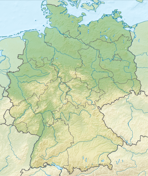
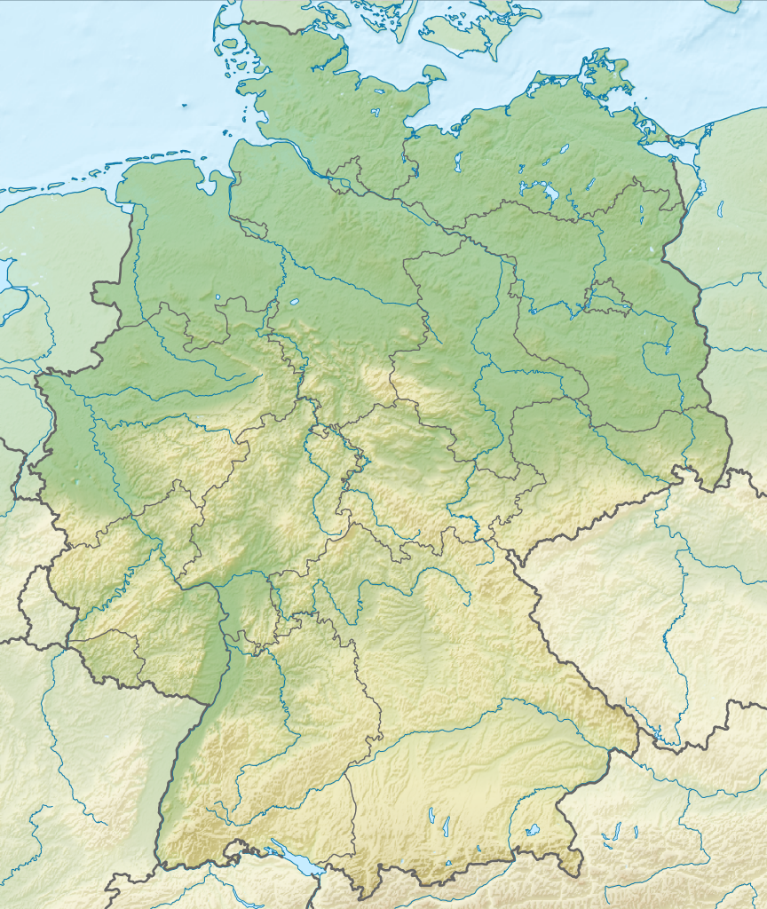
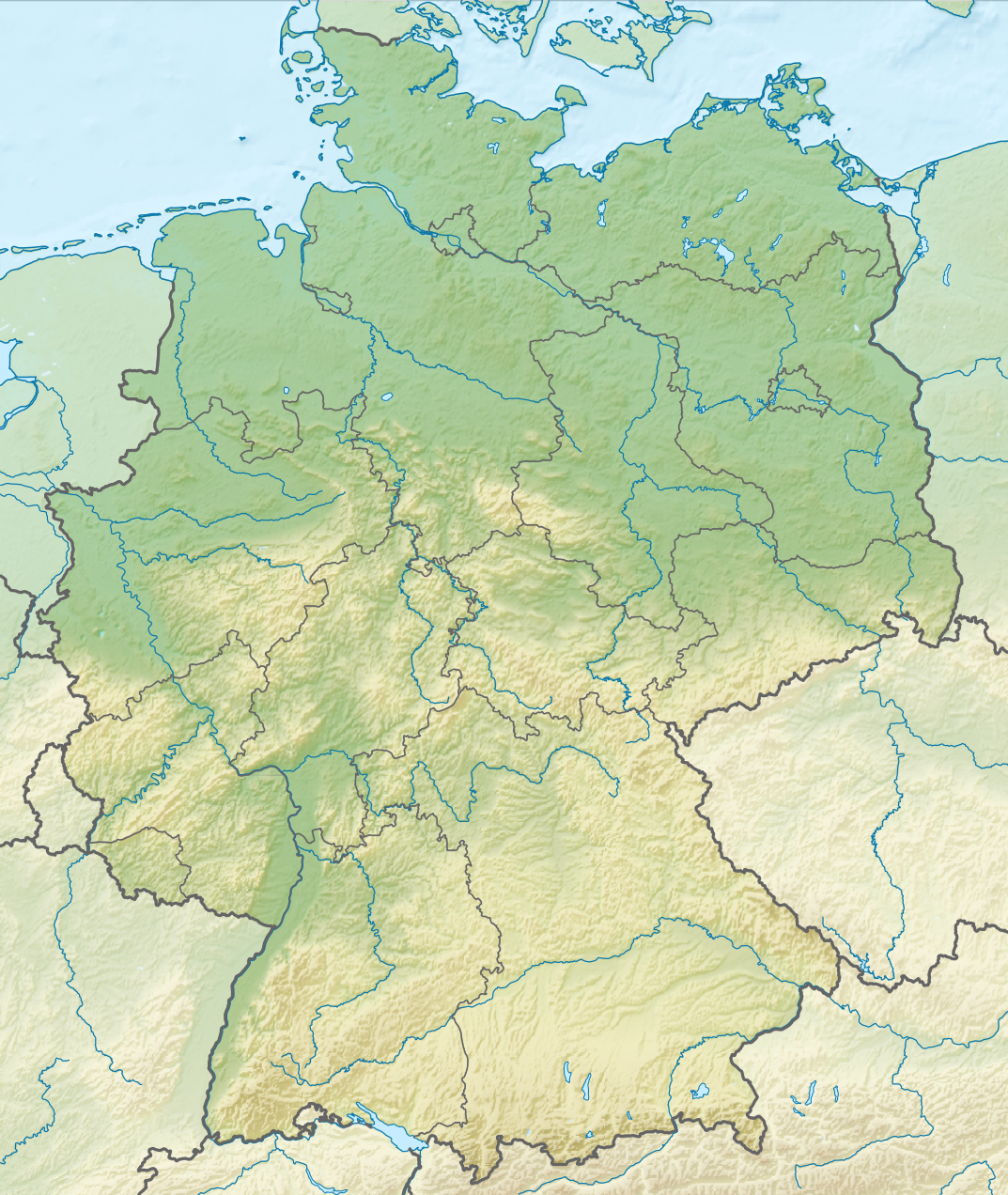
Deutsch: Positionskarte von Deutschland mit Gewässern
Quadratische Plattkarte, N-S-Streckung 150 %. Geographische Begrenzung der Karte:
English: Location map of Germany with waterbodies
Equirectangular projection, N/S stretching 150 %. Geographic limits of the map:
|
| Dîrok | |
| Çavkanî |
Min çêkir This vector image includes elements that have been taken or adapted from this file: This vector image includes elements that have been taken or adapted from this file: |
| Xwedî |
TUBS |
| Guhartoyên din |
Bundesrepublik Deutschland (vor 1990 nur West-Deutschland):
Deutsche Demokratische Republik (mit BRD im Ausschnitt):
Ostdeutschland (vor 1990 Deutsche Demokratische Republik):
Deutschland zwischen Mai 1945 und Oktober 1949:
Thematisch:
Deutsches Reich (1918–1945) (best used with this template (de)):
|
| SVG genesis |


_23_May_1949_-_6_Oct_1949.svg)


_location_map.svg)
_location_map_2013.svg)


Lîsans[biguhêre]
- Tu azad î:
- parve bike – ji bo kopîkirin, belavkirin û weşandina xebatê
- ji bo guhartin û adaptekirina naverokê – ji bo adaptekirina xebatê
- Di bin van mercan de:
- isnad – Divê tu isnadeke maqûl bikî, lînekek pêşkêş bikî ji bo lîsansê, û diyar bikî ku guhartin hatiye kirin an na. Tu dikarî vê yekê bi adilî bi cih bînî, lê ne bi awayê ku wekî lîsansor te an bikaranîna te pejirandibe.
- parvekirinê mîna hev – Ger tu materyalê biguherînî, bizivirînî formeke din, an ava bikî divê beşdariyên xwe di bin eynî lîsansê an lîsansa hevaheng de wekî ya eslî belav bikî.

|
I'd greatly appreciate, that you attribute this media file to Wikimedia Commons, if used outside Wikipedia or Commons. For use in publications such as books, newspapers, blogs, websites, please insert here the following line:
|
Dîroka daneyê
Ji bo dîtina guhartoya wê demê bişkoka dîrokê bitikîne.
| Dîrok/Katjimêr | Wêneyê biçûk | Mezinahî | Bikarhêner | Şirove | |
|---|---|---|---|---|---|
| niha | 14:00, 1 kanûna pêşîn 2011 | | 1073 x 1272 (6,54 MB) | TUBS (gotûbêj | beşdarî) |
Tu nikarî cardin li ser vê dosyeyê binivîsînî.
Bikaranîna pelê
Ev 43 rûpel li jêr vê dosyeyê bi kar tînin:
- Commons:Files used on RegiowikiAT/9
- Commons:Files used on Wikimedia Österreich Mitglieder/2
- File:Deutschland Autobahnen.svg
- File:East-West-Germany-October 1949-July 1952.svg
- File:East Germany location map.svg
- File:Germany, Federal Republic of location map 23 May 1949 - 6 Oct 1949.svg
- File:Germany, Federal Republic of location map April 1952 - August 1955.svg
- File:Germany, Federal Republic of location map December 1950 - April 1952.svg
- File:Germany, Federal Republic of location map January 1957 - October 1990.svg
- File:Germany, Federal Republic of location map October 1949 - November 1950.svg
- File:Germany, Federal Republic of location map September 1955 - December 1956.svg
- File:Germany, German Democratic Republic location map January 1957 - October 1990.svg
- File:Germany, German Democratic Republic location map July 1952 - January 1957.svg
- File:Germany, German Democratic Republic location map October 1949 - July 1952.svg
- File:Germany, German Democratic Republic location map w·o FRG July 1952 - October 1990.svg
- File:Germany, German Democratic Republic location map w·o FRG October 1949 - June 1952.svg
- File:Germany, location map (SBZ perspective) 23 May 1949 - 6 Oct 1949.svg
- File:Germany2 location map.svg
- File:Germany location map.svg
- File:Germany location map 23 April 1949 - 22 May 1949.svg
- File:Germany location map 8 Jun 1947 - 22 Apr 1949.svg
- File:Germany location map April 1992 - July 1992.svg
- File:Germany location map August 1992 - June 1993.svg
- File:Germany location map July 1993 - December 2009.svg
- File:Germany location map October 1990 - March 1992.svg
- File:Germany location map labeled 8 Jun 1947 - 22 Apr 1949.svg
- File:Lage Freiberg in Deutschland.png
- File:Map Artemia Germany Uwe Manzke.jpg
- File:Map Branchipus schaefferi Germany Uwe Manzke.jpg
- File:Map Chirocephalus diaphanus Germany Uwe Manzke.jpg
- File:Map Eubranchipus grubii Germany Uwe Manzke.jpg
- File:Map Lepidurus apus Germany Uwe Manzke.jpg
- File:Map Leptestheria dahalacensis Germany Uwe Manzke.jpg
- File:Map Limnadia lenticularis Germany Uwe Manzke.jpg
- File:Map Lynceus brachyurus Germany Uwe Manzke.jpg
- File:Map Streptocephalus torvicornis Germany Uwe Manzke.jpg
- File:Map Tanymastix stagnalis Germany Uwe Manzke.jpg
- File:Map Triops cancriformis Germany Uwe Manzke.jpg
- File:Relief Map of Germany.png
- File:Relief Map of Germany.svg
- File:Spielbanken Deutschland.png
- File:Westphalia in Germany FMue.png
- Template:Germany location map/other versions
Bikaranîna gerdûnî ya pelê
Ev wîkiyên di rêzê de vê pelê bi kar tînin:
- Bikaranîna di an.wikipedia.org de
- Bikaranîna di ar.wikipedia.org de
- Bikaranîna di ast.wikipedia.org de
- Bikaranîna di az.wikipedia.org de
- Bikaranîna di ban.wikipedia.org de
- Taman Nasional Swiss Saxon
- Taman Nasional Hunsrück-Hochwald
- Taman Nasional Eifel
- Taman Nasional Hainich
- Taman Nasional Kellerwald-Edersee
- Taman Nasional Harz
- Taman Nasional Lebah Oder Sor
- Taman Nasional Müritz
- Taman Nasional Wawengkon Laguna Pomerania Kawan
- Taman Nasional Jasmund
- Taman Nasional Segara Wadden Saxon Sor
- Danu Laacher
- Bikaranîna di ba.wikipedia.org de
- Bikaranîna di be.wikipedia.org de
Zêdetir bikaranîna global a vê pelê bibîne.