File:Relief Map of Germany.svg
跳至導覽
跳至搜尋

此 SVG 檔案的 PNG 預覽的大小:506 × 600 像素。 其他解析度:202 × 240 像素 | 405 × 480 像素 | 648 × 768 像素 | 864 × 1,024 像素 | 1,728 × 2,048 像素 | 1,073 × 1,272 像素。
原始檔案 (SVG 檔案,表面大小:1,073 × 1,272 像素,檔案大小:6.54 MB)
說明
說明
添加單行說明來描述出檔案所代表的內容
摘要[編輯]
| 描述 |
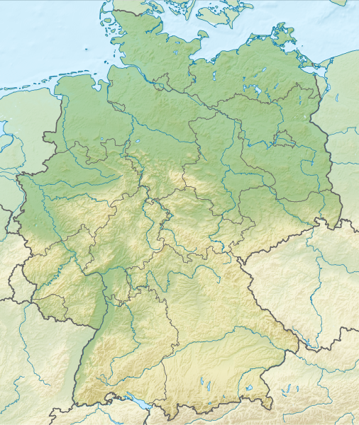
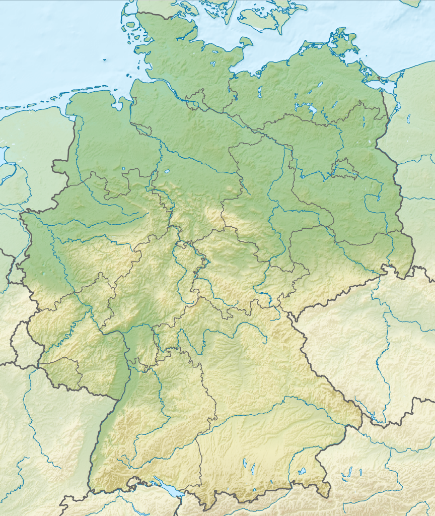
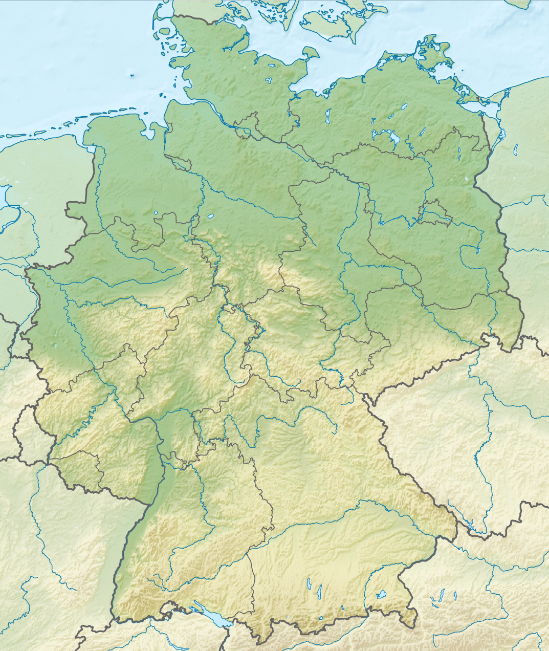
Deutsch: Positionskarte von Deutschland mit Gewässern
Quadratische Plattkarte, N-S-Streckung 150 %. Geographische Begrenzung der Karte:
English: Location map of Germany with waterbodies
Equirectangular projection, N/S stretching 150 %. Geographic limits of the map:
|
| 日期 | |
| 來源 |
自己的作品 |
| 作者 |
TUBS |
| 其他版本 |
Bundesrepublik Deutschland (vor 1990 nur West-Deutschland):
Deutsche Demokratische Republik (mit BRD im Ausschnitt):
Ostdeutschland (vor 1990 Deutsche Demokratische Republik):
Deutschland zwischen Mai 1945 und Oktober 1949:
Thematisch:
Deutsches Reich (1918–1945) (best used with this template (de)):
|
| SVG開發 |


_23_May_1949_-_6_Oct_1949.svg)


_location_map.svg)
_location_map_2013.svg)


授權條款[編輯]
我,本作品的著作權持有者,決定用以下授權條款發佈本作品:
此檔案採用創用CC 姓名標示-相同方式分享 3.0 未在地化版本授權條款。
- 您可以自由:
- 分享 – 複製、發佈和傳播本作品
- 重新修改 – 創作演繹作品
- 惟需遵照下列條件:
- 姓名標示 – 您必須指名出正確的製作者,和提供授權條款的連結,以及表示是否有對內容上做出變更。您可以用任何合理的方式來行動,但不得以任何方式表明授權條款是對您許可或是由您所使用。
- 相同方式分享 – 如果您利用本素材進行再混合、轉換或創作,您必須基於如同原先的相同或兼容的條款,來分布您的貢獻成品。

|
如果在維基百科或共享資源之外使用,您將此媒體檔案歸於維基共享資源,我將不勝感激。要在書籍、報紙、博客、網站等出版物中使用,請插入這以下行:
|
檔案歷史
點選日期/時間以檢視該時間的檔案版本。
| 日期/時間 | 縮圖 | 尺寸 | 使用者 | 備註 | |
|---|---|---|---|---|---|
| 目前 | 2011年12月1日 (四) 14:00 | | 1,073 × 1,272(6.54 MB) | TUBS(留言 | 貢獻) |
無法覆蓋此檔案。
檔案用途
下列43個頁面有用到此檔案:
- Commons:Files used on RegiowikiAT/9
- Commons:Files used on Wikimedia Österreich Mitglieder/2
- File:Deutschland Autobahnen.svg
- File:East-West-Germany-October 1949-July 1952.svg
- File:East Germany location map.svg
- File:Germany, Federal Republic of location map 23 May 1949 - 6 Oct 1949.svg
- File:Germany, Federal Republic of location map April 1952 - August 1955.svg
- File:Germany, Federal Republic of location map December 1950 - April 1952.svg
- File:Germany, Federal Republic of location map January 1957 - October 1990.svg
- File:Germany, Federal Republic of location map October 1949 - November 1950.svg
- File:Germany, Federal Republic of location map September 1955 - December 1956.svg
- File:Germany, German Democratic Republic location map January 1957 - October 1990.svg
- File:Germany, German Democratic Republic location map July 1952 - January 1957.svg
- File:Germany, German Democratic Republic location map October 1949 - July 1952.svg
- File:Germany, German Democratic Republic location map w·o FRG July 1952 - October 1990.svg
- File:Germany, German Democratic Republic location map w·o FRG October 1949 - June 1952.svg
- File:Germany, location map (SBZ perspective) 23 May 1949 - 6 Oct 1949.svg
- File:Germany2 location map.svg
- File:Germany location map.svg
- File:Germany location map 23 April 1949 - 22 May 1949.svg
- File:Germany location map 8 Jun 1947 - 22 Apr 1949.svg
- File:Germany location map April 1992 - July 1992.svg
- File:Germany location map August 1992 - June 1993.svg
- File:Germany location map July 1993 - December 2009.svg
- File:Germany location map October 1990 - March 1992.svg
- File:Germany location map labeled 8 Jun 1947 - 22 Apr 1949.svg
- File:Lage Freiberg in Deutschland.png
- File:Map Artemia Germany Uwe Manzke.jpg
- File:Map Branchipus schaefferi Germany Uwe Manzke.jpg
- File:Map Chirocephalus diaphanus Germany Uwe Manzke.jpg
- File:Map Eubranchipus grubii Germany Uwe Manzke.jpg
- File:Map Lepidurus apus Germany Uwe Manzke.jpg
- File:Map Leptestheria dahalacensis Germany Uwe Manzke.jpg
- File:Map Limnadia lenticularis Germany Uwe Manzke.jpg
- File:Map Lynceus brachyurus Germany Uwe Manzke.jpg
- File:Map Streptocephalus torvicornis Germany Uwe Manzke.jpg
- File:Map Tanymastix stagnalis Germany Uwe Manzke.jpg
- File:Map Triops cancriformis Germany Uwe Manzke.jpg
- File:Relief Map of Germany.png
- File:Relief Map of Germany.svg
- File:Spielbanken Deutschland.png
- File:Westphalia in Germany FMue.png
- Template:Germany location map/other versions
全域檔案使用狀況
以下其他 wiki 使用了這個檔案:
- an.wikipedia.org 的使用狀況
- ar.wikipedia.org 的使用狀況
- ast.wikipedia.org 的使用狀況
- az.wikipedia.org 的使用狀況
- ban.wikipedia.org 的使用狀況
- Taman Nasional Swiss Saxon
- Taman Nasional Hunsrück-Hochwald
- Taman Nasional Eifel
- Taman Nasional Hainich
- Taman Nasional Kellerwald-Edersee
- Taman Nasional Harz
- Taman Nasional Lebah Oder Sor
- Taman Nasional Müritz
- Taman Nasional Wawengkon Laguna Pomerania Kawan
- Taman Nasional Jasmund
- Taman Nasional Segara Wadden Saxon Sor
- Danu Laacher
- ba.wikipedia.org 的使用狀況
- be.wikipedia.org 的使用狀況
檢視此檔案的更多全域使用狀況。