File:RetrieveUnitStitch.PNG
Jump to navigation
Jump to search

Size of this preview: 635 × 600 pixels. Other resolutions: 254 × 240 pixels | 508 × 480 pixels | 994 × 939 pixels.
Original file (994 × 939 pixels, file size: 1.01 MB, MIME type: image/png)
Captions
Captions
Add a one-line explanation of what this file represents
Summary[edit]
| Description |
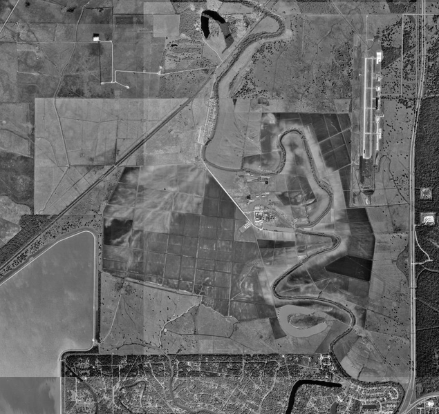
English: Aerial photograph of the Wayne Scott (Retrieve) Unit and the Texas Gulf Coast Regional Airport (Brazoria County Airport)
Español: Fotografía aérea de la Unidad Wayne Scott (Retrieve) y el Aeropuerto Texas Gulf Coast (Aeropuerto del Condado de Brazoria) |
| Date | |
| Source | http://msrmaps.com/image.aspx?T=1&S=13&Z=15&X=160&Y=2013&W=3 |
| Author | U.S. Geological Survey/Servicio Geológico de los Estados Unidos |
| Permission (Reusing this file) |
Public domain |
Licensing[edit]
This image is in the public domain in the United States because it only contains materials that originally came from the United States Geological Survey, an agency of the United States Department of the Interior. For more information, see the official USGS copyright policy.
|
| Annotations | This image is annotated: View the annotations at Commons |
File history
Click on a date/time to view the file as it appeared at that time.
| Date/Time | Thumbnail | Dimensions | User | Comment | |
|---|---|---|---|---|---|
| current | 04:35, 12 March 2011 | | 994 × 939 (1.01 MB) | WhisperToMe (talk | contribs) | {{Information |Description ={{en|1=Aerial photograph of the Wayne Scott (Retrieve) Unit and Brazoria County Airport}} {{es|1=Fotografía aérea de la Unidad Wayne Scott (Retrieve) y el Aeropuerto |
You cannot overwrite this file.
File usage on Commons
The following page uses this file:
File usage on other wikis
The following other wikis use this file:
- Usage on arz.wikipedia.org
- Usage on ceb.wikipedia.org
- Usage on en.wikipedia.org
- Usage on www.wikidata.org