File:Road and Rail - geograph.org.uk - 1753898.jpg
Jump to navigation
Jump to search

Size of this preview: 800 × 495 pixels. Other resolutions: 320 × 198 pixels | 640 × 396 pixels | 1,024 × 634 pixels | 1,600 × 990 pixels.
Original file (1,600 × 990 pixels, file size: 606 KB, MIME type: image/jpeg)
Captions
Captions
Add a one-line explanation of what this file represents
Summary
[edit]
| Description |
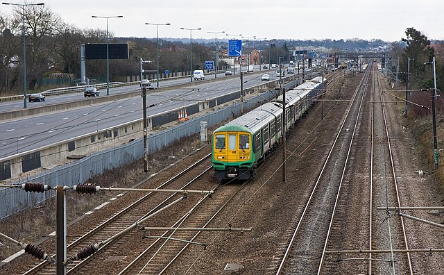
English: Road and Rail View southeast from a footbridge carrying the path between Mill Way and Hale Grove Gardens. On the Left is the M1 Motorway - traffic is quite light in the middle of the day photograph. The large blue sign advises drivers of the junction with the A1 a short distance down the road - giving access to the City and Holloway as well as the A406 North Circular Road eastbound.
On the right is the St. Pancras to Leicester railway line. Approaching is a class 319 electric unit in Southern livery operating a stopping service to St. Albans City station. In the distance is Mill Hill Broadway station where the opposite direction service can be seen in the platform - in this case the destination was Brighton. On the fast lines, another train can be seen approaching Mill Hill Broadway - a fast Bedford service which calls a Luton then all stations to Bedford. |
| Date | |
| Source | From geograph.org.uk |
| Author | Martin Addison |
| Attribution (required by the license) | Martin Addison / Road and Rail / |
| Camera location | | View this and other nearby images on: OpenStreetMap |
|---|
_heading:135.00&language=en)
| Object location | | View this and other nearby images on: OpenStreetMap |
|---|
_heading:135.00&language=en)
Licensing
[edit]

|
This image was taken from the Geograph project collection. See this photograph's page on the Geograph website for the photographer's contact details. The copyright on this image is owned by Martin Addison and is licensed for reuse under the Creative Commons Attribution-ShareAlike 2.0 license.
|
This file is licensed under the Creative Commons Attribution-Share Alike 2.0 Generic license.
Attribution: Martin Addison
- You are free:
- to share – to copy, distribute and transmit the work
- to remix – to adapt the work
- Under the following conditions:
- attribution – You must give appropriate credit, provide a link to the license, and indicate if changes were made. You may do so in any reasonable manner, but not in any way that suggests the licensor endorses you or your use.
- share alike – If you remix, transform, or build upon the material, you must distribute your contributions under the same or compatible license as the original.
File history
Click on a date/time to view the file as it appeared at that time.
| Date/Time | Thumbnail | Dimensions | User | Comment | |
|---|---|---|---|---|---|
| current | 00:07, 6 March 2011 | | 1,600 × 990 (606 KB) | GeographBot (talk | contribs) | == {{int:filedesc}} == {{Information |description={{en|1=Road and Rail View southeast from a footbridge carrying the path between Mill Way and Hale Grove Gardens. On the Left is the M1 Motorway - traffic is quite light in the middle of the day photograph |
You cannot overwrite this file.
File usage on Commons
There are no pages that use this file.