File:Rock Lake bathymetric map.pdf
Jump to navigation
Jump to search

Size of this JPG preview of this PDF file: 780 × 600 pixels. Other resolutions: 312 × 240 pixels | 624 × 480 pixels | 999 × 768 pixels | 1,280 × 984 pixels | 2,560 × 1,968 pixels | 6,914 × 5,316 pixels.

Original file (6,914 × 5,316 pixels, file size: 328 KB, MIME type: application/pdf, 3 pages)
Captions
Captions
Add a one-line explanation of what this file represents
Summary
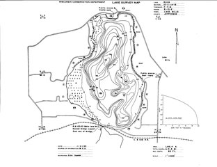
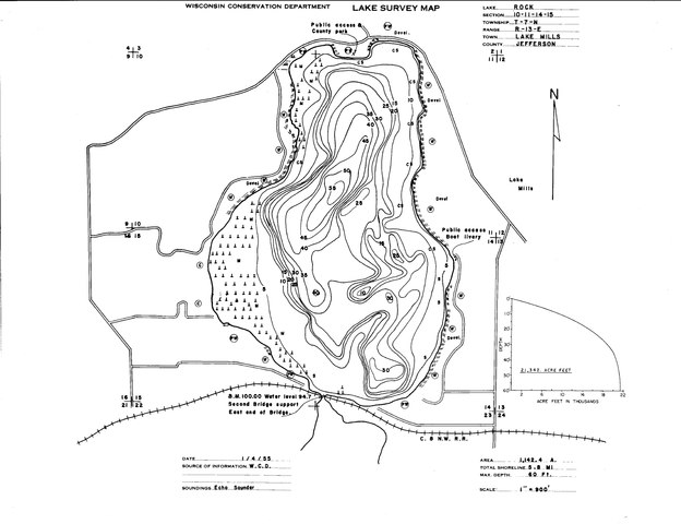
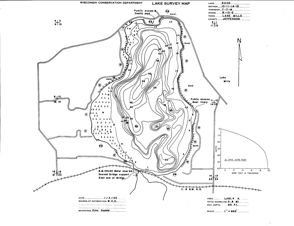
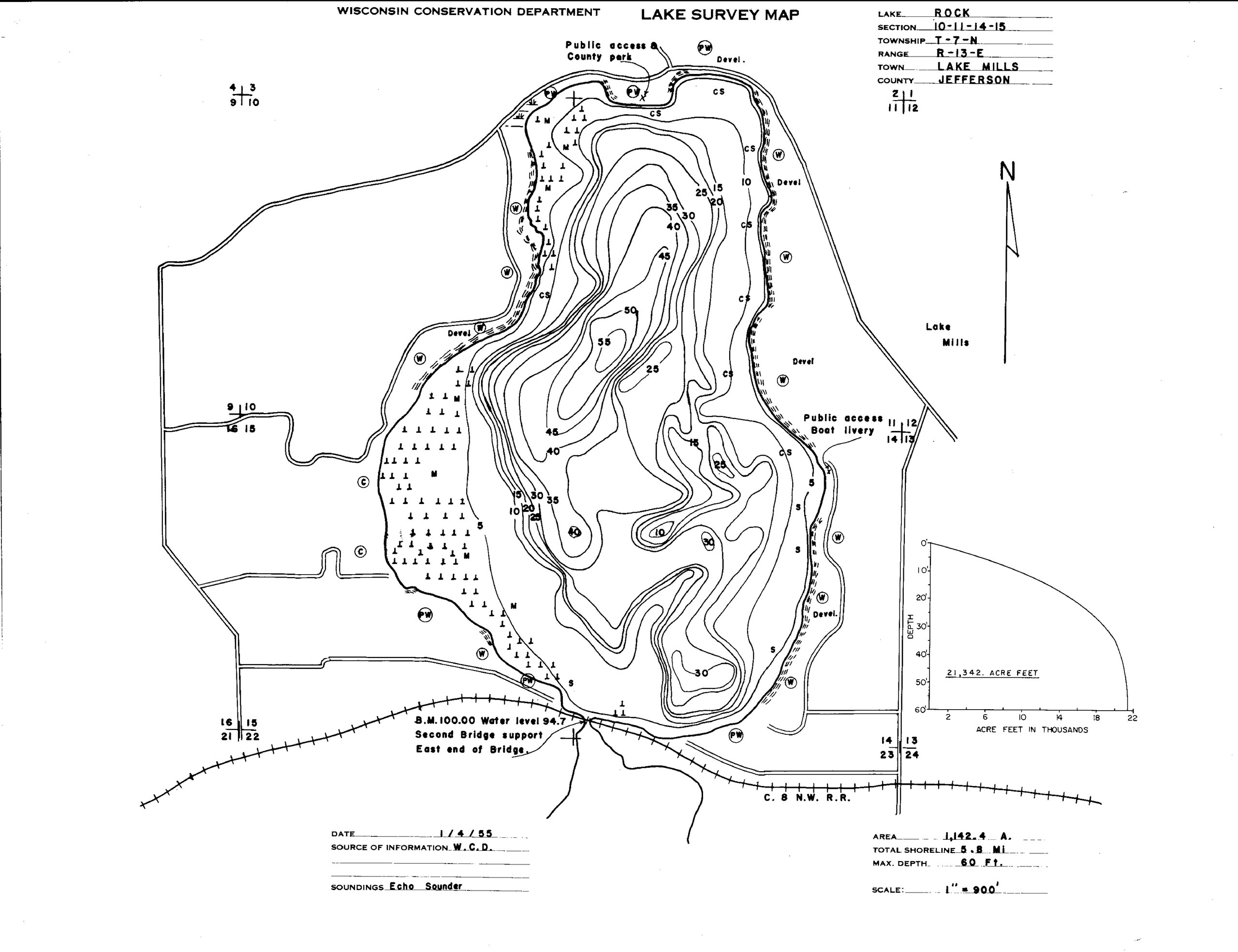
[edit]| Description | This is taken from Wisconsin DNR. Bathymetric map of Rock Lake |
| Date | |
| Source | [1] |
| Author | State of Wisconsin |
Licensing
[edit]This work is in the public domain in the United States because it was published in the United States between 1929 and 1977, inclusive, without a copyright notice. For further explanation, see Commons:Hirtle chart as well as a detailed definition of "publication" for public art. Note that it may still be copyrighted in jurisdictions that do not apply the rule of the shorter term for US works (depending on the date of the author's death), such as Canada (50 p.m.a.), Mainland China (50 p.m.a., not Hong Kong or Macao), Germany (70 p.m.a.), Mexico (100 p.m.a.), Switzerland (70 p.m.a.), and other countries with individual treaties.
|
 |
Original upload log
[edit]The original description page was here. All following user names refer to en.wikipedia.
| Date/Time | Dimensions | User | Comment |
|---|---|---|---|
| 2020-12-11 00:48:28 | 6914 × 5316 | Zhhuangj | This is taken from Wisconsin DNR. Bathymetric map of Rock Lake <ref>https://dnr.wi.gov/lakes/maps/DNR/0830700a.pdf</ref> |
File history
Click on a date/time to view the file as it appeared at that time.
| Date/Time | Thumbnail | Dimensions | User | Comment | |
|---|---|---|---|---|---|
| current | 00:17, 18 January 2021 |  | 6,914 × 5,316, 3 pages (328 KB) | FSock (talk | contribs) | Transferred from en.wikipedia (MTC!) (1.1.1) |
You cannot overwrite this file.
File usage on Commons
There are no pages that use this file.
File usage on other wikis
The following other wikis use this file:
- Usage on en.wikipedia.org