File:Rur Urft map.png
Jump to navigation
Jump to search
Size of this preview: 651 × 600 pixels. Other resolutions: 260 × 240 pixels | 521 × 480 pixels | 833 × 768 pixels | 1,111 × 1,024 pixels | 1,899 × 1,750 pixels.
Original file (1,899 × 1,750 pixels, file size: 3.05 MB, MIME type: image/png)
Captions
Captions
Add a one-line explanation of what this file represents
| Description |
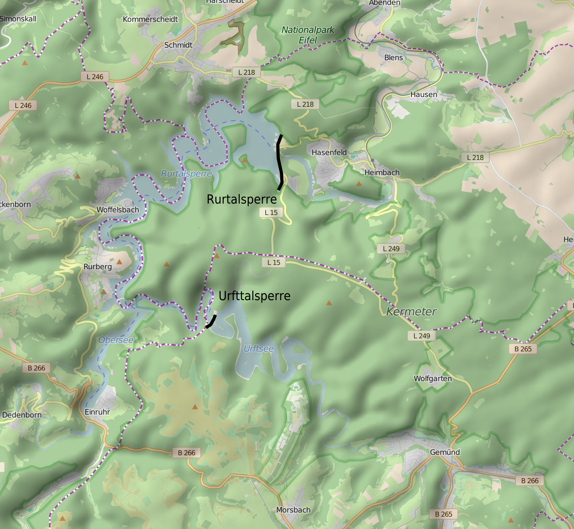
English: Location map for Rurtalsperre and Urfttalsperre, Germany Nederlands: Lokatiekaart van de Roerdaldam en Urftdaldam, Duitsland Deutsch: Lagekarte der Rurtalsperre und Urfttalsperre |
| Date | (UTC) |
| Source | Own work, OpenStreetmap, SRTM |
| Author | Hans Erren, OpenStreetMap, NASA-SRTM |
SRTM hillshade added using QGIS
I, the copyright holder of this work, hereby publish it under the following license:
| This file is licensed under the Creative Commons Attribution-Share Alike 3.0 Unported license. | ||
| ||
| This licensing tag was added to this file as part of the GFDL licensing update. |
This image uses high-resolution digital topography data from NASA's Shuttle Radar Topography Mission (SRTM) at JPL-Caltech [1]. It is in the public domain in the United States.
|
 | |
| Description |
This map was created from OpenStreetMap project data, collected by the community. This map may be incomplete, and may contain errors. Don't rely solely on it for navigation. |
|||
| Date | (see file history) | |||
| Source | openstreetmap.org | |||
| Creator |
OpenStreetMap contributors |
|||
| Permission (Reusing this file) |
OpenStreetMap data is available under the Open Database License (details). Map tiles are licensed under the Creative Commons Attribution-ShareAlike 2.0 license (CC-BY-SA 2.0).
This file is licensed under the Creative Commons Attribution-Share Alike 2.0 Generic license.
|
|||
| Georeferencing | If inappropriate please set warp_status = skip to hide. |
File history
Click on a date/time to view the file as it appeared at that time.
| Date/Time | Thumbnail | Dimensions | User | Comment | |
|---|---|---|---|---|---|
| current | 18:26, 1 August 2016 | | 1,899 × 1,750 (3.05 MB) | Hans Erren (talk | contribs) | extent of first version |
| 22:12, 30 July 2016 |  | 1,546 × 1,692 (2.96 MB) | Hans Erren (talk | contribs) | smooth SRTM hillshade rendering using QGIS | |
| 15:20, 3 December 2010 |  | 1,883 × 1,750 (1.35 MB) | Hans Erren (talk | contribs) | {{Information |Description={{en|1=Location map for Rurtalsperre and Urfttalsperre, Germany}} {{nl|1=Lokatiekaart van de Roerdaldam en Urftdaldam, Duitsland}} {{de|1=Lagekarte der Rurtalsperre und Urfttalsperre}} |Source=*File:Rur_Urft_map.svg |Date= |
You cannot overwrite this file.
File usage on Commons
The following 2 pages use this file:
File usage on other wikis
The following other wikis use this file:
- Usage on ceb.wikipedia.org
- Usage on it.wikipedia.org
- Usage on nl.wikipedia.org
- Usage on www.wikidata.org