File:Russia Row and Trump Street 1910s Ordnance Survey map.jpg
Original file (2,235 × 2,171 pixels, file size: 2.04 MB, MIME type: image/jpeg)
Captions
Captions
| Description |
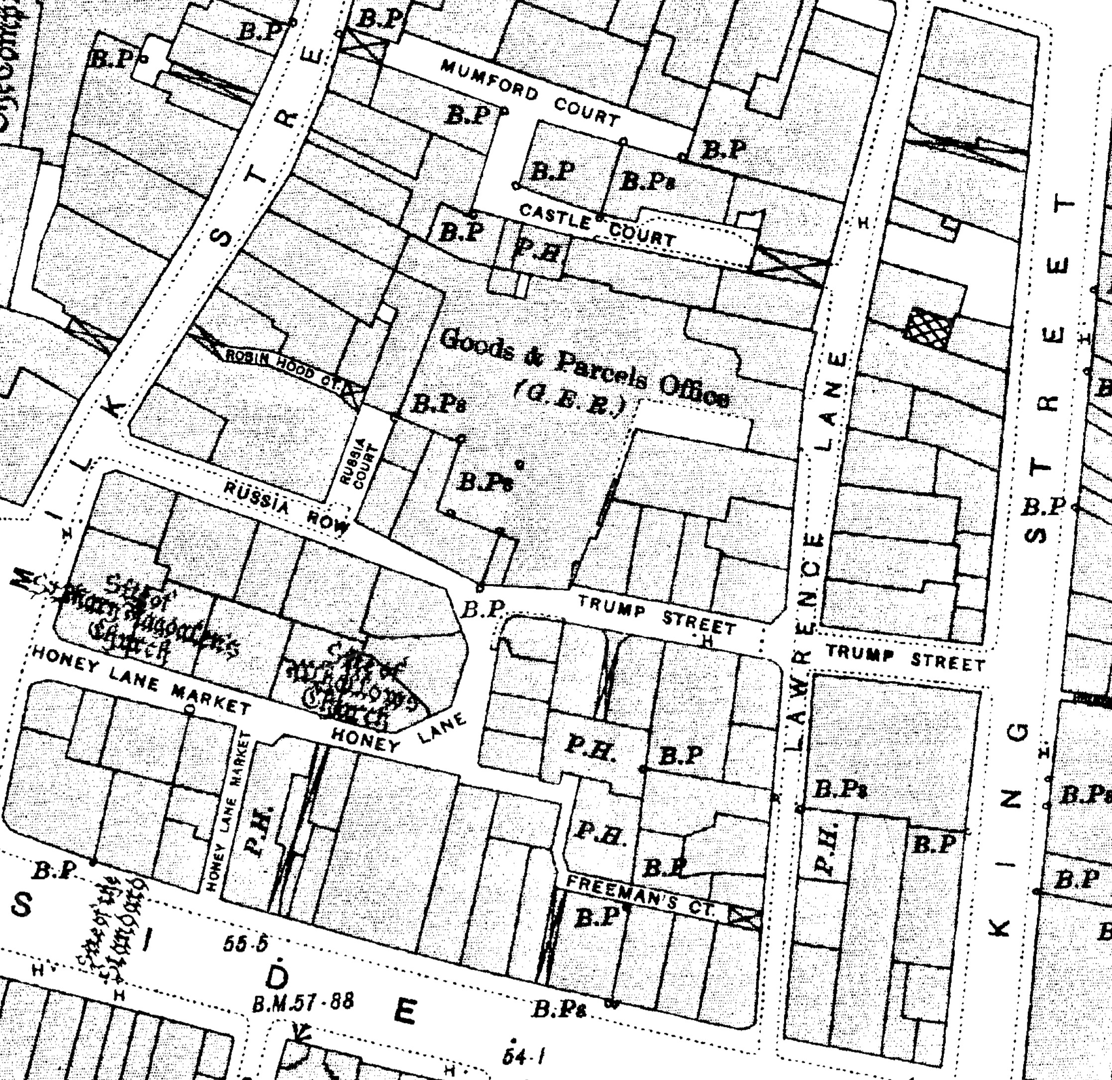
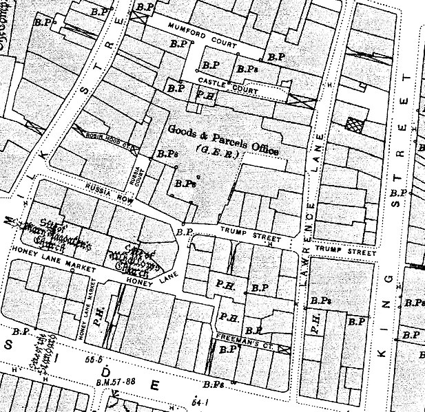
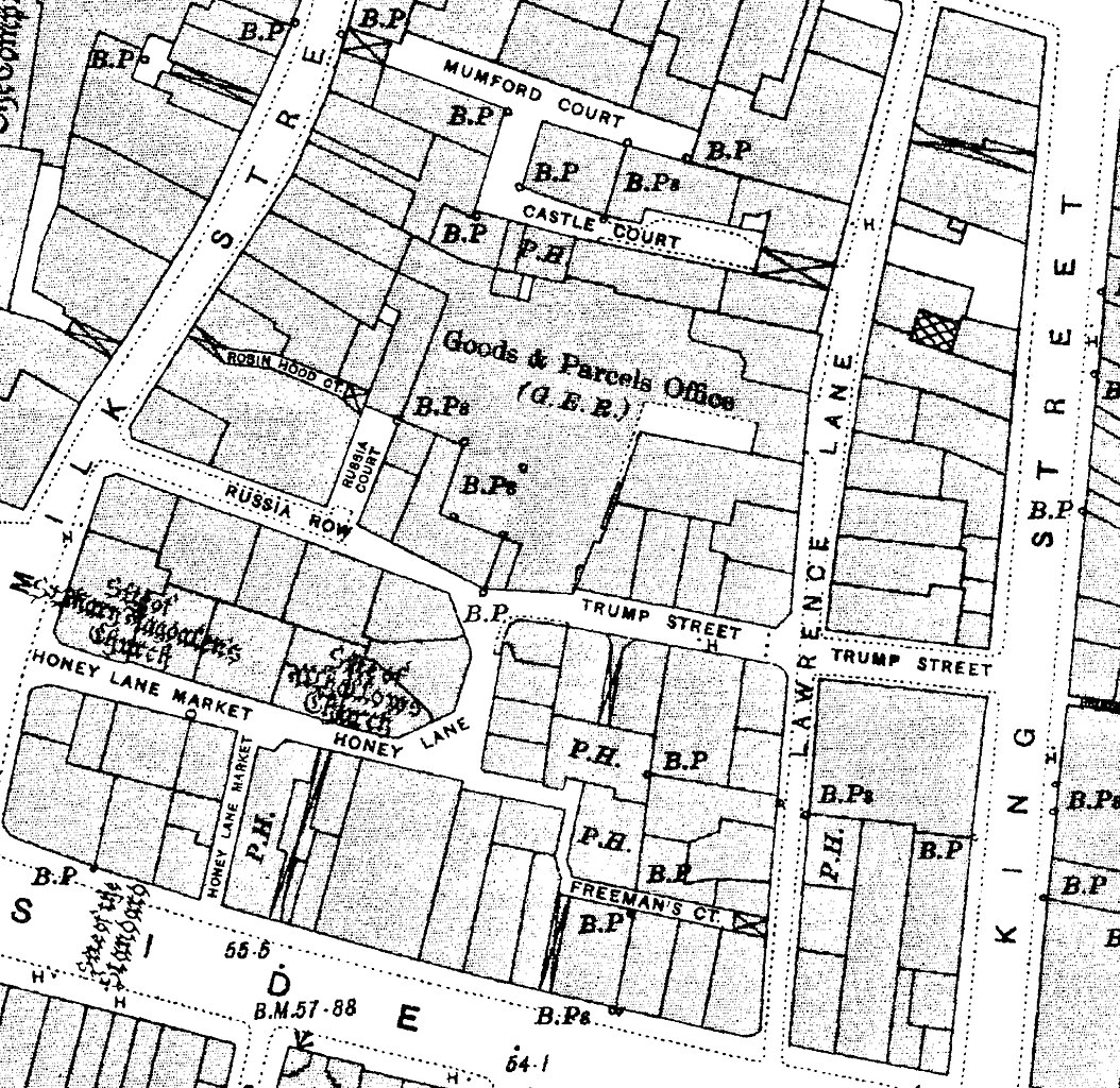
English: Russia Row and Trump Street 1910s Ordnance Survey map. |
|||||||
| Date | 1910s | |||||||
| Source | Scan of original | |||||||
| Author | Ordnance Survey | |||||||
| Permission (Reusing this file) |
|
|||||||

File history
Click on a date/time to view the file as it appeared at that time.
| Date/Time | Thumbnail | Dimensions | User | Comment | |
|---|---|---|---|---|---|
| current | 22:57, 6 January 2018 | | 2,235 × 2,171 (2.04 MB) | Philafrenzy (talk | contribs) | {{Information |Description ={{en|1=Russia Row and Trump Street 1910s Ordnance Survey map.}} |Source =Scan of original |Author =Ordnance Survey |Date =1910s |Permission ={{PD-Old}}{{PD-UKGov}} |other_versions = }} [[Cat... |
You cannot overwrite this file.
File usage on Commons
There are no pages that use this file.
File usage on other wikis
The following other wikis use this file:
- Usage on de.wikipedia.org
- Usage on en.wikipedia.org