File:Sázava topo 1955.jpg
Jump to navigation
Jump to search

Size of this preview: 655 × 600 pixels. Other resolutions: 262 × 240 pixels | 524 × 480 pixels | 839 × 768 pixels | 1,118 × 1,024 pixels | 1,765 × 1,616 pixels.
Original file (1,765 × 1,616 pixels, file size: 1.49 MB, MIME type: image/jpeg)
Captions
Captions
Add a one-line explanation of what this file represents
Summary[edit]
| Description |
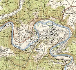
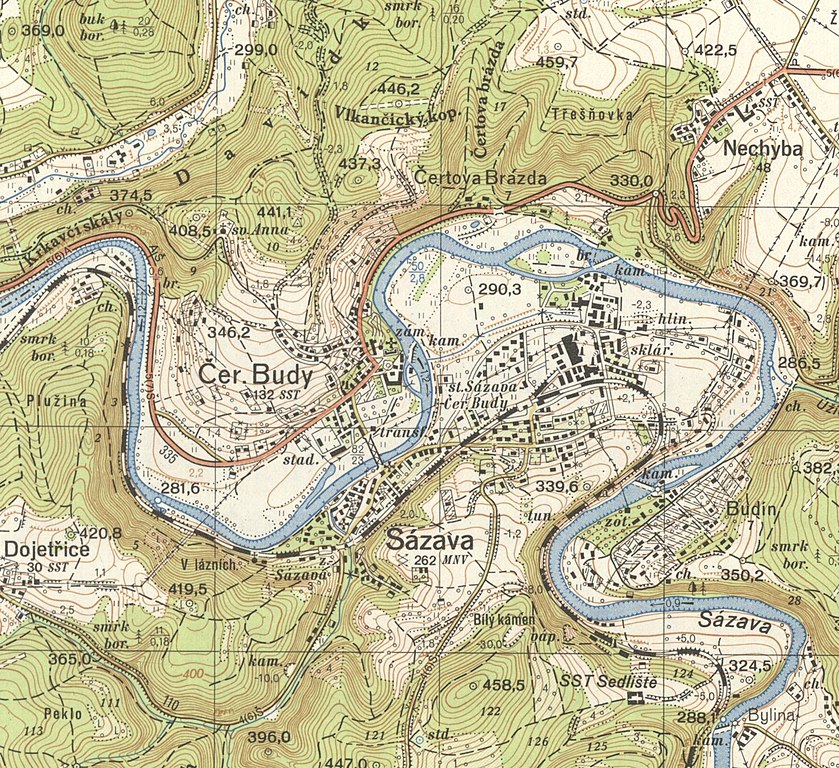
Čeština: Město Sázava, výřez z mapového listu M_33_78_B_d topografické mapy S-1952 v měřítku 1:25 000, mapováno 1955, tištěno 1956 |
| Date | |
| Source | https://www.cuzk.cz/Urady/Zememericky-urad/Dalsi-informace/UAZK/Prohlizeni-archivalii,-archivni-mapy.aspx |
| Author | Anonymous |
| Camera location | | View this and other nearby images on: OpenStreetMap |
|---|

|
This file was created on the basis of data provided by the Central Archives of Surveying and Land Register (State Administration of Land Surveying and Cadastre).
|
Licensing[edit]
According to the Czech Copyright Act, this work is in the public domain.
(Law No. 121/2000, Article 3, Section a) “Protection pursuant to this Act shall not apply to
|
 |
File history
Click on a date/time to view the file as it appeared at that time.
| Date/Time | Thumbnail | Dimensions | User | Comment | |
|---|---|---|---|---|---|
| current | 05:52, 9 June 2021 | | 1,765 × 1,616 (1.49 MB) | Gampe (talk | contribs) | Uploaded a work by {{anonymous}} from https://www.cuzk.cz/Urady/Zememericky-urad/Dalsi-informace/UAZK/Prohlizeni-archivalii,-archivni-mapy.aspx with UploadWizard |
You cannot overwrite this file.
File usage on Commons
There are no pages that use this file.
File usage on other wikis
The following other wikis use this file:
- Usage on cs.wikipedia.org