File:Salzwanderweg 12.jpg
Jump to navigation
Jump to search
Size of this preview: 288 × 600 pixels. Other resolutions: 115 × 240 pixels | 230 × 480 pixels | 368 × 768 pixels | 491 × 1,024 pixels | 1,855 × 3,864 pixels.
Original file (1,855 × 3,864 pixels, file size: 939 KB, MIME type: image/jpeg)
Captions
Captions
Add a one-line explanation of what this file represents
Summary
[edit]
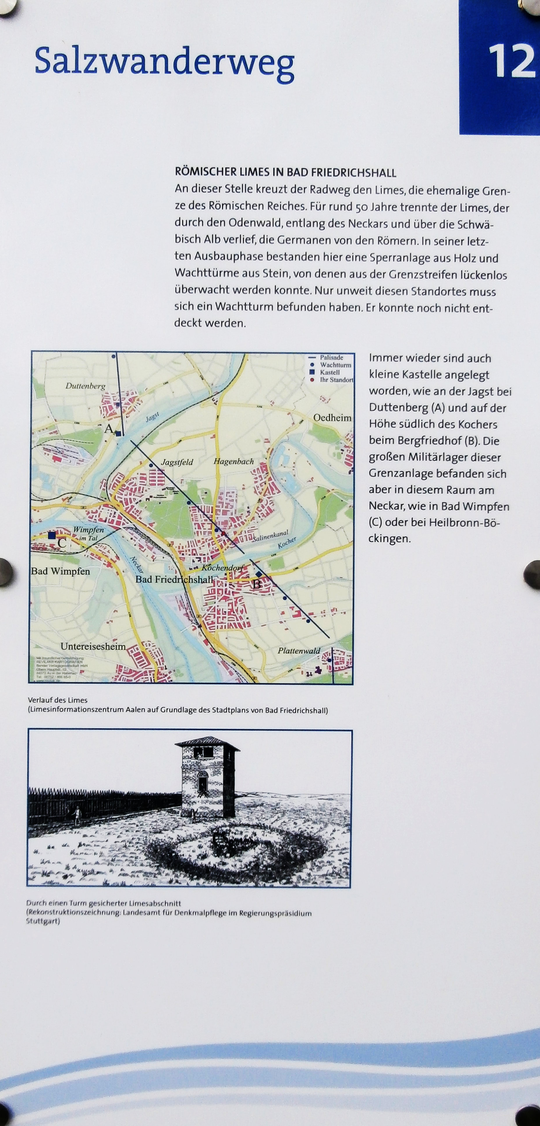
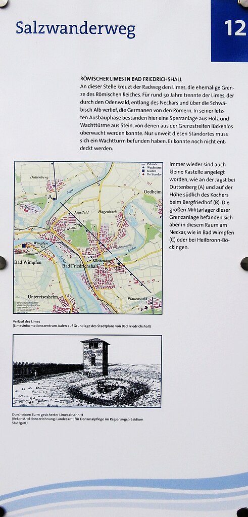
| Description | Standort 12 des Salzwanderwegs in Bad Friedrichshall: der Limes. |
| Date | |
| Source | Own work |
| Author | Sarang |
| Other versions | Salzwanderweg 14.jpg |
| Object location | | View this and other nearby images on: OpenStreetMap |
|---|
Licensing
[edit]
| I, the copyright holder of this work, release this work into the public domain. This applies worldwide. In some countries this may not be legally possible; if so: I grant anyone the right to use this work for any purpose, without any conditions, unless such conditions are required by law. |
File history
Click on a date/time to view the file as it appeared at that time.
| Date/Time | Thumbnail | Dimensions | User | Comment | |
|---|---|---|---|---|---|
| current | 13:43, 1 April 2021 | | 1,855 × 3,864 (939 KB) | Sarang (talk | contribs) | {{Information |Description=Standort 12 des Salzwanderwegs in Bad Friedrichshall: der {{Wd|Limes}}. |Date=2021-04-01 |Source={{own}} |Author={{U|Sarang}} |Other versions={{F|Salzwanderweg 14.jpg}} }} {{Object location|49°13′55.2″N 09°13′01.3″E|dim:512}} == {{int:license-header}} == {{PD-self}} 12 Category:Maps of Limes Germanicus |
You cannot overwrite this file.
File usage on Commons
The following 2 pages use this file: