File:Sfc map 2020-06-14.png
Jump to navigation
Jump to search
Size of this preview: 499 × 599 pixels. Other resolutions: 200 × 240 pixels | 400 × 480 pixels | 950 × 1,141 pixels.
Original file (950 × 1,141 pixels, file size: 555 KB, MIME type: image/png)
Captions
Captions
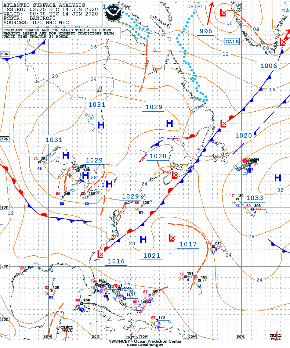
Surface map related to ex-tropical storm Cristobal on June 14, 2020.
Summary[edit]
| Description |
Français : Carte de surface reliée à l'ex-tempête tropicale Cristobal le 14 juin 2020.
English: Surface map related to ex-tropical storm Cristobal on June 14, 2020. |
| Date | |
| Source | https://ocean.weather.gov/Loops/index.php?category=atlantic&product=watlsfc&days=10&loop=1 |
| Author | US Ocean Prediction Center |
Licensing[edit]
This image is in the public domain because it was stored on the web servers of the U.S. National Weather Service. NWS-created images are automatically public domain in the U.S. since the NWS is a part of the U.S. government. However, the NWS sites also host non-NWS images which have been submitted by individuals: these are generally shown as "Courtesy of ...". Such images have explicitly been released to the public domain by the copyright owner as part of the upload process.
As stated at https://www.weather.gov/fsd/disclaimer: "By submitting images, you understand that your image is being released into the public domain. This means that your photo or video may be downloaded, copied, and used by others." Thus, all* images on NWS servers are public domain (including "Courtesy of ..." and “Photo by ...” images) unless specifically stated otherwise through a copyright (©) watermark.
*A deletion discussion in November 2023 ruled that Getty Images on the web servers of NWS, are to be considered copyrighted, even without a copyright (©) watermark and are the sole exception to this rule.
|
File history
Click on a date/time to view the file as it appeared at that time.
| Date/Time | Thumbnail | Dimensions | User | Comment | |
|---|---|---|---|---|---|
| current | 22:43, 18 June 2020 | | 950 × 1,141 (555 KB) | Pierre cb (talk | contribs) | Uploaded a work by US Ocean Prediction Center from https://ocean.weather.gov/Loops/index.php?category=atlantic&product=watlsfc&days=10&loop=1 with UploadWizard |
You cannot overwrite this file.
File usage on Commons
There are no pages that use this file.
File usage on other wikis
The following other wikis use this file:
- Usage on fr.wikipedia.org