File:Shore near Ardoch - view east - geograph.org.uk - 1078420.jpg
Jump to navigation
Jump to search
No higher resolution available.
Shore_near_Ardoch_-_view_east_-_geograph.org.uk_-_1078420.jpg (640 × 480 pixels, file size: 61 KB, MIME type: image/jpeg)
Captions
Captions
Add a one-line explanation of what this file represents
Summary
[edit]
| Description |
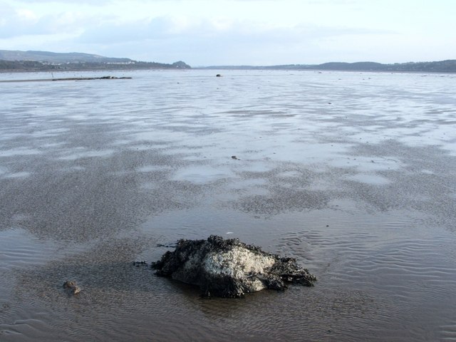
English: Shore near Ardoch - view east. This barnacle-covered rock provided a useful reference point from which to take several photos. The images were taken near low tide; this area was not above water for very long.
The River Clyde is well over a mile wide at this point, where it is opening out into an estuary. The navigable channel to the south, deepened long ago by dredging, is much narrower. Dumbarton Rock is visible on the skyline, a little left of centre; it stands on the northern shore of the Clyde. Although it is too distant to be visible in this image, the Erskine Bridge can also be seen from here, just to the right of the Rock. For other pictures taken from the same spot, see: 1078431 and 1078443. After this, I headed to the shore, briefly visiting an old fish yair on the way: 1055008. |
| Date | |
| Source | From geograph.org.uk |
| Author | Lairich Rig |
| Attribution (required by the license) | Lairich Rig / Shore near Ardoch - view east / |
| Camera location | | View this and other nearby images on: OpenStreetMap |
|---|
_heading:90.00&language=en)
| Object location | | View this and other nearby images on: OpenStreetMap |
|---|
_heading:90.00&language=en)
Licensing
[edit]

|
This image was taken from the Geograph project collection. See this photograph's page on the Geograph website for the photographer's contact details. The copyright on this image is owned by Lairich Rig and is licensed for reuse under the Creative Commons Attribution-ShareAlike 2.0 license.
|
This file is licensed under the Creative Commons Attribution-Share Alike 2.0 Generic license.
Attribution: Lairich Rig
- You are free:
- to share – to copy, distribute and transmit the work
- to remix – to adapt the work
- Under the following conditions:
- attribution – You must give appropriate credit, provide a link to the license, and indicate if changes were made. You may do so in any reasonable manner, but not in any way that suggests the licensor endorses you or your use.
- share alike – If you remix, transform, or build upon the material, you must distribute your contributions under the same or compatible license as the original.
File history
Click on a date/time to view the file as it appeared at that time.
| Date/Time | Thumbnail | Dimensions | User | Comment | |
|---|---|---|---|---|---|
| current | 08:22, 24 February 2011 | | 640 × 480 (61 KB) | GeographBot (talk | contribs) | == {{int:filedesc}} == {{Information |description={{en|1=Shore near Ardoch - view east This barnacle-covered rock provided a useful reference point from which to take several photos. The images were taken near low tide; this area was not above water for v |
You cannot overwrite this file.
File usage on Commons
There are no pages that use this file.