File:Sparbach - Ortsansicht.JPG
Jump to navigation
Jump to search

Size of this preview: 800 × 450 pixels. Other resolutions: 320 × 180 pixels | 640 × 360 pixels | 1,024 × 576 pixels | 1,280 × 720 pixels | 2,560 × 1,440 pixels | 5,210 × 2,930 pixels.
Original file (5,210 × 2,930 pixels, file size: 9.83 MB, MIME type: image/jpeg)
Captions
Captions
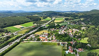
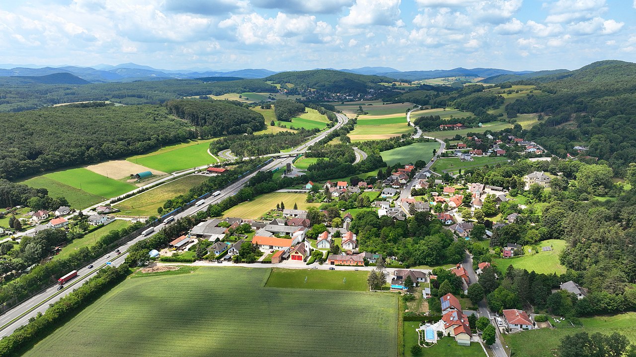
Aerial view of Sparbach, Lower Austria.
Summary
[edit]
| Description |
Deutsch: Ostansicht von Sparbach, ein Dorf in der niederösterreichischen Marktgemeinde Hinterbrühl.
English: Aerial view of Sparbach, Lower Austria. |
| Date | |
| Source | Own work |
| Author | C.Stadler/Bwag |
| Permission (Reusing this file) |
Deutsch: Hallo, du darfst mein Foto kostenlos nutzen, aber nenne mich bitte als Fotograf, beispielsweise „Foto: C.Stadler/Bwag“ oder © C.Stadler/Bwag; CC-BY-SA-4.0. Auf mehr Angaben bestehe ich nicht - im Gegensatz zu manch anderen, die die Vorgaben der unten angeführten Lizenzierung auf Punkt und Beistrich einfordern. English: Feel free to use my photos, but please mention me as the author like © C.Stadler/Bwag or © C.Stadler/Bwag; CC-BY-SA-4.0 (that's good enough) and if you want send me a message: bwag@gmx.net. |
| Object location | | View this and other nearby images on: OpenStreetMap |
|---|
| Camera location | | View this and other nearby images on: OpenStreetMap |
|---|
Licensing
[edit]
I, the copyright holder of this work, hereby publish it under the following license:
This file is licensed under the Creative Commons Attribution-Share Alike 4.0 International license.
- You are free:
- to share – to copy, distribute and transmit the work
- to remix – to adapt the work
- Under the following conditions:
- attribution – You must give appropriate credit, provide a link to the license, and indicate if changes were made. You may do so in any reasonable manner, but not in any way that suggests the licensor endorses you or your use.
- share alike – If you remix, transform, or build upon the material, you must distribute your contributions under the same or compatible license as the original.
| Annotations | This image is annotated: View the annotations at Commons |
File history
Click on a date/time to view the file as it appeared at that time.
| Date/Time | Thumbnail | Dimensions | User | Comment | |
|---|---|---|---|---|---|
| current | 21:37, 25 June 2022 | | 5,210 × 2,930 (9.83 MB) | Bwag (talk | contribs) | == {{int:filedesc}} == {{Information |Description= {{de|1= Ostansicht von Sparbach, ein Dorf in der niederösterreichischen Marktgemeinde Hinterbrühl.}} {{en|1= Aerial view of Sparbach, Lower Austria.}} |Source= {{own}} |Date= 2022-06-23 |Author= Bwag |Permission= {{User:Bwag/Credits}} |other versions= }} {{Object location dec|48.07398|16.19023}} {{Location|48.073583|16.19597|heading:270}} == {{int:license-header}} == {{self|cc-by-sa-4.0}} [[Category:Sparbach (Gemeinde Hinter... |
You cannot overwrite this file.
File usage on Commons
The following page uses this file:
File usage on other wikis
The following other wikis use this file:
- Usage on de.wikipedia.org
- Usage on en.wikipedia.org
- Usage on www.wikidata.org