File:Sraidhiort2.jpg
Jump to navigation
Jump to search
No higher resolution available.
Sraidhiort2.jpg (640 × 480 pixels, file size: 132 KB, MIME type: image/jpeg)
Captions
Captions
Add a one-line explanation of what this file represents
Summary[edit]
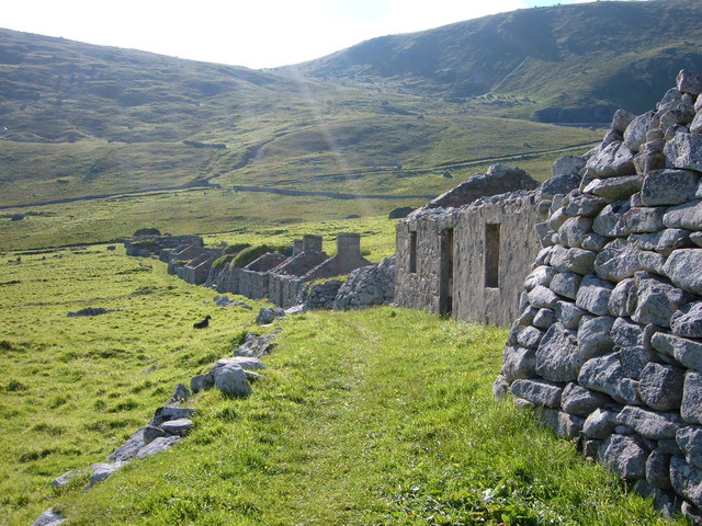
| Description | The High Street of the deserted village of Hirta, St Kilda — abandoned in 1930. | ||
| Date | |||
| Source | https://www.geograph.org.uk/photo/254084 | ||
| Author | Stephen Hodges | ||
| Permission (Reusing this file) |
This file is licensed under the Creative Commons Attribution-Share Alike 2.0 Generic licence. Attribution: Stephen Hodges
|

| Camera location | | View this and other nearby images on: OpenStreetMap |
|---|
File history
Click on a date/time to view the file as it appeared at that time.
| Date/Time | Thumbnail | Dimensions | User | Comment | |
|---|---|---|---|---|---|
| current | 15:06, 23 May 2007 | | 640 × 480 (132 KB) | MacRusgail (talk | contribs) | {{Information |Description=the High Street of the deserted village of Hirta, St Kilda - abandoned in 1930 |Source=This image was taken from the Geograph project collection. See this photograph's page on the Geograph website for the photographer's cont |
You cannot overwrite this file.
File usage on Commons
There are no pages that use this file.
File usage on other wikis
The following other wikis use this file:
- Usage on br.wikipedia.org
- Usage on cy.wikipedia.org
- Usage on de.wikipedia.org
- Usage on en.wikipedia.org
- Usage on fr.wikipedia.org
- Usage on he.wikipedia.org
- Usage on hy.wikipedia.org
- Usage on it.wikipedia.org
- Usage on ka.wikipedia.org
- Usage on kk.wikipedia.org
- Usage on no.wikipedia.org
- Usage on pl.wikipedia.org
- Usage on ru.wikipedia.org
- Usage on xmf.wikipedia.org
- Usage on zh.wikipedia.org