File:St Andrews Church Whitminster (geograph 4013134).jpg
Jump to navigation
Jump to search

Size of this preview: 516 × 600 pixels. Other resolutions: 206 × 240 pixels | 413 × 480 pixels | 688 × 800 pixels.
Original file (688 × 800 pixels, file size: 193 KB, MIME type: image/jpeg)
Captions
Captions
Add a one-line explanation of what this file represents
Summary[edit]
.jpg&action=edit§ion=1)
| Description |
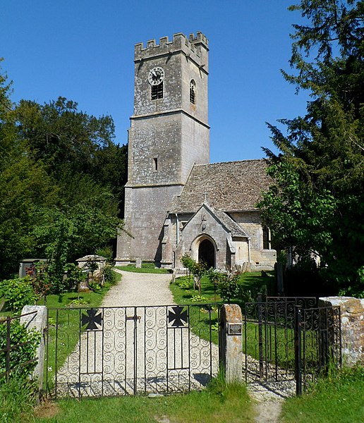
English: St Andrews Church Whitminster. St Andrews is one of the Cotswold Edge Anglican Parishes, together with Eastington, Frocester, Haresfield, Moreton Valence and Standish. Located about a mile from the village, St Andrews is an off-road church. Vehicle access is along a gravel drive, by courtesy of the landowner. |
| Date | |
| Source | From geograph.org.uk |
| Author | Jaggery |
| Permission (Reusing this file) |
Creative Commons Attribution Share-alike license 2.0 |
| Attribution (required by the license) | Jaggery / St Andrews Church Whitminster / |
| Camera location | | View this and other nearby images on: OpenStreetMap |
|---|
.jpg¶ms=051.779417_N_-002.348847_E_globe:Earth_type:camera_source:geograph-osgb36(SO76030903)_heading:337.00&language=en)
| Object location | | View this and other nearby images on: OpenStreetMap |
|---|
.jpg¶ms=051.779690_N_-002.348990_E_globe:Earth_class:object_type:object_source:geograph-osgb36(SO76020906)_heading:337.00&language=en)
Licensing[edit]
.jpg&action=edit§ion=2)

|
This image was taken from the Geograph project collection. See this photograph's page on the Geograph website for the photographer's contact details. The copyright on this image is owned by Jaggery and is licensed for reuse under the Creative Commons Attribution-ShareAlike 2.0 license.
|
This file is licensed under the Creative Commons Attribution-Share Alike 2.0 Generic license.
Attribution: Jaggery
- You are free:
- to share – to copy, distribute and transmit the work
- to remix – to adapt the work
- Under the following conditions:
- attribution – You must give appropriate credit, provide a link to the license, and indicate if changes were made. You may do so in any reasonable manner, but not in any way that suggests the licensor endorses you or your use.
- share alike – If you remix, transform, or build upon the material, you must distribute your contributions under the same or compatible license as the original.
File history
Click on a date/time to view the file as it appeared at that time.
| Date/Time | Thumbnail | Dimensions | User | Comment | |
|---|---|---|---|---|---|
| current | 23:25, 5 February 2020 | | 688 × 800 (193 KB) | Salen9 (talk | contribs) | Transferred from geograph.co.uk using [https://tools.wmflabs.org/geograph2commons/ geograph2commons] |
You cannot overwrite this file.
File usage on Commons
The following page uses this file:
File usage on other wikis
The following other wikis use this file:
- Usage on ceb.wikipedia.org
- Usage on cy.wikipedia.org
- Usage on es.wikipedia.org
- Usage on fr.wikipedia.org
- Usage on lld.wikipedia.org
- Usage on pl.wikipedia.org
- Usage on www.wikidata.org
.jpg&oldid=714888973)