File:Statistische Gebiete Harvestehude.png
Jump to navigation
Jump to search

Size of this preview: 800 × 549 pixels. Other resolutions: 320 × 220 pixels | 640 × 439 pixels | 1,024 × 703 pixels | 1,280 × 878 pixels | 1,903 × 1,306 pixels.
Original file (1,903 × 1,306 pixels, file size: 2.15 MB, MIME type: image/png)
Captions
Captions
Add a one-line explanation of what this file represents
Summary[edit]
| Description |
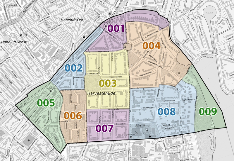
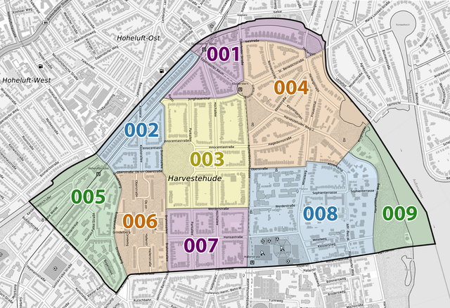
Deutsch: Statistische Gebiete von Hamburg-Harvestehude |
| Date | |
| Source |
Own work using:
|
| Author | NordNordWest |

|
This map has been made or improved in the German Kartenwerkstatt (Map Lab). You can propose maps to improve as well.
|
Licensing[edit]

|
This file is licensed under the terms of the Data licence Germany – attribution – version 2.0 |
|
You are free:
Under the following conditions:
|
File history
Click on a date/time to view the file as it appeared at that time.
| Date/Time | Thumbnail | Dimensions | User | Comment | |
|---|---|---|---|---|---|
| current | 21:53, 9 February 2022 | | 1,903 × 1,306 (2.15 MB) | NordNordWest (talk | contribs) | == {{int:filedesc}} == {{Information |description= {{de|1=Statistische Gebiete von Hamburg-Harvestehude}} |source={{Own using}} * Grundkarte/Base map: ** [https://geoportal-hamburg.de/geo-online/ TopPlusOpen] ** Kartendarstellung: © Bundesamt für Kartographie und Geodäsie (2021) ** Datenquelle: © Freie und Hansestadt Hamburg, Landesbetrieb Geoinformation und Vermessung 2021 * Statistische Gebiete: ** [https://suche.transparenz.hamburg.de/dataset/statistische-gebiete-in-hamburg12?forceWeb=tru... |
You cannot overwrite this file.
File usage on Commons
The following page uses this file:
File usage on other wikis
The following other wikis use this file: