File:Stuttgarter Höhenpark Killesberg Hauser V2A-Stahlplastik 2.JPG
Jump to navigation
Jump to search

Size of this preview: 400 × 600 pixels. Other resolutions: 160 × 240 pixels | 320 × 480 pixels | 512 × 768 pixels | 682 × 1,024 pixels | 1,365 × 2,048 pixels | 4,000 × 6,000 pixels.
Original file (4,000 × 6,000 pixels, file size: 10.13 MB, MIME type: image/jpeg)
Captions
Captions
Add a one-line explanation of what this file represents
Summary
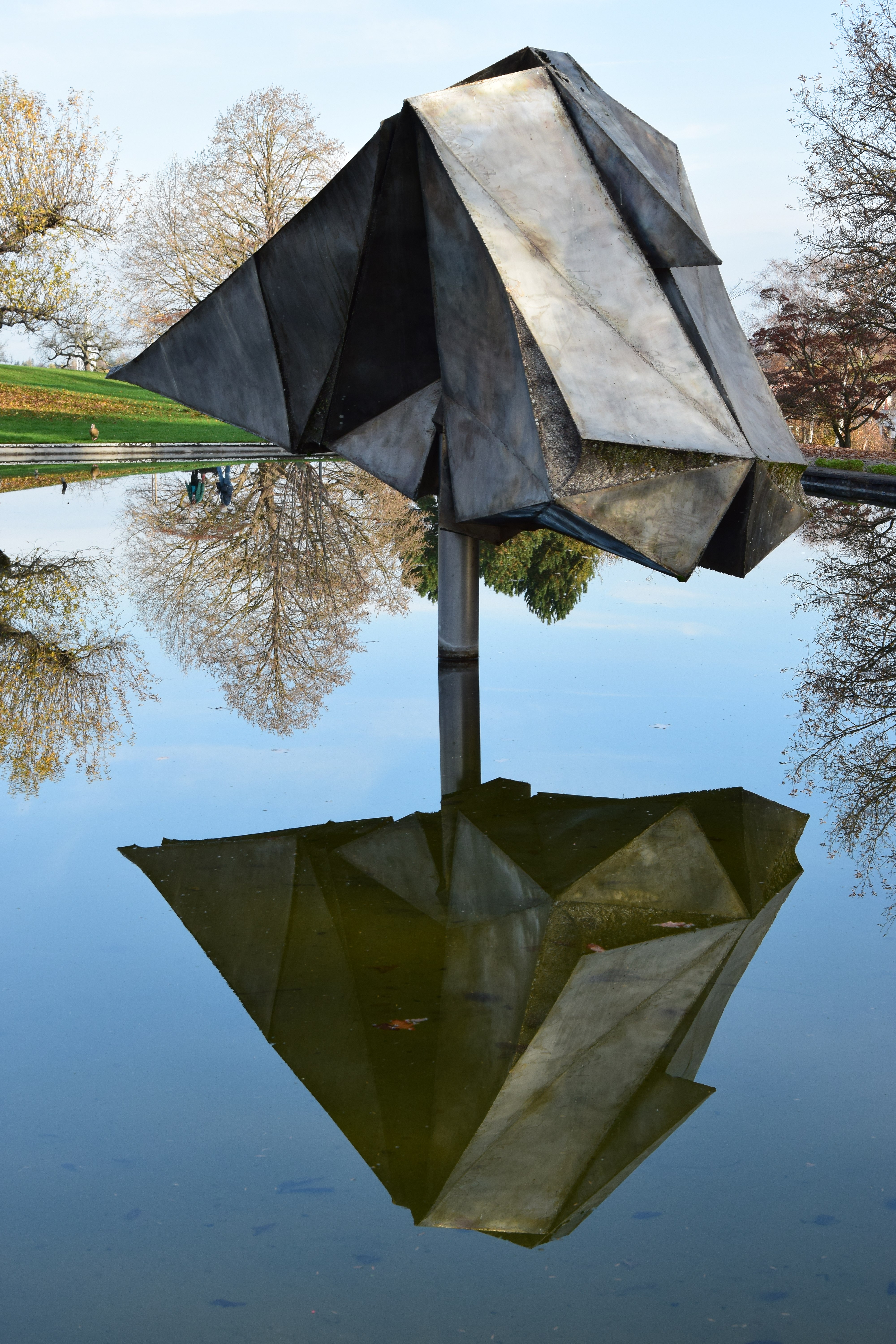
Object
| Erich Hauser: Deutsch: V2A-Stahlplastik
( |
|||||||||||||||||||||
|---|---|---|---|---|---|---|---|---|---|---|---|---|---|---|---|---|---|---|---|---|---|
| Artist |
|
||||||||||||||||||||
| Title |
Deutsch: V2A-Stahlplastik |
||||||||||||||||||||
| Description |
English: Piece of art "V2A-steel plastic" in the height park Killesberg in Stuttgart, Baden-Wurttemberg, Germany. Created in 1965 from high-grade steel of the artist Erich Hauser (1930-2004).
Deutsch: Kunstwerk "V2A-Stahlplastik" im Höhenpark Killesberg in Stuttgart, Baden-Württemberg, Deutschland. Geschaffen 1965 aus Edelstahl vom Künstler Erich Hauser (1930-2004).
Français : Oeuvre d' art "la sculpture d'acier de V2A" dans le parc de hauteurs la Killesberg à Stuttgart, le Baden-Wurtemberg, l'Allemagne. De manière créée en 1965 de l'acier spécial de l'artiste Éric Hauser (1930-2004).
Italiano: Il pezzo di "materia plastica V2A-d'acciaio artistica" nell'altezza parcheggia la Killesberg in Stoccarda, Baden-Wurttemberg, la Germania. Creato nel 1965 di acciaio di alto livello dell'artista Erich Hauser (1930-2004).
Português: A parte de "plástico V2A-de-aço de arte" na altura estaciona a Killesberg em Stuttgart, Baden-Wurttemberg, a Alemanha. Criado em 1965 de aço de primeira qualidade do artista Erich Hauser (1930-2004).
Español: Obra de arte "el V2A-plástico de acero" en el parque de alturas la Killesberg en Stuttgart, el Baden-Wurtemberg, Alemania. De modo creado en 1965 del acero inoxidable del artista Erich Hauser (1930-2004). |
||||||||||||||||||||
| Date | 1965 | ||||||||||||||||||||
| Medium | steel | ||||||||||||||||||||
| Current location |
Höhenpark Killesberg |
||||||||||||||||||||

Photograph
| Date |
|
| Source |
Own work |
| Author |
MSeses |
| Attribution (required by the license) | © MSeses / Wikimedia Commons / |
| Camera location | | View this and other nearby images on: OpenStreetMap |
|---|
Licensing
I, the copyright holder of this work, hereby publish it under the following licenses:

|
Permission is granted to copy, distribute and/or modify this document under the terms of the GNU Free Documentation License, Version 1.2 or any later version published by the Free Software Foundation; with no Invariant Sections, no Front-Cover Texts, and no Back-Cover Texts. A copy of the license is included in the section entitled GNU Free Documentation License. |
This file is licensed under the Creative Commons Attribution-Share Alike 3.0 Unported, 2.5 Generic, 2.0 Generic and 1.0 Generic license.
- You are free:
- to share – to copy, distribute and transmit the work
- to remix – to adapt the work
- Under the following conditions:
- attribution – You must give appropriate credit, provide a link to the license, and indicate if changes were made. You may do so in any reasonable manner, but not in any way that suggests the licensor endorses you or your use.
- share alike – If you remix, transform, or build upon the material, you must distribute your contributions under the same or compatible license as the original.
You may select the license of your choice.
|
The photographical reproduction of this work is covered under the article § 59 of the German copyright law, which states that "It shall be permissible to reproduce, by painting, drawing, photography or cinematography, works which are permanently located on public ways, streets or places and to distribute and publicly communicate such copies. For works of architecture, this provision shall be applicable only to the external appearance."
As with all other “limits of copyright by legally permitted uses”, no changes to the actual work are permitted under § 62 of the German copyright law (UrhG). See Commons:Copyright rules by territory/Germany#Freedom of panorama for more information.
|
File history
Click on a date/time to view the file as it appeared at that time.
| Date/Time | Thumbnail | Dimensions | User | Comment | |
|---|---|---|---|---|---|
| current | 14:01, 8 November 2015 | | 4,000 × 6,000 (10.13 MB) | MSeses (talk | contribs) | {{Information |Description ={{de|1=V2A}} |Source ={{own}} |Author =MSeses |Date =2015-11-08 |Permission = |other_versions = }} Category:Höhenpark Killesberg [[Category:Sculptures in Stuttgart-Nord]... |
You cannot overwrite this file.
File usage on Commons
The following 3 pages use this file:
File usage on other wikis
The following other wikis use this file:
- Usage on de.wikipedia.org