File:Sudan. LOC 2013588063.jpg
Jump to navigation
Jump to search
Size of this preview: 467 × 599 pixels. Other resolutions: 187 × 240 pixels | 374 × 480 pixels | 598 × 768 pixels | 798 × 1,024 pixels | 2,338 × 3,001 pixels.
Original file (2,338 × 3,001 pixels, file size: 874 KB, MIME type: image/jpeg)
Captions
Captions
Add a one-line explanation of what this file represents
Summary
[edit]| Description |
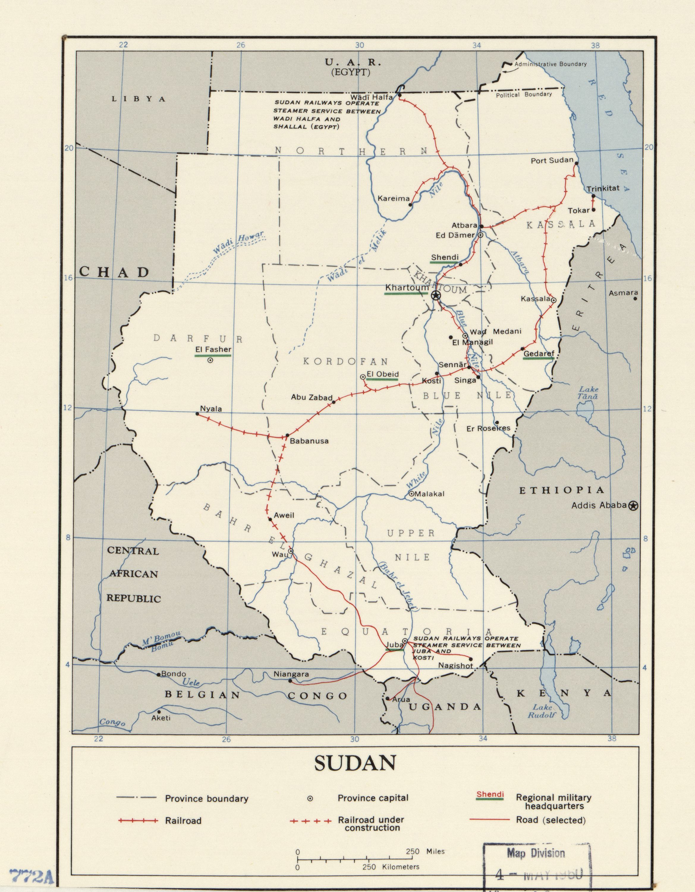
English: Shows international boundaries, provincial boundaries, provincial capitals, roads, railroads, railroads under construction, and regional military headquarters. LC copy has label on verso: 322879856. Available also through the Library of Congress Web site as a raster image. |
||
| Title | Sudan. | ||
| Shelf ID | G8310 1960 .U5 | ||
| Date | |||
| Source | https://www.loc.gov/item/2013588063/ | ||
| Author | United States. Central Intelligence Agency | ||
| Permission (Reusing this file) |
|
||
| Other versions |
|
||
| Location | Sudan | ||
| Part of | American Memory · General Maps · Catalog · Geography And Map Division | ||
| Subject | Sudan · Maps |


Licensing
[edit]
| This image is a work of a Central Intelligence Agency employee, taken or made as part of that person's official duties. As a Work of the United States Government, this image or media is in the public domain in the United States.
|

|
File history
Click on a date/time to view the file as it appeared at that time.
| Date/Time | Thumbnail | Dimensions | User | Comment | |
|---|---|---|---|---|---|
| current | 22:16, 24 September 2018 | | 2,338 × 3,001 (874 KB) | Fæ (talk | contribs) | LOC Maps https://www.loc.gov/item/2013588063/ #6235 |
You cannot overwrite this file.
File usage on Commons
The following page uses this file: