File:Sunk Island - geograph.org.uk - 312199.jpg
Jump to navigation
Jump to search
No higher resolution available.
Sunk_Island_-_geograph.org.uk_-_312199.jpg (640 × 477 pixels, file size: 81 KB, MIME type: image/jpeg)
Captions
Captions
Add a one-line explanation of what this file represents
Summary
[edit]
| Description |
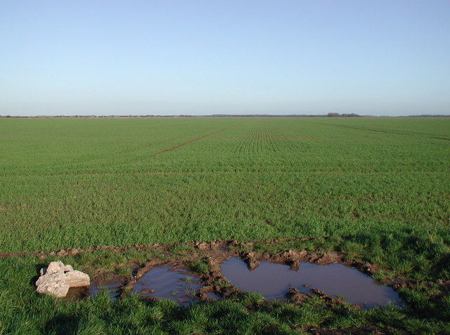
English: Sunk Island, East Riding of Yorkshire, England. Looking across the flat, arable farmland of Sunk Island from the roadside west of Stone Creek Farm, a fairly typical view in these parts as there's been a battle throughout history to reclaim such land as this from the saltmarsh north of the River Humber. There's not much else to look at in this grid square until you get to Sunk Island Drain: even the field boundaries and ditches shown on the 1:25000 scale map have largely disappeared under the plough. |
| Date | |
| Source | From geograph.org.uk |
| Author | Paul Glazzard |
| Permission (Reusing this file) |
Creative Commons Attribution Share-alike license 2.0 |
| Attribution (required by the license) | Paul Glazzard / Sunk Island / |
| Camera location | | View this and other nearby images on: OpenStreetMap |
|---|
_heading:22.00&language=en)
| Object location | | View this and other nearby images on: OpenStreetMap |
|---|
_heading:22.00&language=en)
Licensing
[edit]

|
This image was taken from the Geograph project collection. See this photograph's page on the Geograph website for the photographer's contact details. The copyright on this image is owned by Paul Glazzard and is licensed for reuse under the Creative Commons Attribution-ShareAlike 2.0 license.
|
This file is licensed under the Creative Commons Attribution-Share Alike 2.0 Generic license.
Attribution: Paul Glazzard
- You are free:
- to share – to copy, distribute and transmit the work
- to remix – to adapt the work
- Under the following conditions:
- attribution – You must give appropriate credit, provide a link to the license, and indicate if changes were made. You may do so in any reasonable manner, but not in any way that suggests the licensor endorses you or your use.
- share alike – If you remix, transform, or build upon the material, you must distribute your contributions under the same or compatible license as the original.
File history
Click on a date/time to view the file as it appeared at that time.
| Date/Time | Thumbnail | Dimensions | User | Comment | |
|---|---|---|---|---|---|
| current | 15:52, 30 December 2010 | | 640 × 477 (81 KB) | GeographBot (talk | contribs) | == {{int:filedesc}} == {{Information |description={{en|1=Sunk Island Looking across the flat, arable farmland of Sunk Island from the roadside west of Stone Creek Farm, a fairly typical view in these parts as there's been a battle throughout history to re |
You cannot overwrite this file.
File usage on Commons
There are no pages that use this file.