File:TR3571 Margate Lifeboat Station.jpg
From Wikimedia Commons, the free media repository
Jump to navigation
Jump to search
TR3571_Margate_Lifeboat_Station.jpg (640 × 480 pixels, file size: 376 KB, MIME type: image/jpeg)
File information
Structured data
Captions
Captions
Add a one-line explanation of what this file represents
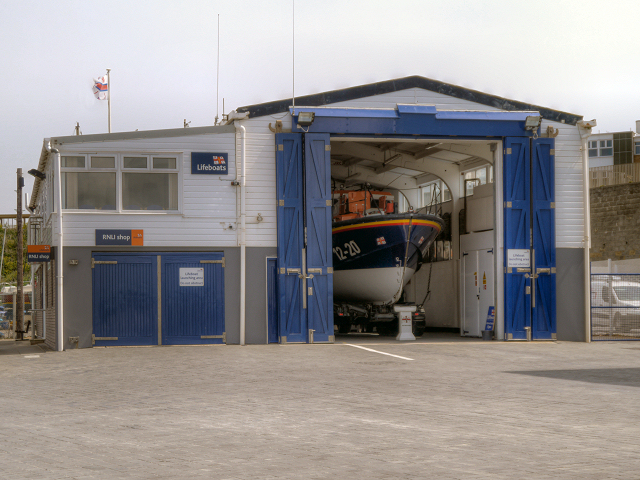
DescriptionTR3571 Margate Lifeboat Station.jpg | Margate Lifeboat Station, Margate, Kent, United Kingdom | ||
Date | |||
Source | https://www.geograph.org.uk/photo/3467732 | ||
Author | David Dixon | ||
Permission (Reusing this file) |
![]() ![]() ![]() This file is licensed under the Creative Commons Attribution-Share Alike 2.0 Generic license. Attribution: David Dixon
|
||
Attribution (required by the license) InfoField | David Dixon / Margate Lifeboat Station / | ||
InfoField | David Dixon / Margate Lifeboat Station |
Camera location | 51° 23′ 29.88″ N, 1° 22′ 57.76″ E ![]() | View this and other nearby images on: OpenStreetMap | ![]() |
---|
File history
Click on a date/time to view the file as it appeared at that time.
Date/Time | Thumbnail | Dimensions | User | Comment | |
---|---|---|---|---|---|
current | 19:57, 5 September 2013 | ![]() | 640 × 480 (376 KB) | Cheeseladder (talk | contribs) | {{Information |Description= Margate Lifeboat Station, Margate, Kent, United Kingdom |Source=http://www.geograph.org.uk/photo/3467732 |Date=Thursday, 16 May , 2013 |Author=David Dixon |Permission= {{Geograph|3467732|David Dixon}} |other_versions= }} {{... |
You cannot overwrite this file.
File usage on Commons
The following page uses this file:
File usage on other wikis
The following other wikis use this file:
- Usage on en.wikipedia.org
- Usage on www.wikidata.org
Metadata
This file contains additional information such as Exif metadata which may have been added by the digital camera, scanner, or software program used to create or digitize it. If the file has been modified from its original state, some details such as the timestamp may not fully reflect those of the original file. The timestamp is only as accurate as the clock in the camera, and it may be completely wrong.
Camera model | DMC-G3 |
---|---|
F-number | f/6.3 |
ISO speed rating | 160 |
Date and time of data generation | 12:22, 16 May 2013 |
Lens focal length | 34 mm |
Orientation | Normal |
Horizontal resolution | 180 dpi |
Vertical resolution | 180 dpi |
File change date and time | 14:43, 19 May 2013 |
Y and C positioning | Co-sited |
Exif version | 2.2 |
Meaning of each component |
|
Supported Flashpix version | 1 |
Color space | sRGB |
Structured data
Items portrayed in this file
depicts
16 May 2013
51°23'29.879"N, 1°22'57.760"E
6.3
34 millimetre
160
image/jpeg
Hidden categories:
- CC-BY-SA-2.0
- Images from Geograph Britain and Ireland
- Images from Geograph Britain and Ireland missing SDC creator
- Images from Geograph Britain and Ireland missing SDC source of file
- Images from Geograph Britain and Ireland missing SDC coordinates of depicted place
- Information field template with formatting
- Files with coordinates missing SDC location of creation (51° N, 1° E)
- Pages with maps