File:Tallassee Mills, 1844 Old Mill Road, Tallassee, Elmore County, AL HABS ALA,26-TALA,1- (sheet 9 of 12).tif
Jump to navigation
Jump to search

Size of this JPG preview of this TIF file: 463 × 599 pixels. Other resolutions: 185 × 240 pixels | 371 × 480 pixels | 593 × 768 pixels | 791 × 1,024 pixels | 1,583 × 2,048 pixels | 13,632 × 17,638 pixels.
Original file (13,632 × 17,638 pixels, file size: 1.95 MB, MIME type: image/tiff)
Captions
Captions
Add a one-line explanation of what this file represents
Summary[edit]
| Warning | The original file is very high-resolution. It might not load properly or could cause your browser to freeze when opened at full size. |
|---|
| HABS ALA,26-TALA,1- (sheet 9 of 12) - Tallassee Mills, 1844 Old Mill Road, Tallassee, Elmore County, AL | ||||
|---|---|---|---|---|
| Photographer |
Hervey, Douglas J., creator |
|||
| Title |
HABS ALA,26-TALA,1- (sheet 9 of 12) - Tallassee Mills, 1844 Old Mill Road, Tallassee, Elmore County, AL |
|||
| Depicted place | Alabama; Elmore County; Tallassee | |||
| Date | 1993 | |||
| Dimensions | 34 x 44 in. (E size) | |||
| Current location |
Library of Congress Prints and Photographs Division Washington, D.C. 20540 USA http://hdl.loc.gov/loc.pnp/pp.print |
|||
| Accession number |
HABS ALA,26-TALA,1- (sheet 9 of 12) |
|||
| Credit line |
|
|||
| Notes |
|
|||
| References |
Related names:
|
|||
| Source | https://www.loc.gov/pictures/item/al1049.sheet.00009a | |||
| Permission (Reusing this file) |
|
|||
| Other versions |
.png) .png) .png) .png) .png) .png) .png) .png) .png) .png) .png) .png) |
|||

| Object location | | View this and other nearby images on: OpenStreetMap |
|---|
File history
Click on a date/time to view the file as it appeared at that time.
| Date/Time | Thumbnail | Dimensions | User | Comment | |
|---|---|---|---|---|---|
| current | 21:11, 30 June 2014 | 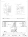 | 13,632 × 17,638 (1.95 MB) | Fæ (talk | contribs) | GWToolset: Creating mediafile for Fæ. HABS batch upload 29 June 2014 (101:150) |
You cannot overwrite this file.
File usage on Commons
The following 2 pages use this file: