File:Taynuilt Pass of Brander geograph-3204576-by-Ben-Brooksbank.jpg
Jump to navigation
Jump to search
Size of this preview: 800 × 404 pixels. Other resolutions: 320 × 162 pixels | 640 × 323 pixels | 966 × 488 pixels.
Original file (966 × 488 pixels, file size: 608 KB, MIME type: image/jpeg)
Captions
Captions
Add a one-line explanation of what this file represents
Summary
[edit]
| Description |
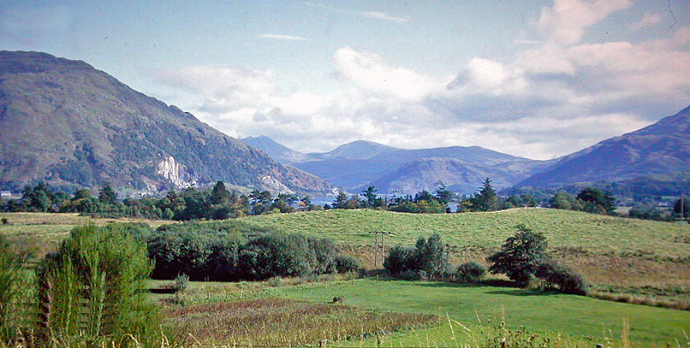
English: SE from Taynuilt to the Pass of Brander, 1974. View up the valley of the River Awe, with Ben Cruachan (3,680 ft.) on the left and further on the mountains by Glen Lochy beyond Dalmally. The Pass of Brander was the site of a major battle in the 14th century Scottish Civil Wars. |
| Date | |
| Source | From geograph.org.uk |
| Author | Ben Brooksbank |
| Permission (Reusing this file) |
Creative Commons Attribution Share-alike license 2.0 |
| Attribution (required by the license) | Ben Brooksbank / SE from Taynuilt to the Pass of Brander, 1974 / |
| Camera location | | View this and other nearby images on: OpenStreetMap |
|---|
Licensing
[edit]

|
This image was taken from the Geograph project collection. See this photograph's page on the Geograph website for the photographer's contact details. The copyright on this image is owned by Ben Brooksbank and is licensed for reuse under the Creative Commons Attribution-ShareAlike 2.0 license.
|
This file is licensed under the Creative Commons Attribution-Share Alike 2.0 Generic license.
Attribution: Ben Brooksbank
- You are free:
- to share – to copy, distribute and transmit the work
- to remix – to adapt the work
- Under the following conditions:
- attribution – You must give appropriate credit, provide a link to the license, and indicate if changes were made. You may do so in any reasonable manner, but not in any way that suggests the licensor endorses you or your use.
- share alike – If you remix, transform, or build upon the material, you must distribute your contributions under the same or compatible license as the original.
File history
Click on a date/time to view the file as it appeared at that time.
| Date/Time | Thumbnail | Dimensions | User | Comment | |
|---|---|---|---|---|---|
| current | 17:33, 23 November 2012 | | 966 × 488 (608 KB) | Chevin (talk | contribs) | == {{int:filedesc}} == {{Information |Description={{en|1='''SE from Taynuilt to the Pass of Brander, 1974.'''<br/> View up the valley of the River Awe, with Ben Cruachan (3,680 ft.) on the left and further on the mountains by Glen Lochy beyond Dalmally... |
You cannot overwrite this file.
File usage on Commons
There are no pages that use this file.