File:The Railway Tavern, Blaguegate - geograph.org.uk - 66803.jpg
Jump to navigation
Jump to search
No higher resolution available.
The_Railway_Tavern,_Blaguegate_-_geograph.org.uk_-_66803.jpg (640 × 480 pixels, file size: 60 KB, MIME type: image/jpeg)
Captions
Captions
Add a one-line explanation of what this file represents
Summary
[edit]
| Description |
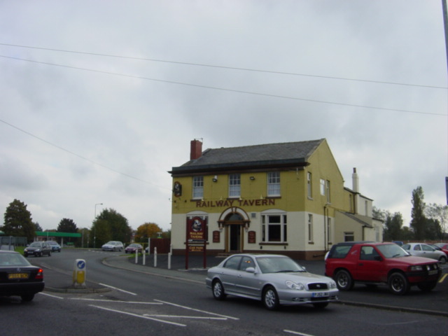
English: The Railway Tavern, Blaguegate Railway Tavern on the corner of Ormskirk Road and Railway Road, Blaguegate where there was once a railway line to Ormskirk and St Helens. Commencing around 1850 and in the course of some 75 years, Skelmersdale became a fast growing mining town and the population grew 8 times as miners came from other parts of the country to exploit the coal reserves. Over this period there were at least 50 coalmines and around 1918 there were some 2,000 people working in local mines. Water was a perennial problem with mines in the area, many having been sunk through the moss lands to reach profitable seams, and this indirectly led to the catastrophic decline of the coal industry in Skelmersdale. Industrial relations were not good in the latter part of the 19th Century and there were several strikes, during which time conditions underground deteriorated as it was often many weeks before a mine could begin production again. The real "coup-de-grace" of the industry was the National Coal Strike of 1926, which resulted in severe flooding of the unattended workings and led to the closure of most of the remaining pits. Thus ended a major epoch in the growth of Skelmersdale, and it is sad to say that the New Town has been built with no acknowledgement of the towns mining past. |
| Date | |
| Source | From geograph.org.uk |
| Author | Sue Adair |
| Attribution (required by the license) | Sue Adair / The Railway Tavern, Blaguegate / |
| Camera location | | View this and other nearby images on: OpenStreetMap |
|---|
_heading:202.00&language=en)
| Object location | | View this and other nearby images on: OpenStreetMap |
|---|
_heading:202.00&language=en)
Licensing
[edit]

|
This image was taken from the Geograph project collection. See this photograph's page on the Geograph website for the photographer's contact details. The copyright on this image is owned by Sue Adair and is licensed for reuse under the Creative Commons Attribution-ShareAlike 2.0 license.
|
This file is licensed under the Creative Commons Attribution-Share Alike 2.0 Generic license.
Attribution: Sue Adair
- You are free:
- to share – to copy, distribute and transmit the work
- to remix – to adapt the work
- Under the following conditions:
- attribution – You must give appropriate credit, provide a link to the license, and indicate if changes were made. You may do so in any reasonable manner, but not in any way that suggests the licensor endorses you or your use.
- share alike – If you remix, transform, or build upon the material, you must distribute your contributions under the same or compatible license as the original.
File history
Click on a date/time to view the file as it appeared at that time.
| Date/Time | Thumbnail | Dimensions | User | Comment | |
|---|---|---|---|---|---|
| current | 19:49, 30 January 2010 | | 640 × 480 (60 KB) | GeographBot (talk | contribs) | == {{int:filedesc}} == {{Information |description={{en|1=The Railway Tavern, Blaguegate. Railway Tavern on the corner of Ormskirk Road and Railway Road, Blaguegate where there was once a railway line to Ormskirk and St Helens. Commencing around 1850 and i |
You cannot overwrite this file.
File usage on Commons
There are no pages that use this file.