File:The River Finn - geograph.org.uk - 483019.jpg
Jump to navigation
Jump to search
No higher resolution available.
The_River_Finn_-_geograph.org.uk_-_483019.jpg (640 × 480 pixels, file size: 129 KB, MIME type: image/jpeg)
Captions
Captions
Add a one-line explanation of what this file represents
Summary
[edit]
| Description |
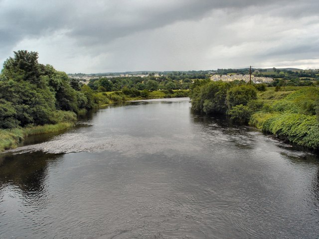
English: The River Finn The river Finn flows between the twin towns of Stranorlar and Ballybofey in County Donegal. The picture is taken from the bridge which separates the two towns. |
| Date | |
| Source | From geograph.org.uk |
| Author | Kay Atherton |
| Attribution (required by the license) | Kay Atherton / The River Finn / |
| Camera location | | View this and other nearby images on: OpenStreetMap |
|---|
_heading:180.00&language=en)
Licensing
[edit]

|
This image was taken from the Geograph project collection. See this photograph's page on the Geograph website for the photographer's contact details. The copyright on this image is owned by Kay Atherton and is licensed for reuse under the Creative Commons Attribution-ShareAlike 2.0 license.
|
This file is licensed under the Creative Commons Attribution-Share Alike 2.0 Generic license.
Attribution: Kay Atherton
- You are free:
- to share – to copy, distribute and transmit the work
- to remix – to adapt the work
- Under the following conditions:
- attribution – You must give appropriate credit, provide a link to the license, and indicate if changes were made. You may do so in any reasonable manner, but not in any way that suggests the licensor endorses you or your use.
- share alike – If you remix, transform, or build upon the material, you must distribute your contributions under the same or compatible license as the original.
File history
Click on a date/time to view the file as it appeared at that time.
| Date/Time | Thumbnail | Dimensions | User | Comment | |
|---|---|---|---|---|---|
| current | 02:56, 5 February 2011 | | 640 × 480 (129 KB) | GeographBot (talk | contribs) | == {{int:filedesc}} == {{Information |description={{en|1=The River Finn The river Finn flows between the twin towns of Stranorlar and Ballybofey in County Donegal. The picture is taken from the bridge which separates the two towns.}} |date=2007-06-30 |sou |
You cannot overwrite this file.
File usage on Commons
The following 13 pages use this file:
- Category:Archaeological sites in County Donegal
- Category:Births in County Donegal
- Category:Castles in County Donegal
- Category:County Donegal
- Category:Disused railway stations in County Donegal
- Category:Education in County Donegal
- Category:Maps of County Donegal
- Category:People of County Donegal
- Category:Railway stations in County Donegal
- Category:Rivers of County Donegal
- Category:Roads in County Donegal
- Category:Views of County Donegal
- Category:Visitor attractions in County Donegal
File usage on other wikis
The following other wikis use this file:
- Usage on ang.wikipedia.org
- Usage on ar.wikipedia.org
- Usage on ast.wikipedia.org
- Usage on ca.wikipedia.org
- Usage on cs.wikipedia.org
- Usage on de.wikivoyage.org
- Usage on en.wikipedia.org
- Usage on en.wikivoyage.org
- Usage on eo.wikipedia.org
- Usage on es.wikipedia.org
- Usage on eu.wikipedia.org
- Usage on fi.wikipedia.org
- Usage on fr.wikipedia.org
- Usage on fr.wikivoyage.org
- Usage on ga.wikipedia.org
- Usage on gl.wikipedia.org
- Usage on he.wikipedia.org
- Usage on he.wikivoyage.org
- Usage on hu.wikipedia.org
- Usage on id.wikipedia.org
- Usage on it.wikipedia.org
- Usage on ka.wikipedia.org
- Usage on ku.wikipedia.org
- Usage on nl.wikipedia.org
- Usage on nn.wikipedia.org
- Usage on no.wikipedia.org
- Usage on os.wikipedia.org
- Usage on pl.wikipedia.org
- Usage on ro.wikipedia.org
- Usage on ru.wikipedia.org
- Usage on sr.wikipedia.org
- Usage on uk.wikipedia.org
- Usage on www.wikidata.org