File:The Selby Canal - geograph.org.uk - 752010.jpg
Jump to navigation
Jump to search
No higher resolution available.
The_Selby_Canal_-_geograph.org.uk_-_752010.jpg (640 × 523 pixels, file size: 93 KB, MIME type: image/jpeg)
Captions
Captions
Add a one-line explanation of what this file represents
Summary
[edit]
| Description |
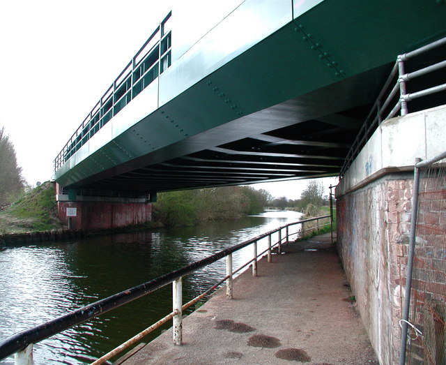
English: The Selby Canal The Selby to Doncaster railway line crossing the Selby Canal, where the towpath forms part of the Trans Pennine Trail. The canal was built in the 1770s by the Aire and Calder Canal Company, worried by rumours of a planned canal between Leeds and Selby which could have taken some of their business. It was dug in a hurry and as a result was only three and a half feet deep. The Trans Pennine Trail runs for 215 miles from Hornsea to Southport and was officially opened in September 2001. |
| Date | |
| Source | From geograph.org.uk |
| Author | Paul Glazzard |
| Permission (Reusing this file) |
Creative Commons Attribution Share-alike license 2.0 |
| Attribution (required by the license) | Paul Glazzard / The Selby Canal / |
| Camera location | | View this and other nearby images on: OpenStreetMap |
|---|
_heading:225.00&language=en)
| Object location | | View this and other nearby images on: OpenStreetMap |
|---|
_heading:225.00&language=en)
Licensing
[edit]

|
This image was taken from the Geograph project collection. See this photograph's page on the Geograph website for the photographer's contact details. The copyright on this image is owned by Paul Glazzard and is licensed for reuse under the Creative Commons Attribution-ShareAlike 2.0 license.
|
This file is licensed under the Creative Commons Attribution-Share Alike 2.0 Generic license.
Attribution: Paul Glazzard
- You are free:
- to share – to copy, distribute and transmit the work
- to remix – to adapt the work
- Under the following conditions:
- attribution – You must give appropriate credit, provide a link to the license, and indicate if changes were made. You may do so in any reasonable manner, but not in any way that suggests the licensor endorses you or your use.
- share alike – If you remix, transform, or build upon the material, you must distribute your contributions under the same or compatible license as the original.
File history
Click on a date/time to view the file as it appeared at that time.
| Date/Time | Thumbnail | Dimensions | User | Comment | |
|---|---|---|---|---|---|
| current | 16:26, 19 February 2011 | | 640 × 523 (93 KB) | GeographBot (talk | contribs) | == {{int:filedesc}} == {{Information |description={{en|1=The Selby Canal The Selby to Doncaster railway line crossing the Selby Canal, where the towpath forms part of the Trans Pennine Trail. The canal was built in the 1770s by the Aire and Calder Canal C |
You cannot overwrite this file.
File usage on Commons
There are no pages that use this file.