File:The Standpipe Tower (geograph 6069796).jpg
Jump to navigation
Jump to search
Size of this preview: 453 × 600 pixels. Other resolutions: 181 × 240 pixels | 362 × 480 pixels | 580 × 768 pixels | 773 × 1,024 pixels | 1,547 × 2,048 pixels | 3,443 × 4,558 pixels.
Original file (3,443 × 4,558 pixels, file size: 3.05 MB, MIME type: image/jpeg)
Captions
Captions
Add a one-line explanation of what this file represents
Summary[edit]
.jpg&action=edit§ion=1)
| Description |
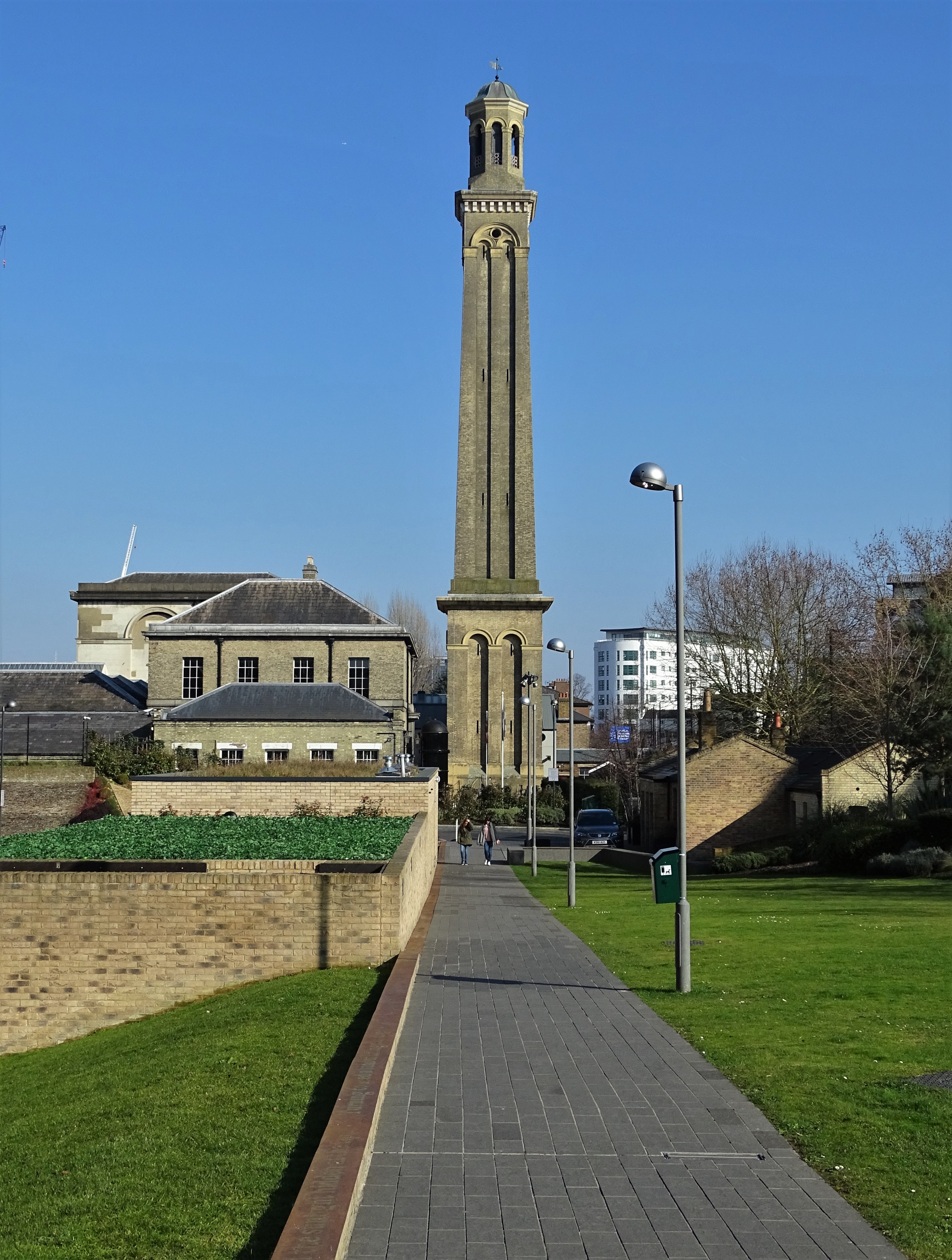
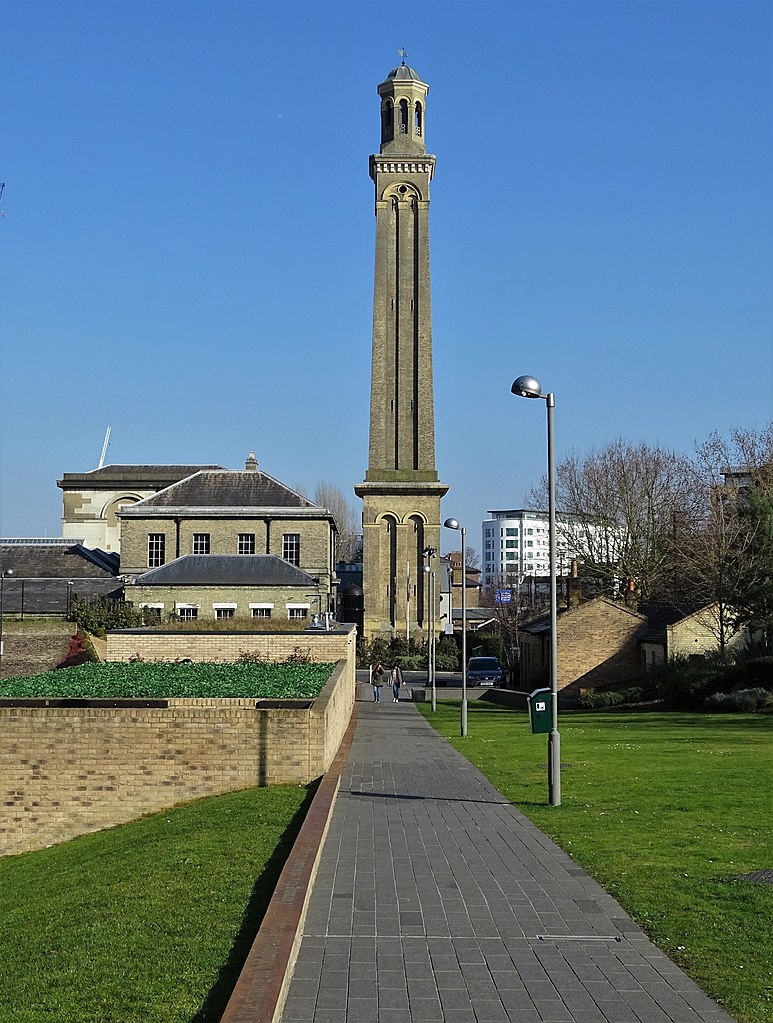
English: The Standpipe Tower. In spite of appearances, this 200 foot tower is not a chimney stack; it houses two systems of vertical pipes through which water was pumped before it entered the mains water supply. The brick tower, of Italianate design, was constructed in 1867 to replace an earlier open metal lattice structure. It is a Grade I listed building now under the stewardship of The London Museum of Water and Steam. |
| Date | Taken on 23 February 2019 |
| Source | From geograph.org.uk |
| Author | Neil Theasby |
| Permission (Reusing this file) |
Creative Commons Attribution Share-alike license 2.0 |
| Attribution (required by the license) | Neil Theasby / The Standpipe Tower / |
| Camera location | | View this and other nearby images on: OpenStreetMap |
|---|
.jpg¶ms=051.488386_N_-000.291961_E_globe:Earth_type:camera_source:geograph-osgb36(TQ1868677987)_heading:67.00&language=en)
| Object location | | View this and other nearby images on: OpenStreetMap |
|---|
.jpg¶ms=051.488410_N_-000.291610_E_globe:Earth_class:object_type:object_source:geograph-osgb36(TQ18717799)_heading:67.00&language=en)
Licensing[edit]
.jpg&action=edit§ion=2)

|
This image was taken from the Geograph project collection. See this photograph's page on the Geograph website for the photographer's contact details. The copyright on this image is owned by Neil Theasby and is licensed for reuse under the Creative Commons Attribution-ShareAlike 2.0 license.
|
This file is licensed under the Creative Commons Attribution-Share Alike 2.0 Generic license.
Attribution: Neil Theasby
- You are free:
- to share – to copy, distribute and transmit the work
- to remix – to adapt the work
- Under the following conditions:
- attribution – You must give appropriate credit, provide a link to the license, and indicate if changes were made. You may do so in any reasonable manner, but not in any way that suggests the licensor endorses you or your use.
- share alike – If you remix, transform, or build upon the material, you must distribute your contributions under the same or compatible license as the original.
File history
Click on a date/time to view the file as it appeared at that time.
| Date/Time | Thumbnail | Dimensions | User | Comment | |
|---|---|---|---|---|---|
| current | 18:56, 26 February 2019 | | 3,443 × 4,558 (3.05 MB) | Chris j wood (talk | contribs) | Transferred from geograph.co.uk using [https://tools.wmflabs.org/geograph2commons/ geograph2commons] |
You cannot overwrite this file.
File usage on Commons
There are no pages that use this file.
.jpg&oldid=670750039)