File:The Tees near Cronkley - geograph.org.uk - 121867.jpg
Jump to navigation
Jump to search
No higher resolution available.
The_Tees_near_Cronkley_-_geograph.org.uk_-_121867.jpg (640 × 310 pixels, file size: 67 KB, MIME type: image/jpeg)
Captions
Captions
Add a one-line explanation of what this file represents
| Description |
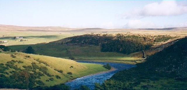
English: The Tees near Cronkley. Here the Tees cuts through a band of volcanic dolerite rock before reaching High Force, another mile downstream. |
||
| Date | |||
| Source | From geograph.org.uk | ||
| Author | Gordon Hatton | ||
| Permission (Reusing this file) |
This file is licensed under the Creative Commons Attribution-Share Alike 2.0 Generic license. Attribution: Gordon Hatton
|
||
| Attribution (required by the license) | Gordon Hatton / The Tees near Cronkley / | ||

| Object location | | View this and other nearby images on: OpenStreetMap |
|---|
_&language=en)
File history
Click on a date/time to view the file as it appeared at that time.
| Date/Time | Thumbnail | Dimensions | User | Comment | |
|---|---|---|---|---|---|
| current | 20:47, 9 March 2010 | | 640 × 310 (67 KB) | Ras67 (talk | contribs) | cropped |
| 05:10, 31 January 2010 |  | 640 × 314 (48 KB) | GeographBot (talk | contribs) | == {{int:filedesc}} == {{Information |description={{en|1=The Tees near Cronkley. Here the Tees cuts through a band of volcanic dolerite rock before reaching High Force, another mile downstream.}} |date=2000-10 |source=From [http://www.geograph.org.uk/phot |
You cannot overwrite this file.
File usage on Commons
There are no pages that use this file.