File:Theatrum orbis terrarum. LOC 98687183-10.tif
Jump to navigation
Jump to search

Size of this JPG preview of this TIF file: 424 × 599 pixels. Other resolutions: 170 × 240 pixels | 340 × 480 pixels | 543 × 768 pixels | 725 × 1,024 pixels | 1,449 × 2,048 pixels | 3,612 × 5,104 pixels.
Original file (3,612 × 5,104 pixels, file size: 52.75 MB, MIME type: image/tiff)
Captions
Captions
Add a one-line explanation of what this file represents
Summary
[edit]| Description |
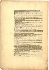
English: Relief shown pictorially. Catalogus auctorum includes 92 names. Epigram on t.p. verso has 16 lines. Includes 53 map sheets, with descriptive text on verso. Phillips, 374, copy 1 Koeman, C. Atlantes Neerlandici, Ort 1 Includes "De Mona druidum insula" by H. Llwyd. Exhibited: A world of names, 1990. Exhibited: Images of the World, 1984. Available also through the Library of Congress Web site as a raster image. G&M microfilm 1051. |
||
| Title | Theatrum orbis terrarum. | ||
| Shelf ID | G1006 .T5 1570b | ||
| Parent | https://www.loc.gov/resource/g3200m.gct00003/ | ||
| Sheet title | Image 10 of Theatrum orbis terrarum. | ||
| Date | |||
| Source | https://www.loc.gov/item/98687183/ | ||
| Author | Ortelius, Abraham; Diesth, Aegid. Coppenius (Aegidius Coppenius); Llwyd, Humphrey | ||
| Permission (Reusing this file) |
|
||
| Other versions |
|
||
| Location | Earth · Netherlands · Earth. | ||
| Part of | American Memory · General Maps · Catalog · Geography And Map Division | ||
| Subject | Atlases · Netherlands · Early Works To 1800 · World Atlases · Earth · Geography |


Licensing
[edit]|
This is a faithful photographic reproduction of a two-dimensional, public domain work of art. The work of art itself is in the public domain for the following reason:
The official position taken by the Wikimedia Foundation is that "faithful reproductions of two-dimensional public domain works of art are public domain".
This photographic reproduction is therefore also considered to be in the public domain in the United States. In other jurisdictions, re-use of this content may be restricted; see Reuse of PD-Art photographs for details. | ||||
File history
Click on a date/time to view the file as it appeared at that time.
| Date/Time | Thumbnail | Dimensions | User | Comment | |
|---|---|---|---|---|---|
| current | 21:37, 11 July 2018 |  | 3,612 × 5,104 (52.75 MB) | Fæ (talk | contribs) | LOC Maps multisheet https://www.loc.gov/item/98687183/ sheet 10 of 182 #10874 |
You cannot overwrite this file.
File usage on Commons
The following page uses this file: