File:Topographical map of the District of Columbia and a portion of Virginia LOC 88693423.tif
Jump to navigation
Jump to search

Size of this JPG preview of this TIF file: 580 × 599 pixels. Other resolutions: 232 × 240 pixels | 465 × 480 pixels | 743 × 768 pixels | 991 × 1,024 pixels | 1,982 × 2,048 pixels | 6,257 × 6,464 pixels.
Original file (6,257 × 6,464 pixels, file size: 115.72 MB, MIME type: image/tiff)
Captions
Captions
Add a one-line explanation of what this file represents
Summary
[edit]| Description |
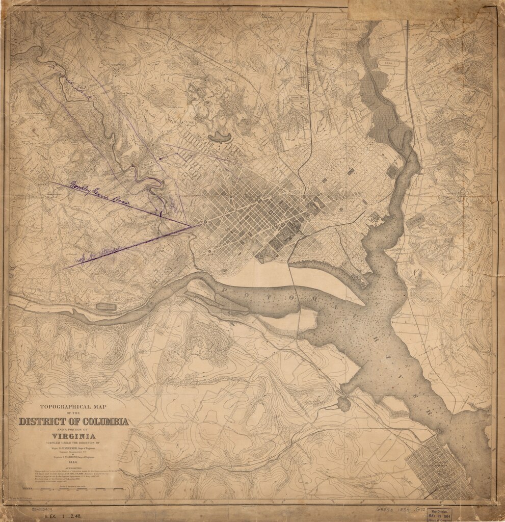
English: Partial cadastral map showing landowners' names in rural areas of D.C. Also shows density of built-up area in city. Relief shown by contours. Depths shown by soundings. Oriented with north toward the upper left. Includes source materials note. In left lower margin: H. Ex. 1, 2, 48. LC copy soiled, darkened, fold-lined, torn, missing edge sections, and annotated in purple pencil to show proposed Rock Creek Park, zoo, and street extensions. Available also through the Library of Congress Web site as a raster image. DCP |
||
| Title | Topographical map of the District of Columbia and a portion of Virginia | ||
| Shelf ID | G3850 1884 .G72 | ||
| Date | |||
| Source | https://www.loc.gov/item/88693423/ | ||
| Author | Greene, F. V. (Francis Vinton); Lydecker, G. J. (Garrett J.); Bruff, William T.O.; United States. Army. Corps Of Engineers; Office Of The Engineer Commissioner D.C. | ||
| Permission (Reusing this file) |
|
||
| Other versions |
|
||
| Location | Washington D.C. · Arlington County · Washington · Virginia · United States · District Of Columbia | ||
| Part of | American Memory · Catalog · Geography And Map Division · Cultural Landscapes | ||
| Subject | Washington (D.C.) · Arlington County · Maps, Topographic · Washington · Arlington County (Va.) · Virginia · United States · Maps · District Of Columbia · Real Property |


Licensing
[edit]|
This is a faithful photographic reproduction of a two-dimensional, public domain work of art. The work of art itself is in the public domain for the following reason:
The official position taken by the Wikimedia Foundation is that "faithful reproductions of two-dimensional public domain works of art are public domain".
This photographic reproduction is therefore also considered to be in the public domain in the United States. In other jurisdictions, re-use of this content may be restricted; see Reuse of PD-Art photographs for details. | ||||
File history
Click on a date/time to view the file as it appeared at that time.
| Date/Time | Thumbnail | Dimensions | User | Comment | |
|---|---|---|---|---|---|
| current | 10:46, 4 June 2018 |  | 6,257 × 6,464 (115.72 MB) | Fæ (talk | contribs) | LOC Maps https://www.loc.gov/item/88693423/ #19708 |
You cannot overwrite this file.
File usage on Commons
The following page uses this file: