File:Train at Drumsough - 1983 (geograph 3600406).jpg
Jump to navigation
Jump to search
Size of this preview: 789 × 599 pixels. Other resolutions: 316 × 240 pixels | 632 × 480 pixels | 866 × 658 pixels.
Original file (866 × 658 pixels, file size: 360 KB, MIME type: image/jpeg)
Captions
Captions
Add a one-line explanation of what this file represents
Summary[edit]
.jpg&action=edit§ion=1)
| Description |
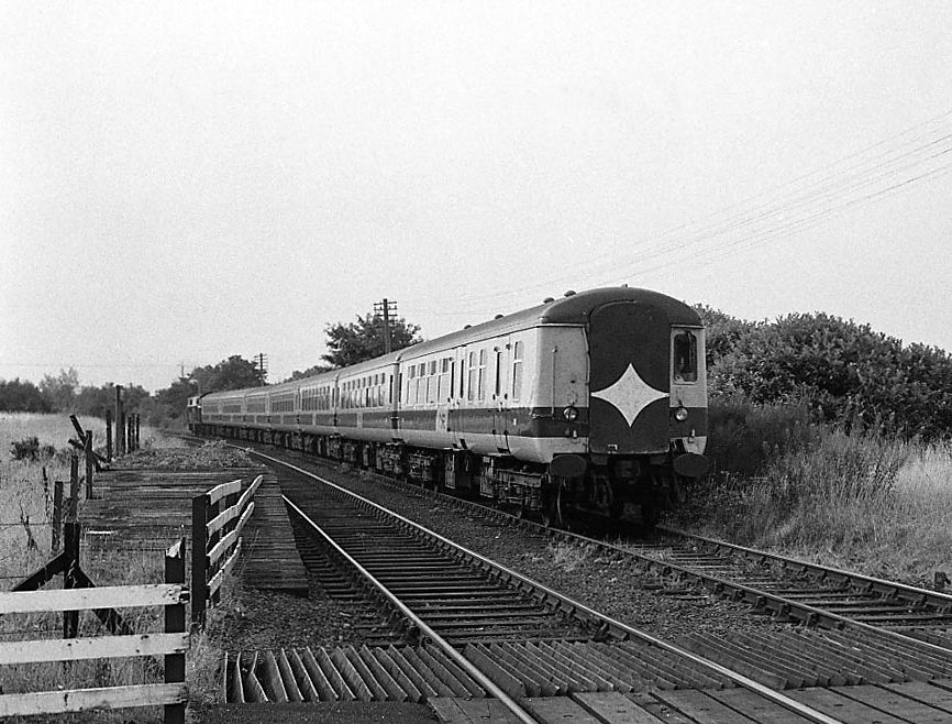
English: Train at Drumsough - 1983 No. 103 "Merlin", a member of Northern Ireland Railways' unsuccessful 101 class of diesel locomotives, pushes the 08.25 Belfast (Central) - Portrush passenger service through the remains of Drumsough station. Once a much larger site, the station was known as Cookstown Junction and served the former branch to Cookstown until that closed in 1959. Many buildings were eradicated by NIR in the late 1960s, when the railway was re-aligned and the basic wooden platforms renamed Drumsough. This remote station finally closed in 1976. |
| Date | |
| Source | From geograph.org.uk |
| Author | The Carlisle Kid |
| Permission (Reusing this file) |
Creative Commons Attribution Share-alike license 2.0 |
| Attribution (required by the license) | The Carlisle Kid / Train at Drumsough - 1983 / |
| Camera location | | View this and other nearby images on: OpenStreetMap |
|---|
.jpg¶ms=054.749293_N_-006.264341_E_globe:Earth_type:camera_source:geograph-irishgrid(J11819042)_heading:337.00&language=en)
| Object location | | View this and other nearby images on: OpenStreetMap |
|---|
.jpg¶ms=054.749840_N_-006.264630_E_globe:Earth_class:object_type:object_source:geograph-irishgrid(J11799048)_heading:337.00&language=en)
Licensing[edit]
.jpg&action=edit§ion=2)

|
This image was taken from the Geograph project collection. See this photograph's page on the Geograph website for the photographer's contact details. The copyright on this image is owned by The Carlisle Kid and is licensed for reuse under the Creative Commons Attribution-ShareAlike 2.0 license.
|
This file is licensed under the Creative Commons Attribution-Share Alike 2.0 Generic license.
Attribution: The Carlisle Kid
- You are free:
- to share – to copy, distribute and transmit the work
- to remix – to adapt the work
- Under the following conditions:
- attribution – You must give appropriate credit, provide a link to the license, and indicate if changes were made. You may do so in any reasonable manner, but not in any way that suggests the licensor endorses you or your use.
- share alike – If you remix, transform, or build upon the material, you must distribute your contributions under the same or compatible license as the original.
File history
Click on a date/time to view the file as it appeared at that time.
| Date/Time | Thumbnail | Dimensions | User | Comment | |
|---|---|---|---|---|---|
| current | 13:35, 10 April 2021 | | 866 × 658 (360 KB) | Lamberhurst (talk | contribs) | Transferred from geograph.co.uk using [https://tools.wmflabs.org/geograph2commons/ geograph2commons] |
You cannot overwrite this file.
File usage on Commons
The following page uses this file:
.jpg&oldid=662192091)