File:Tyne Bridges - geograph.org.uk - 123773.jpg
Jump to navigation
Jump to search
No higher resolution available.
Tyne_Bridges_-_geograph.org.uk_-_123773.jpg (640 × 480 pixels, file size: 108 KB, MIME type: image/jpeg)
Captions
Captions
Add a one-line explanation of what this file represents
Summary
[edit]
| Description |
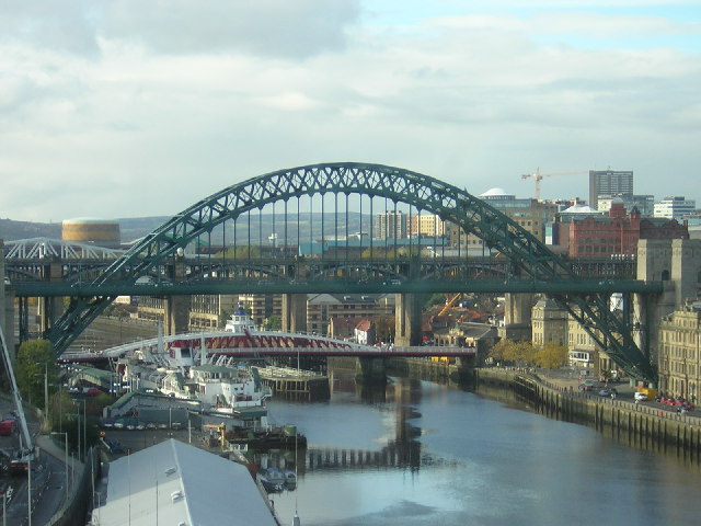
English: The bridges across the River Tyne in Newcastle upon Tyne, England, as viewed from the BALTIC centre on the Gateshead side of the river. The large arch is of the Tyne Bridge, while beneath and beyond it is the Swing Bridge, and beyond that, the High Level Bridge. The white girders of the Queen Elizabeth II Metro Bridge to the left complete the scene. The roof in the lower left belongs to the Royal Naval Reserve shore establishment HMS Calliope. The large white ship beyond it is the Tuxedo Princess (the former car ferry TSS Caledonian Princess), a permanently moored floating nightclub. |
| Date | |
| Source | From geograph.org.uk |
| Author | rob bishop |
| Attribution (required by the license) | rob bishop / Tyne Bridges / |
| Object location | | View this and other nearby images on: OpenStreetMap |
|---|
_&language=en)
Licensing
[edit]

|
This image was taken from the Geograph project collection. See this photograph's page on the Geograph website for the photographer's contact details. The copyright on this image is owned by rob bishop and is licensed for reuse under the Creative Commons Attribution-ShareAlike 2.0 license.
|
This file is licensed under the Creative Commons Attribution-Share Alike 2.0 Generic license.
Attribution: rob bishop
- You are free:
- to share – to copy, distribute and transmit the work
- to remix – to adapt the work
- Under the following conditions:
- attribution – You must give appropriate credit, provide a link to the license, and indicate if changes were made. You may do so in any reasonable manner, but not in any way that suggests the licensor endorses you or your use.
- share alike – If you remix, transform, or build upon the material, you must distribute your contributions under the same or compatible license as the original.
File history
Click on a date/time to view the file as it appeared at that time.
| Date/Time | Thumbnail | Dimensions | User | Comment | |
|---|---|---|---|---|---|
| current | 05:28, 31 January 2010 | | 640 × 480 (108 KB) | GeographBot (talk | contribs) | == {{int:filedesc}} == {{Information |description={{en|1=Tyne Bridges.}} |date=2004-10-05 |source=From [http://www.geograph.org.uk/photo/123773 geograph.org.uk] |author=[http://www.geograph.org.uk/profile/5053 rob bishop] |permission= |other_versions= }} |
You cannot overwrite this file.
File usage on Commons
The following 4 pages use this file: