File:Vampyrum spectrum distribution (colored).png
Jump to navigation
Jump to search

Size of this preview: 800 × 600 pixels. Other resolutions: 320 × 240 pixels | 640 × 480 pixels | 1,024 × 768 pixels | 1,259 × 944 pixels.
Original file (1,259 × 944 pixels, file size: 2.09 MB, MIME type: image/png)
Captions
Captions
Add a one-line explanation of what this file represents
| Description |
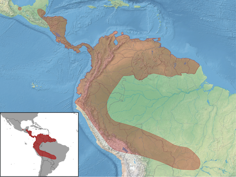
English: geographic distribution of Vampyrum spectrum |
| Date | |
| Source | map data: http://www.naturalearthdata.com/downloads/ distribution data: http://www.iucnredlist.org/details/22843/0 |
| Author |
|
| Permission (Reusing this file) |
This file is licensed under the Creative Commons Attribution-Share Alike 3.0 Unported license. Attribution: IUCN Red List of Threatened Species, species assessors and the authors of the spatial data.
This file is licensed under the Creative Commons Attribution-Share Alike 3.0 Unported license.
|

File history
Click on a date/time to view the file as it appeared at that time.
| Date/Time | Thumbnail | Dimensions | User | Comment | |
|---|---|---|---|---|---|
| current | 15:49, 26 October 2012 | | 1,259 × 944 (2.09 MB) | Rbrausse (talk | contribs) | {{Information |Description ={{en|1=geographic distribution of ''Vampyrum spectrum''}} |Source =map data: http://www.naturalearthdata.com/downloads/ distribution data: http://www.iucnredlist.org/details/22843/0 |Author =* map data: Ma... |
You cannot overwrite this file.
File usage on Commons
The following page uses this file:
File usage on other wikis
The following other wikis use this file:
- Usage on ceb.wikipedia.org
- Usage on de.wikipedia.org
- Usage on en.wikipedia.org
- Usage on es.wikipedia.org
- Usage on et.wikipedia.org
- Usage on fr.wikipedia.org
- Usage on he.wikipedia.org
- Usage on hu.wikipedia.org
- Usage on ja.wikipedia.org
- Usage on ko.wikipedia.org
- Usage on nl.wikipedia.org
- Usage on nv.wikipedia.org
- Usage on pl.wikipedia.org
- Usage on pt.wikipedia.org
- Usage on ru.wikipedia.org
- Usage on simple.wikipedia.org
- Usage on sk.wikipedia.org
- Usage on sv.wikipedia.org
- Usage on uk.wikipedia.org
- Usage on vi.wikipedia.org
- Usage on zh.wikipedia.org
Metadata
.png&oldid=472616032)
Categories:
- IUCN distribution maps
- Vampyrum spectrum
- Distributional maps of Colombia
- Topographic maps of Brazil
- Topographic maps of Bolivia
- Topographic maps of Peru
- Topographic maps of Ecuador
- Topographic maps of Colombia
- Topographic maps of Venezuela
- Topographic maps of Guyana
- Topographic maps of Suriname
- Topographic maps of Panama
- Topographic maps of Costa Rica
- Topographic maps of Nicaragua
- Topographic maps of Honduras
- Topographic maps of Guatemala
- Topographic maps of Belize
- Topographic maps of Mexico