File:Wales Carmarthenshire locator map.svg
跳转到导航
跳转到搜索

此SVG文件的PNG预览的大小:502 × 600像素。 其他分辨率:201 × 240像素 | 402 × 480像素 | 643 × 768像素 | 857 × 1,024像素 | 1,714 × 2,048像素 | 1,047 × 1,251像素。
原始文件 (SVG文件,尺寸为1,047 × 1,251像素,文件大小:151 KB)
说明
说明
添加一行文字以描述该文件所表现的内容
摘要
[编辑]
| 描述 |
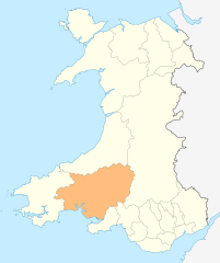
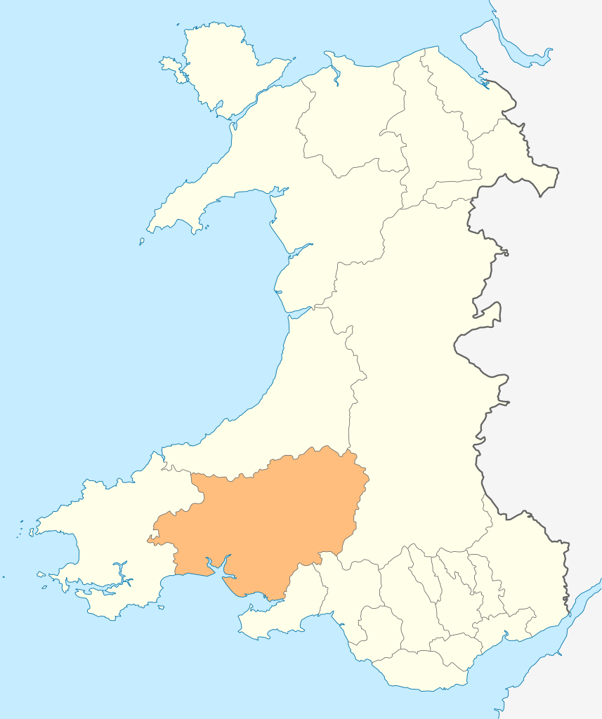
Deutsch: Lagekarte von Carmarthenshire in Wales
English: Locator map of Carmarthenshire in Wales |
| 日期 | |
| 来源 | 自己的作品 |
| 作者 | NordNordWest |
| 授权 (二次使用本文件) |
我,本作品著作权人,特此采用以下许可协议发表本作品: 本文件采用知识共享署名-相同方式共享 3.0 未本地化版本许可协议授权。
|

|
|
文件历史
点击某个日期/时间查看对应时刻的文件。
| 日期/时间 | 缩略图 | 大小 | 用户 | 备注 | |
|---|---|---|---|---|---|
| 当前 | 2010年5月4日 (二) 18:49 | | 1,047 × 1,251(151 KB) | NordNordWest(留言 | 贡献) | {{int:filedesc}} {{Information |Description= {{de|Lagekarte von Carmarthenshire in Wales}} {{en|Locator map of Carmarthenshire in Wales}} |Source={{Own}} |Date=2010-05-04 |Author={{U|NordNordWest}} |Permission={{self|cc-by-sa-3.0}} |other_versions= }} {{ |
您不可以覆盖此文件。
文件用途
以下23个页面使用本文件:
- Template:Carmarthenshire year
- Category:2002 in Carmarthenshire
- Category:2003 in Carmarthenshire
- Category:2004 in Carmarthenshire
- Category:2005 in Carmarthenshire
- Category:2006 in Carmarthenshire
- Category:2007 in Carmarthenshire
- Category:2008 in Carmarthenshire
- Category:2009 in Carmarthenshire
- Category:2010 in Carmarthenshire
- Category:2012 in Carmarthenshire
- Category:2013 in Carmarthenshire
- Category:2014 in Carmarthenshire
- Category:2015 in Carmarthenshire
- Category:2016 in Carmarthenshire
- Category:2017 in Carmarthenshire
- Category:2018 in Carmarthenshire
- Category:2019 in Carmarthenshire
- Category:2020 in Carmarthenshire
- Category:2021 in Carmarthenshire
- Category:2022 in Carmarthenshire
- Category:2023 in Carmarthenshire
- Category:2024 in Carmarthenshire
全域文件用途
以下其他wiki使用此文件:
- cs.wikipedia.org上的用途
- de.wikipedia.org上的用途
- en.wikipedia.org上的用途
- WWT Llanelli Wetlands Centre
- Carmarthenshire
- Sandy, Carmarthenshire
- Llanelli
- Carmarthen
- Llandeilo
- Newcastle Emlyn
- Whitland
- Burry Port
- Kidwelly
- Llandovery
- Laugharne
- St Clears
- Pendine
- Garreg Lwyd (Black Mountain)
- Llandybie
- Llanwrda
- Afon Cothi
- Cwmann
- Bancyfelin
- Talley
- Aber-arad
- Aber-giar
- Abergorlech
- Abernant, Carmarthenshire
- Cross Hands
- Pantyffynnon
- List of places in Carmarthenshire
- Brandy Hill, Wales
- Caio, Carmarthenshire
- Template:Carmarthenshire-geo-stub
- Bryn, Llanelli
- Pemberton, Carmarthenshire
- Dafen, Carmarthenshire
- Pendine Museum of Speed
- Usk Reservoir
- River Cywyn
- Five Roads
- Maesybont
- Glanymor
- Trefawr Track
- Bethlehem, Carmarthenshire
- Stradey
- Cross Inn
- Bronwydd
- Llanfihangel Rhos-y-Corn
- St Ishmael, Carmarthenshire
- Elvet Hundred
查看此文件的更多全域用途。