File:Waliau sych - on a journey from car park on B4417 (nr Llanaelhaearn) to the main entrance to Tre'r Ceiri, Gwynedd Cymru (Wales) 07.jpg
Jump to navigation
Jump to search

Size of this preview: 800 × 451 pixels. Other resolutions: 320 × 180 pixels | 640 × 361 pixels | 1,024 × 577 pixels | 1,280 × 721 pixels | 2,560 × 1,443 pixels | 5,919 × 3,336 pixels.
Original file (5,919 × 3,336 pixels, file size: 14.07 MB, MIME type: image/jpeg)
Captions
Captions
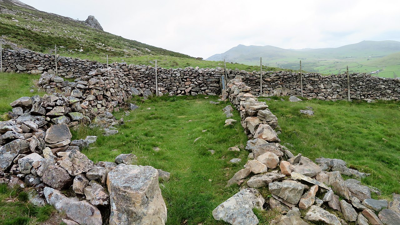
On a journey from car park on B4417 (nr Llanaelhaearn) to the main entrance to Tre'r Ceiri, Gwynedd Cymru (Wales)
Summary
[edit]_to_the_main_entrance_to_Tre%27r_Ceiri,_Gwynedd_Cymru_(Wales)_07.jpg&action=edit§ion=1)
| Description |
Cymraeg: Taith o faes partcio Llanaelhaearn (ar y B4417) i fynedfa Caer Tre'r Ceiri.
English: On a journey from car park on B4417 (nr Llanaelhaearn) to the main entrance to Tre'r Ceiri, Gwynedd Cymru (Wales).
Tre'r Ceiri is a hillfort dating back to the Iron Age. The name means 'town of the giants', from cewri, plural of cawr, 'giant'. The settlement is located 450 metres (1,480 ft) above sea level on the slopes of Yr Eifl, a mountain on the north coast of the Llŷn Peninsula in Gwynedd, north-western Wales. |
| Date | |
| Source | Own work |
| Author | Llywelyn2000 |
| Camera location | | View this and other nearby images on: OpenStreetMap |
|---|
_to_the_main_entrance_to_Tre%27r_Ceiri,_Gwynedd_Cymru_(Wales)_07.jpg¶ms=052.970571_N_-004.423366_E_globe:Earth_type:camera__&language=en)
Licensing
[edit]_to_the_main_entrance_to_Tre%27r_Ceiri,_Gwynedd_Cymru_(Wales)_07.jpg&action=edit§ion=2)
I, the copyright holder of this work, hereby publish it under the following license:
This file is licensed under the Creative Commons Attribution-Share Alike 4.0 International license.
- You are free:
- to share – to copy, distribute and transmit the work
- to remix – to adapt the work
- Under the following conditions:
- attribution – You must give appropriate credit, provide a link to the license, and indicate if changes were made. You may do so in any reasonable manner, but not in any way that suggests the licensor endorses you or your use.
- share alike – If you remix, transform, or build upon the material, you must distribute your contributions under the same or compatible license as the original.
This image was uploaded as part of Wiki Loves Earth 2022.
|
 |
File history
Click on a date/time to view the file as it appeared at that time.
| Date/Time | Thumbnail | Dimensions | User | Comment | |
|---|---|---|---|---|---|
| current | 11:01, 10 June 2022 | | 5,919 × 3,336 (14.07 MB) | Llywelyn2000 (talk | contribs) | Uploaded own work with UploadWizard |
You cannot overwrite this file.
File usage on Commons
There are no pages that use this file.
_to_the_main_entrance_to_Tre%27r_Ceiri,_Gwynedd_Cymru_(Wales)_07.jpg&oldid=670726764)