File:Walton-on-the-Naze, The former railway station building - geograph.org.uk - 1475420.jpg
Jump to navigation
Jump to search

No higher resolution available.
Walton-on-the-Naze,_The_former_railway_station_building_-_geograph.org.uk_-_1475420.jpg (640 × 480 pixels, file size: 56 KB, MIME type: image/jpeg)
Captions
Captions
Add a one-line explanation of what this file represents
Summary
[edit]
| Description |
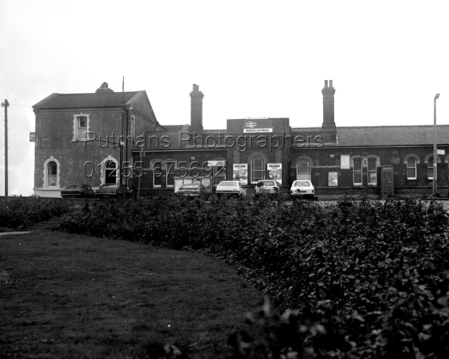
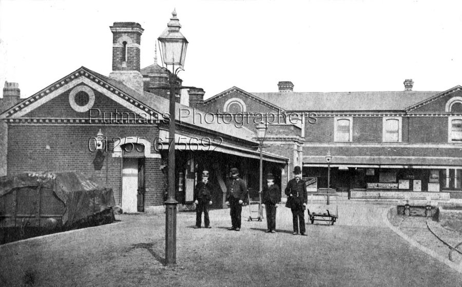
English: Walton-on-the-Naze: The former railway station building Walton still has its functioning railway station, seen here 793301, but this building next door, now converted into residential accommodation, is the original Great Eastern Railway structure. The local photographic firm of Putmans have an image from the same viewpoint dated 1984 here http://www.putmans.co.uk/OldWalton_sundry_Assetts/926-Railway-Stn-1984.jpg which shows the building in use as the station. Since then the domed roof and block above the original entrance have been added, although another old photograph in Putmans' archive http://www.putmans.co.uk/OldWalton_sundry_Assetts/933-Walton-Station.jpg taken from a different angle would suggest that a tower there was part of the original fabric of the building anyway.
The station name in the 1984 image is Walton-on-Naze. This did not change until 2007 when it became the current Walton-on-the-Naze. |
| Date | |
| Source | From geograph.org.uk |
| Author | Nigel Cox |
| Attribution (required by the license) | Nigel Cox / Walton-on-the-Naze: The former railway station building / |
| Camera location | | View this and other nearby images on: OpenStreetMap |
|---|
_heading:157.00&language=en)
| Object location | | View this and other nearby images on: OpenStreetMap |
|---|
_heading:157.00&language=en)
Licensing
[edit]

|
This image was taken from the Geograph project collection. See this photograph's page on the Geograph website for the photographer's contact details. The copyright on this image is owned by Nigel Cox and is licensed for reuse under the Creative Commons Attribution-ShareAlike 2.0 license.
|
This file is licensed under the Creative Commons Attribution-Share Alike 2.0 Generic license.
Attribution: Nigel Cox
- You are free:
- to share – to copy, distribute and transmit the work
- to remix – to adapt the work
- Under the following conditions:
- attribution – You must give appropriate credit, provide a link to the license, and indicate if changes were made. You may do so in any reasonable manner, but not in any way that suggests the licensor endorses you or your use.
- share alike – If you remix, transform, or build upon the material, you must distribute your contributions under the same or compatible license as the original.
File history
Click on a date/time to view the file as it appeared at that time.
| Date/Time | Thumbnail | Dimensions | User | Comment | |
|---|---|---|---|---|---|
| current | 13:26, 2 March 2011 | | 640 × 480 (56 KB) | GeographBot (talk | contribs) | == {{int:filedesc}} == {{Information |description={{en|1=Walton-on-the-Naze: The former railway station building Walton still has its functioning railway station, seen here 793301, but this building next door, now converted into residential accommodat |
You cannot overwrite this file.
File usage on Commons
There are no pages that use this file.
File usage on other wikis
The following other wikis use this file:
- Usage on en.wikipedia.org