File:Ward, Lock, & Co.s plan of the city of Paris, ca. 1905 - Stanford Libraries.jpg
Jump to navigation
Jump to search

Size of this preview: 800 × 538 pixels. Other resolutions: 320 × 215 pixels | 640 × 431 pixels | 1,024 × 689 pixels | 1,280 × 861 pixels | 2,560 × 1,723 pixels | 8,338 × 5,611 pixels.
Original file (8,338 × 5,611 pixels, file size: 9.12 MB, MIME type: image/jpeg)
Captions
Captions
Add a one-line explanation of what this file represents
Summary[edit]
| Title |
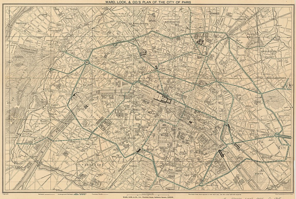
Ward, Lock, & Co.s plan of the city of Paris |
| Description |
English: Shows railways, underground railways, and tramway routes; underground railways routes outlined in green. Probably issued in: A pictorial and descriptive guide to Paris ... London : Ward, Lock and Co., [1905?] |
| Date | circa 1905 |
| Source | Stanford Libraries |
| Creator |
Ward, Lock & Co. |
| Georeferencing | If inappropriate please set warp_status = skip to hide. |
| Bibliographic data | |
| Publisher |
London : Ward, Lock, & Co., Ltd., Warwick House, Salisbury Square, [ca. 1905] (Edinr. : John Bartholomew & Co.) |
| Archival data | |
| Collection | Stanford Libraries |
| Medium | 1 map |
Licensing[edit]
|
This work is in the public domain in its country of origin and other countries and areas where the copyright term is the author's life plus 100 years or fewer. | |
| This file has been identified as being free of known restrictions under copyright law, including all related and neighboring rights. | |
File history
Click on a date/time to view the file as it appeared at that time.
| Date/Time | Thumbnail | Dimensions | User | Comment | |
|---|---|---|---|---|---|
| current | 17:37, 10 July 2020 | | 8,338 × 5,611 (9.12 MB) | Paris 16 (talk | contribs) | Uploaded own work with UploadWizard |
You cannot overwrite this file.
File usage on Commons
The following 3 pages use this file:
File usage on other wikis
The following other wikis use this file:
- Usage on fr.wikipedia.org