File:Wash Lane - geograph.org.uk - 1762170.jpg
Jump to navigation
Jump to search
No higher resolution available.
Wash_Lane_-_geograph.org.uk_-_1762170.jpg (640 × 480 pixels, file size: 112 KB, MIME type: image/jpeg)
Captions
Captions
Add a one-line explanation of what this file represents
Summary
[edit]
| Description |
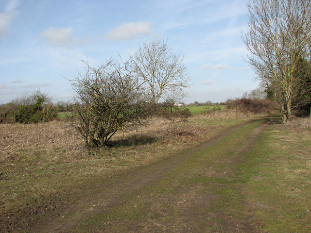
English: Wash Lane. Wash Lane is a track with public access, linking Bradcar Road > 1761808 and Sallow Lane > 1762236 further to the south-east. About half way along, the lane fords the River Thet > 1762177 - 1762186 and a footbridge > 1762181 takes pedestrians across the river without getting their feet wet. |
| Date | |
| Source | From geograph.org.uk |
| Author | Evelyn Simak |
| Attribution (required by the license) | Evelyn Simak / Wash Lane / |
| Camera location | | View this and other nearby images on: OpenStreetMap |
|---|
_heading:292.00&language=en)
| Object location | | View this and other nearby images on: OpenStreetMap |
|---|
_heading:292.00&language=en)
Licensing
[edit]

|
This image was taken from the Geograph project collection. See this photograph's page on the Geograph website for the photographer's contact details. The copyright on this image is owned by Evelyn Simak and is licensed for reuse under the Creative Commons Attribution-ShareAlike 2.0 license.
|
This file is licensed under the Creative Commons Attribution-Share Alike 2.0 Generic license.
Attribution: Evelyn Simak
- You are free:
- to share – to copy, distribute and transmit the work
- to remix – to adapt the work
- Under the following conditions:
- attribution – You must give appropriate credit, provide a link to the license, and indicate if changes were made. You may do so in any reasonable manner, but not in any way that suggests the licensor endorses you or your use.
- share alike – If you remix, transform, or build upon the material, you must distribute your contributions under the same or compatible license as the original.
File history
Click on a date/time to view the file as it appeared at that time.
| Date/Time | Thumbnail | Dimensions | User | Comment | |
|---|---|---|---|---|---|
| current | 22:16, 11 March 2011 | | 640 × 480 (112 KB) | GeographBot (talk | contribs) | == {{int:filedesc}} == {{Information |description={{en|1=Wash Lane Wash Lane is a track with public access, linking Bradcar Road > http://www.geograph.org.uk/photo/1761808 and Sallow Lane > http://www.geograph.org.uk/photo/1762236 further to the south-eas |
You cannot overwrite this file.
File usage on Commons
There are no pages that use this file.