File:Water level marker, River Key, Purton Stoke - geograph.org.uk - 1635346.jpg
Jump to navigation
Jump to search

Size of this preview: 800 × 600 pixels. Other resolutions: 320 × 240 pixels | 640 × 480 pixels | 1,024 × 768 pixels | 1,280 × 960 pixels | 2,560 × 1,920 pixels | 2,816 × 2,112 pixels.
Original file (2,816 × 2,112 pixels, file size: 2.79 MB, MIME type: image/jpeg)
Captions
Captions
Add a one-line explanation of what this file represents
Summary
[edit]
| Description |
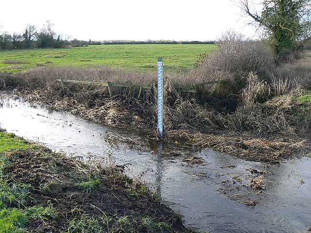
English: Water level marker, River Key, Purton Stoke The River Key is a tributary of the River Thames, which it joins just east of Cricklade about 4 kilometres to the north. The area is prone to flooding at times. Not visible at this resolution is the height above ordnance datum shown on the marker of 83 metres. |
| Date | |
| Source | From geograph.org.uk |
| Author | Brian Robert Marshall |
| Attribution (required by the license) | Brian Robert Marshall / Water level marker, River Key, Purton Stoke / |
| Camera location | | View this and other nearby images on: OpenStreetMap |
|---|
_heading:247.00&language=en)
| Object location | | View this and other nearby images on: OpenStreetMap |
|---|
_heading:247.00&language=en)
Licensing
[edit]

|
This image was taken from the Geograph project collection. See this photograph's page on the Geograph website for the photographer's contact details. The copyright on this image is owned by Brian Robert Marshall and is licensed for reuse under the Creative Commons Attribution-ShareAlike 2.0 license.
|
This file is licensed under the Creative Commons Attribution-Share Alike 2.0 Generic license.
Attribution: Brian Robert Marshall
- You are free:
- to share – to copy, distribute and transmit the work
- to remix – to adapt the work
- Under the following conditions:
- attribution – You must give appropriate credit, provide a link to the license, and indicate if changes were made. You may do so in any reasonable manner, but not in any way that suggests the licensor endorses you or your use.
- share alike – If you remix, transform, or build upon the material, you must distribute your contributions under the same or compatible license as the original.
File history
Click on a date/time to view the file as it appeared at that time.
| Date/Time | Thumbnail | Dimensions | User | Comment | |
|---|---|---|---|---|---|
| current | 18:20, 4 March 2011 | | 2,816 × 2,112 (2.79 MB) | GeographBot (talk | contribs) | == {{int:filedesc}} == {{Information |description={{en|1=Water level marker, River Key, Purton Stoke The River Key is a tributary of the River Thames, which it joins just east of Cricklade about 4 kilometres to the north. The area is prone to flooding at |
You cannot overwrite this file.
File usage on Commons
There are no pages that use this file.