File:Weobley Castle.jpg
Jump to navigation
Jump to search
No higher resolution available.
Weobley_Castle.jpg (640 × 480 pixels, file size: 186 KB, MIME type: image/jpeg)
Captions
Captions
Add a one-line explanation of what this file represents
|
This is a photo of listed building number 11534. |
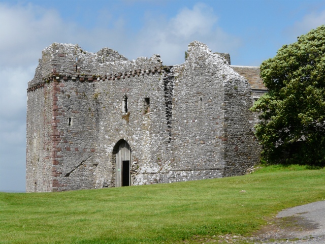
| Description | The west face of Weobley Castle. Weobley Castle is a fortified manor house on the Gower peninsula, Wales, UK in the care of Cadw. |
| Date | |
| Source | From geograph.org.uk |
| Author | Graham Taylor |
| Permission (Reusing this file) |
Creative Commons Attribution Share-alike license 2.0 |
| Camera location | | View this and other nearby images on: OpenStreetMap |
|---|

|
This image was taken from the Geograph project collection. See this photograph's page on the Geograph website for the photographer's contact details. The copyright on this image is owned by Graham Taylor and is licensed for reuse under the Creative Commons Attribution-ShareAlike 2.0 license.
|
This file is licensed under the Creative Commons Attribution-Share Alike 2.0 Generic license.
Attribution: Graham Taylor
- You are free:
- to share – to copy, distribute and transmit the work
- to remix – to adapt the work
- Under the following conditions:
- attribution – You must give appropriate credit, provide a link to the license, and indicate if changes were made. You may do so in any reasonable manner, but not in any way that suggests the licensor endorses you or your use.
- share alike – If you remix, transform, or build upon the material, you must distribute your contributions under the same or compatible license as the original.
File history
Click on a date/time to view the file as it appeared at that time.
| Date/Time | Thumbnail | Dimensions | User | Comment | |
|---|---|---|---|---|---|
| current | 09:07, 15 August 2008 | | 640 × 480 (186 KB) | Arthena (talk | contribs) | {{Information |Description=The west face of Weobley Castle. |Source=From [http://www.geograph.org.uk/photo/868693 geograph.org.uk] |Date=2008-06-22 |Author=[http://www.geograph.org.uk/profile/26281 Graham Taylor] |Permission=Creative Commons Attribution S |
You cannot overwrite this file.
File usage on Commons
There are no pages that use this file.
File usage on other wikis
The following other wikis use this file:
- Usage on cy.wikipedia.org
- Usage on da.wikipedia.org
- Usage on en.wikipedia.org
- Usage on en.wikivoyage.org
- Usage on fr.wikipedia.org
- Usage on ru.wikipedia.org