File:West Elevation - Washington Monument, High ground West of Fifteenth Street, Northwest, between Independence and Constitution Avenues, Washington, District of Columbia, HABS DC,WASH,2- (sheet 15 of 37).tif
Jump to navigation
Jump to search

Size of this JPG preview of this TIF file: 466 × 599 pixels. Other resolutions: 187 × 240 pixels | 373 × 480 pixels | 597 × 768 pixels | 796 × 1,024 pixels | 1,593 × 2,048 pixels | 13,696 × 17,608 pixels.
Original file (13,696 × 17,608 pixels, file size: 869 KB, MIME type: image/tiff)
Captions
Captions
Add a one-line explanation of what this file represents
Summary[edit]
| Warning | The original file is very high-resolution. It might not load properly or could cause your browser to freeze when opened at full size. |
|---|
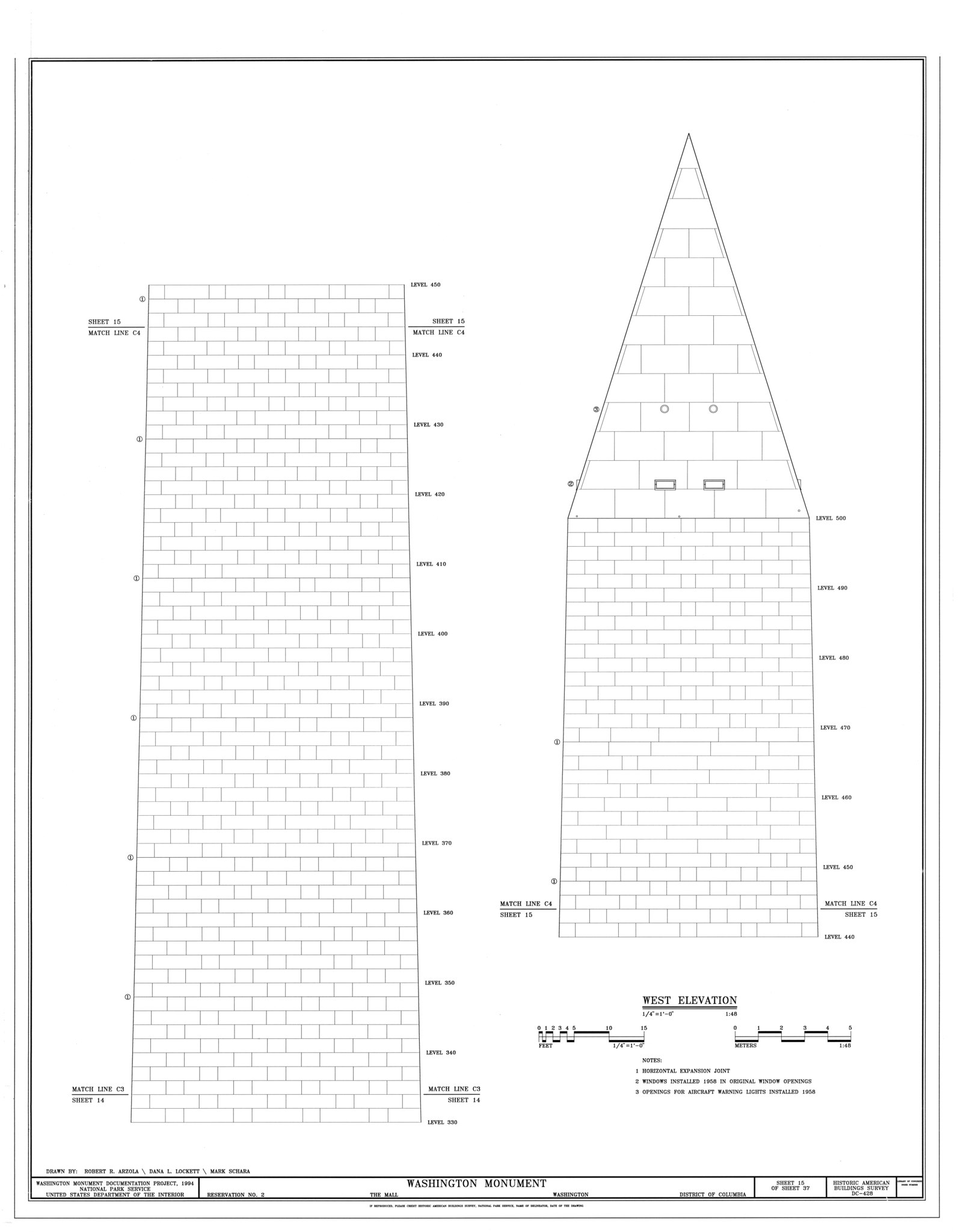
| West Elevation - Washington Monument, High ground West of Fifteenth Street, Northwest, between Independence and Constitution Avenues, Washington, District of Columbia, DC | ||||
|---|---|---|---|---|
| Photographer |
Arzola, Robert R. |
|||
| Title |
West Elevation - Washington Monument, High ground West of Fifteenth Street, Northwest, between Independence and Constitution Avenues, Washington, District of Columbia, DC |
|||
| Depicted place | District of Columbia; District of Columbia; Washington | |||
| Date | 1994 | |||
| Dimensions | 34 x 44 in. (E size) | |||
| Current location |
Library of Congress Prints and Photographs Division Washington, D.C. 20540 USA http://hdl.loc.gov/loc.pnp/pp.print |
|||
| Accession number |
HABS DC,WASH,2- (sheet 15 of 37) |
|||
| Credit line |
|
|||
| Notes |
|
|||
| References |
Related names:
|
|||
| Source | https://www.loc.gov/pictures/item/dc0261.sheet.00015a | |||
| Permission (Reusing this file) |
|
|||
| Other versions |
.png) .png) .png) .png) .png) .png) .png) .png) .png) .png) .png) .png) .png) .png) .png) .png) .png) .png) .png) .png) .png) .png) .png) .png) .png) .png) .png) .png) .png) .png) .png) .png) .png) |
|||

| Object location | | View this and other nearby images on: OpenStreetMap |
|---|
File history
Click on a date/time to view the file as it appeared at that time.
| Date/Time | Thumbnail | Dimensions | User | Comment | |
|---|---|---|---|---|---|
| current | 08:08, 9 July 2014 |  | 13,696 × 17,608 (869 KB) | Fæ (talk | contribs) | GWToolset: Creating mediafile for Fæ. HABS 08 July 2014 (701:800) |
You cannot overwrite this file.
File usage on Commons
The following page uses this file: