File:Winestead railway station (site), Yorkshire (geograph 5657857).jpg
Jump to navigation
Jump to search
Size of this preview: 800 × 600 pixels. Other resolutions: 320 × 240 pixels | 640 × 480 pixels | 1,024 × 768 pixels | 1,280 × 960 pixels | 1,600 × 1,200 pixels.
Original file (1,600 × 1,200 pixels, file size: 407 KB, MIME type: image/jpeg)
Captions
Captions
Add a one-line explanation of what this file represents
Summary[edit]
,_Yorkshire_(geograph_5657857).jpg&action=edit§ion=1)
| Description |
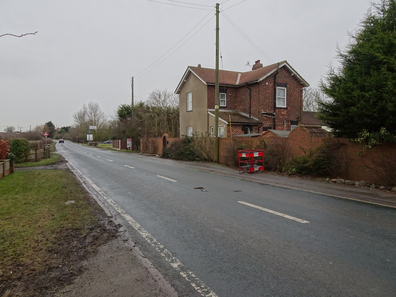
English: Winestead railway station (site) Winestead, East Riding of Yorkshire, England. Opened in 1854 by the Hull & Holderness railway, later part of the North Eastern Railway, on the line from Hull Victoria Docks (Hull Paragon from 1864) to Withernsea, this station closed to passengers in 1904 and completely in 1956. View south at the former entrance. The railway ran left to right behind the building with a level crossing across the road. |
| Date | |
| Source | From geograph.org.uk |
| Author | Nigel Thompson |
| Permission (Reusing this file) |
Creative Commons Attribution Share-alike license 2.0 |
| Attribution (required by the license) | Nigel Thompson / Winestead railway station (site), Yorkshire / |
| Camera location | | View this and other nearby images on: OpenStreetMap |
|---|
,_Yorkshire_(geograph_5657857).jpg¶ms=053.691136_N_-000.032126_E_globe:Earth_type:camera_source:geograph-osgb36(TA30042343)_heading:202.00&language=en)
| Object location | | View this and other nearby images on: OpenStreetMap |
|---|
,_Yorkshire_(geograph_5657857).jpg¶ms=053.690870_N_-000.032440_E_globe:Earth_class:object_type:object_source:geograph-osgb36(TA30022340)_heading:202.00&language=en)
Licensing[edit]
,_Yorkshire_(geograph_5657857).jpg&action=edit§ion=2)

|
This image was taken from the Geograph project collection. See this photograph's page on the Geograph website for the photographer's contact details. The copyright on this image is owned by Nigel Thompson and is licensed for reuse under the Creative Commons Attribution-ShareAlike 2.0 license.
|
This file is licensed under the Creative Commons Attribution-Share Alike 2.0 Generic license.
Attribution: Nigel Thompson
- You are free:
- to share – to copy, distribute and transmit the work
- to remix – to adapt the work
- Under the following conditions:
- attribution – You must give appropriate credit, provide a link to the license, and indicate if changes were made. You may do so in any reasonable manner, but not in any way that suggests the licensor endorses you or your use.
- share alike – If you remix, transform, or build upon the material, you must distribute your contributions under the same or compatible license as the original.
File history
Click on a date/time to view the file as it appeared at that time.
| Date/Time | Thumbnail | Dimensions | User | Comment | |
|---|---|---|---|---|---|
| current | 19:31, 10 September 2018 | | 1,600 × 1,200 (407 KB) | Schlosser67 (talk | contribs) | Transferred from geograph.co.uk using [https://tools.wmflabs.org/geograph2commons/ geograph2commons] |
You cannot overwrite this file.
File usage on Commons
The following page uses this file:
File usage on other wikis
The following other wikis use this file:
- Usage on en.wikipedia.org
- Usage on www.wikidata.org
,_Yorkshire_(geograph_5657857).jpg&oldid=716107302)
Categories:
- Winestead
- Disused railway stations in the East Riding of Yorkshire
- Hull and Holderness Railway
- A1033 road (England)
- Houses in the East Riding of Yorkshire
- Walls in the East Riding of Yorkshire
- Trees in the East Riding of Yorkshire
- Utility poles in the East Riding of Yorkshire
- January 2018 in the East Riding of Yorkshire