File:Woodchester railway station (site), Gloucestershire (geograph 7015970).jpg
Jump to navigation
Jump to search

Size of this preview: 800 × 600 pixels. Other resolutions: 320 × 240 pixels | 640 × 480 pixels | 1,024 × 768 pixels | 1,280 × 960 pixels | 1,600 × 1,200 pixels.
Original file (1,600 × 1,200 pixels, file size: 682 KB, MIME type: image/jpeg)
Captions
Captions
Add a one-line explanation of what this file represents
Summary
[edit],_Gloucestershire_(geograph_7015970).jpg&action=edit§ion=1)
| Description |
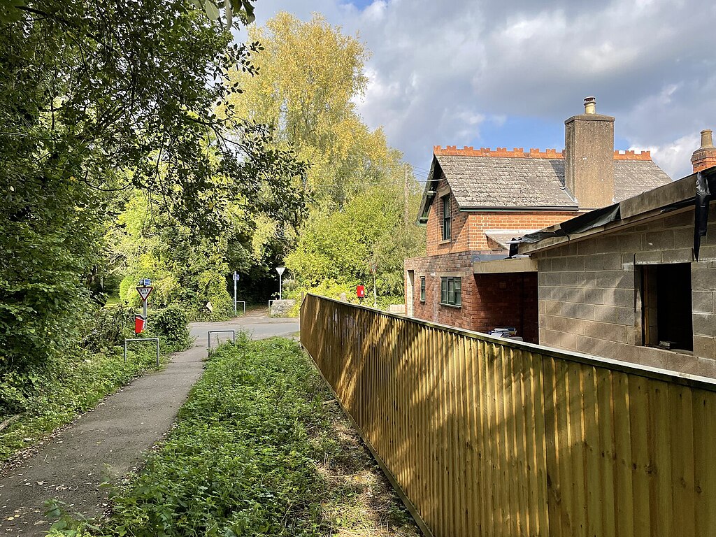
English: Woodchester railway station (site), Gloucestershire Opened in 1867 by the Stonehouse & Nailsworth Railway, very soon to become part of the Midland Railway, on the line between those two places, this station closed to passengers in 1947 and completely in 1966. View north on the track-bed, now a footpath, towards Dudbridge and Stonehouse. The former Station Master's house was undergoing renovation and extension when this image was taken. Beyond was a level crossing, and then the platform was to the right of the track with a wooden station building. No trace of the latter appears to remain. |
| Date | |
| Source | From geograph.org.uk |
| Author | Nigel Thompson |
| Permission (Reusing this file) |
Creative Commons Attribution Share-alike license 2.0 |
| Attribution (required by the license) | Nigel Thompson / Woodchester railway station (site), Gloucestershire / |
| Camera location | | View this and other nearby images on: OpenStreetMap |
|---|
,_Gloucestershire_(geograph_7015970).jpg¶ms=051.718390_N_-002.230546_E_globe:Earth_type:camera_source:geograph-osgb36(SO84170221)_heading:0.00&language=en)
| Object location | | View this and other nearby images on: OpenStreetMap |
|---|
,_Gloucestershire_(geograph_7015970).jpg¶ms=051.718660_N_-002.230550_E_globe:Earth_class:object_type:object_source:geograph-osgb36(SO84170224)_heading:0.00&language=en)
Licensing
[edit],_Gloucestershire_(geograph_7015970).jpg&action=edit§ion=2)

|
This image was taken from the Geograph project collection. See this photograph's page on the Geograph website for the photographer's contact details. The copyright on this image is owned by Nigel Thompson and is licensed for reuse under the Creative Commons Attribution-ShareAlike 2.0 license.
|
This file is licensed under the Creative Commons Attribution-Share Alike 2.0 Generic license.
Attribution: Nigel Thompson
- You are free:
- to share – to copy, distribute and transmit the work
- to remix – to adapt the work
- Under the following conditions:
- attribution – You must give appropriate credit, provide a link to the license, and indicate if changes were made. You may do so in any reasonable manner, but not in any way that suggests the licensor endorses you or your use.
- share alike – If you remix, transform, or build upon the material, you must distribute your contributions under the same or compatible license as the original.
File history
Click on a date/time to view the file as it appeared at that time.
| Date/Time | Thumbnail | Dimensions | User | Comment | |
|---|---|---|---|---|---|
| current | 10:10, 14 November 2021 | | 1,600 × 1,200 (682 KB) | Lamberhurst (talk | contribs) | == {{int:filedesc}} == {{Information |Description={{en|1=<b>Woodchester railway station (site), Gloucestershire</b><br>Opened in 1867 by the Stonehouse & Nailsworth Railway, very soon to become part of the Midland Railway, on the line between those two places, this station closed to passengers in 1947 and completely in 1966. View north on the track-bed, now a footpath, towards Dudbridge and Stonehouse. The former Station Master's house was undergoing renovation and extension when this image w... |
You cannot overwrite this file.
File usage on Commons
The following page uses this file:
,_Gloucestershire_(geograph_7015970).jpg&oldid=607106835)