File:15th century map of Turkey region.jpg
Pereiti į navigaciją
Jump to search
Šios peržiūros dydis: 800 × 600 taškų. Kitos 5 rezoliucijos: 320 × 240 taškų | 640 × 480 taškų | 1 024 × 768 taškų | 1 280 × 960 taškų | 2 048 × 1 536 taškų.
Pradinė rinkmena (2 048 × 1 536 taškų, rinkmenos dydis: 884 KiB, MIME tipas: image/jpeg)
Captions
Captions
Add a one-line explanation of what this file represents
| Aprašymas |
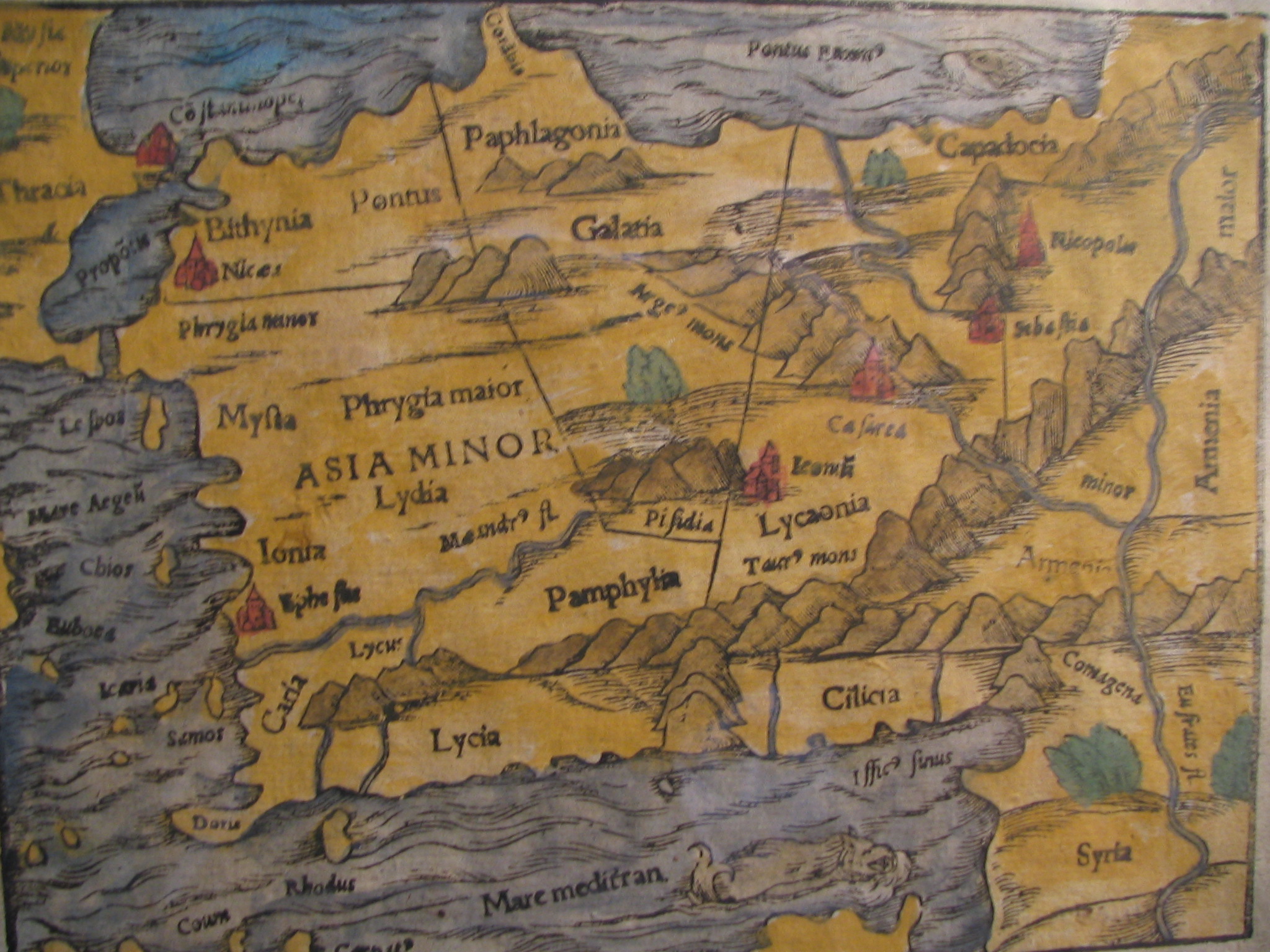
English: Picture of a map of the region of what is now Turkey from the 15th Century. I own this map, having purchased it, and have all official documentation regarding its authenticity. |
||||
| Data | 15 century, Digitized on: 2006 m. gruodžio 10 d., 19:42:23 | ||||
| Šaltinis |
|
||||
| Autorius | Nežinoma, Photographer: Electionworld | ||||
| Leidimas (Šios rinkmenos panaudojimas kitur) |
Šiam failui taikoma Creative Commons Attribution-Share Alike 2.5 Generic licencija.
|
||||

Rinkmenos istorija
Paspauskite ant datos/laiko, kad pamatytumėte rinkmeną tokią, kokia ji buvo tuo metu.
| Data/Laikas | Miniatiūra | Matmenys | Naudotojas | Paaiškinimas | |
|---|---|---|---|---|---|
| dabartinis | 14:04, 21 vasario 2018 | | 2 048 × 1 536 (884 KiB) | Ket (aptarimas | indėlis) | Reverted to version as of 09:40, 17 December 2006 (UTC) |
| 14:03, 21 vasario 2018 |  | 2 048 × 1 536 (921 KiB) | Ket (aptarimas | indėlis) | better contrast | |
| 09:40, 17 gruodžio 2006 |  | 2 048 × 1 536 (884 KiB) | Electionworld (aptarimas | indėlis) | {{ew|en|Rarelibra}} == Summary == Picture of a map of the region of what is now Turkey from the 15th Century. I own this map, having purchased it, and have all official documentation regarding its authenticity. == Licensing == {{cc-by-sa-2.5}} |
Jūs negalite perrašyti šios rinkmenos.
Rinkmenos naudojimas
Šie puslapiai naudoja šią rinkmeną:
Visuotinis rinkmenos naudojimas
Ši rinkmena naudojama šiose viki svetainėse:
- Naudojama ar.wikipedia.org
- Naudojama ast.wikipedia.org
- Naudojama bg.wikipedia.org
- Naudojama ca.wikipedia.org
- Naudojama cs.wikipedia.org
- Naudojama da.wikipedia.org
- Naudojama de.wikipedia.org
- Naudojama el.wikipedia.org
- Naudojama en.wikipedia.org
- Naudojama eo.wikipedia.org
- Naudojama es.wikipedia.org
- Naudojama eu.wikipedia.org
- Naudojama fr.wikipedia.org
- Naudojama gl.wikipedia.org
- Naudojama hr.wikipedia.org
Žiūrėti visuotinį šios rinkmenos naudojimą.