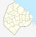
File:Argentina Buenos Aires City location map.svg
From Wikimedia Commons, the free media repository
Jump to navigation
Jump to search

Size of this PNG preview of this SVG file: 589 × 600 pixels. Other resolutions: 236 × 240 pixels | 471 × 480 pixels | 754 × 768 pixels | 1,006 × 1,024 pixels | 2,011 × 2,048 pixels | 1,152 × 1,173 pixels.
Original file (SVG file, nominally 1,152 × 1,173 pixels, file size: 54 KB)
File information
Structured data
Captions
Captions
Add a one-line explanation of what this file represents
Summary
[edit]| DescriptionArgentina Buenos Aires City location map.svg |
Quadratische Plattkarte. Geographische Begrenzung der Karte:
Equirectangular projection. Geographic limits of the map:
|
| Date | |
| Source |
Own work using |
| Author | NordNordWest and OpenStreetMap contributors |

|
This map has been made or improved in the German Kartenwerkstatt (Map Lab). You can propose maps to improve as well.
azərbaycanca ∙ čeština ∙ Deutsch ∙ Deutsch (Sie-Form) ∙ English ∙ español ∙ français ∙ italiano ∙ latviešu ∙ magyar ∙ Nederlands ∙ Plattdüütsch ∙ polski ∙ português ∙ română ∙ sicilianu ∙ slovenščina ∙ suomi ∙ македонски ∙ русский ∙ ქართული ∙ հայերեն ∙ বাংলা ∙ ไทย ∙ +/−
|
Licensing
[edit]This file is licensed under the Creative Commons Attribution-Share Alike 2.0 Generic license.
- You are free:
- to share – to copy, distribute and transmit the work
- to remix – to adapt the work
- Under the following conditions:
- attribution – You must give appropriate credit, provide a link to the license, and indicate if changes were made. You may do so in any reasonable manner, but not in any way that suggests the licensor endorses you or your use.
- share alike – If you remix, transform, or build upon the material, you must distribute your contributions under the same or compatible license as the original.
File history
Click on a date/time to view the file as it appeared at that time.
| Date/Time | Thumbnail | Dimensions | User | Comment | |
|---|---|---|---|---|---|
| current | 11:33, 17 March 2012 |  | 1,152 × 1,173 (54 KB) | NordNordWest (talk | contribs) | == {{int:filedesc}} == {{Information |Description= {{de|Positionskarte der Stadt Buenos Aires, Argentinien}} Quadratische Plattkarte. Geographische Begrenzung der Karte: * N: 34.5205861° S * S: 34.7143027° S *... |
You cannot overwrite this file.
File usage on Commons
The following 49 pages use this file:
- Buenos Aires
- User:NordNordWest/Gallery/Location maps
- File:Flag-map of Buenos Aires City.svg
- Category:Airports in Buenos Aires
- Category:Art Nouveau architecture in Buenos Aires
- Category:Art in Buenos Aires
- Category:Association football clubs of Buenos Aires autonomous city
- Category:Births in Buenos Aires
- Category:Bridges in Buenos Aires
- Category:Buenos Aires
- Category:Buenos Aires Metro ghost stations
- Category:Buenos Aires by decade
- Category:Buenos Aires in the 1900s
- Category:Buenos Aires in the 1910s
- Category:Buenos Aires in the 1920s
- Category:Buenos Aires in the 1930s
- Category:Buenos Aires in the 1940s
- Category:Buenos Aires in the 1950s
- Category:Buenos Aires in the 1960s
- Category:Buenos Aires in the 1970s
- Category:Buenos Aires in the 1980s
- Category:Buenos Aires in the 1990s
- Category:Buenos Aires in the 2000s
- Category:Buenos Aires in the 2010s
- Category:Cemeteries in Buenos Aires
- Category:Christianity in Buenos Aires
- Category:Churches in Buenos Aires
- Category:Deaths in Buenos Aires
- Category:Education in Buenos Aires
- Category:Embassies in Buenos Aires
- Category:Hospitals in Buenos Aires
- Category:Hotels in Buenos Aires
- Category:Maps of Buenos Aires
- Category:Musical groups from Buenos Aires
- Category:Palaces in Buenos Aires
- Category:Parks in Buenos Aires
- Category:Rail transport in Buenos Aires
- Category:Religion in Buenos Aires
- Category:Schools in Buenos Aires
- Category:Shopping malls in Buenos Aires
- Category:Skyscrapers in Buenos Aires
- Category:Sports competitions in Buenos Aires
- Category:Sports in Buenos Aires
- Category:Sports venues in Buenos Aires
- Category:Squares in Buenos Aires
- Category:Stations of the Buenos Aires Metro
- Category:Streets in Buenos Aires
- Category:Train stations in Buenos Aires City
- Category:Views of Buenos Aires
File usage on other wikis
The following other wikis use this file:
- Usage on ar.wikipedia.org
- Usage on ast.wikipedia.org
- Usage on ba.wikipedia.org
- Usage on bs.wikipedia.org
- Usage on ceb.wikipedia.org
- Usage on da.wikipedia.org
- Usage on de.wikipedia.org
- Estadio José Amalfitani
- La Bombonera
- Estadio Monumental Antonio Vespucio Liberti
- Estadio Islas Malvinas
- Estadio Arquitecto Ricardo Etcheverry
- República Cromañón
- Wikipedia:Kartenwerkstatt/Positionskarten/Südamerika
- Zoo Buenos Aires
- Bahnhof Buenos Aires Federico Lacroze
- Bahnhof Buenos Aires Plaza Constitución
- Historisches Nationalmuseum (Argentinien)
- Buenos Aires Lawn Tennis Club
- Estadio Pedro Bidegain
- Kavanagh-Gebäude
- Estadio Nueva España
- Estadio Tomás Adolfo Ducó
- Vorlage:Positionskarte Argentinien Stadt Buenos Aires
- SAFICO-Gebäude
- Puerto Nuevo (Buenos Aires)
- Torre Espacial
- Puente de la Mujer
- Usage on en.wikipedia.org
- 1978 FIFA World Cup
- Constitución railway station
- User:Onceler/Sandbox14
- Retiro railway station
- Buenos Aires Belgrano Sur Line railway station
- Synagogue of the Israelite Argentine Congregation
- Module:Location map/data/Argentina Buenos Aires/doc
- Estrugamou Building
- 8N
- Hospital Muñiz
- Faena Arts Center
- Central Station (Buenos Aires)
- Casa Amarilla
- Retiro Mitre railway station
- Retiro San Martín railway station
- Dr. Max Nordau Synagogue
- Module:Location map/data/Argentina Buenos Aires
- Congregation Amijai
- User:Paninigenie/line-ups
View more global usage of this file.